
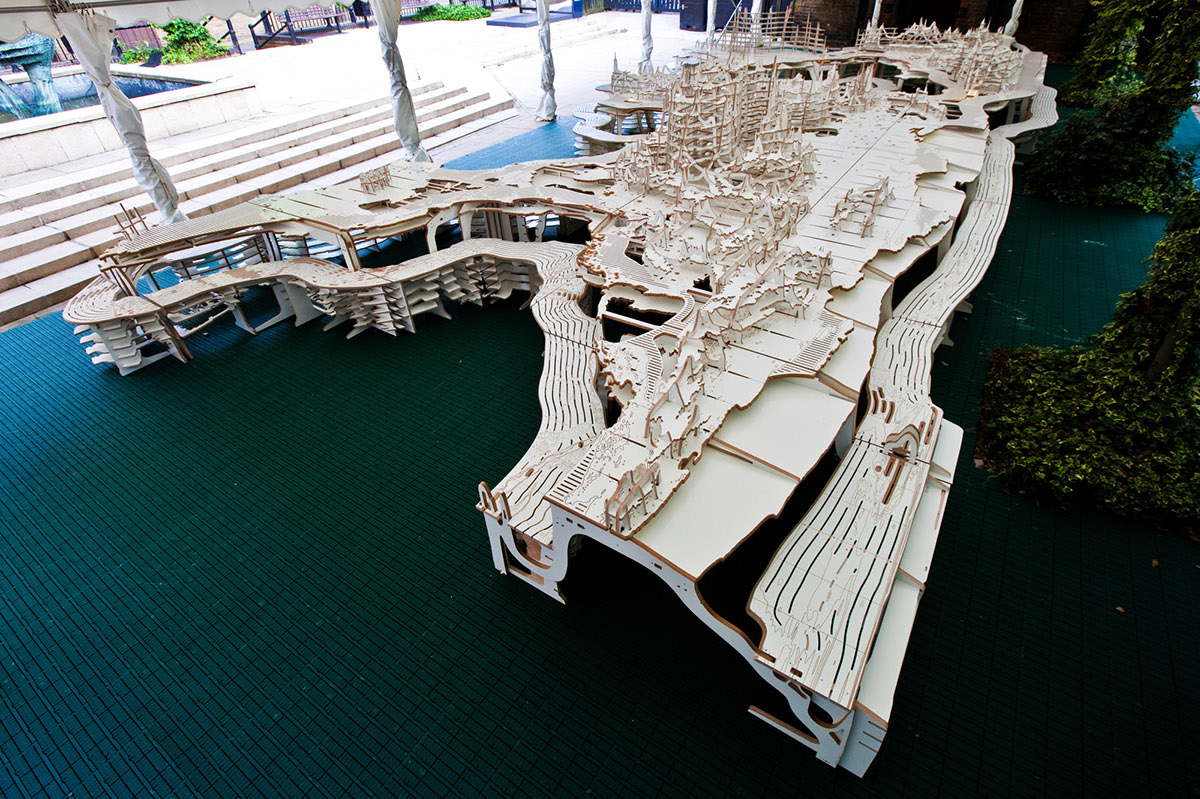


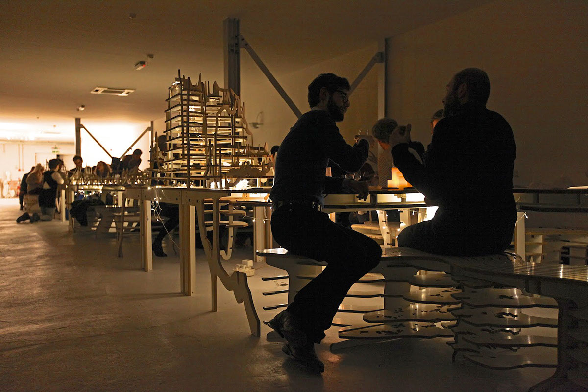
Worldscape is a vast dining landscape seating 80 people around the geometry of our planet, and first conceived and executed for Global Feast – 20 sequential evenings of world culinary exploration over the course of the London Olympics 2012.
Combining table and bench, its deeply sculptural landscape uses all the world’s contours to create a smorgasbord of unique inhabitable spaces – faithful to world geographic geometry, yet deeply unfamiliar as furniture. As a social instrument, it frames and prompts new and unprecedented dining relationships, encouraging intimacy and interaction between its occupants.
Worldscape continues atmos’s fascination with conjuring space from data, and creating immersive ergonomic environments. It uses the Equidistant Cylindrical map of the world, where all degrees are equal lengths in both directions, to create an inhabitable dining environment. Though it dates back to 100AD, it is NASA’s digital map of choice because it clearly maps the world onto square pixels. Appropriately enough for a dining experience, this map type is also called Plate Carrée.
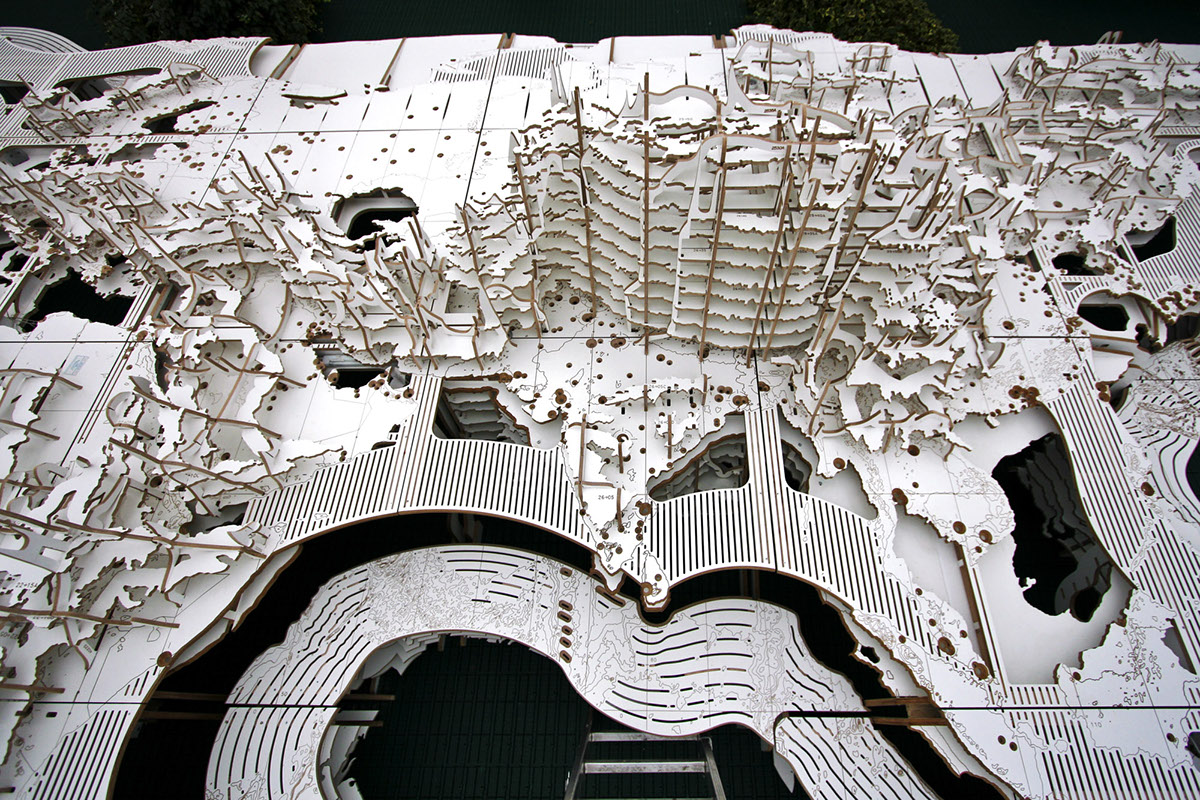
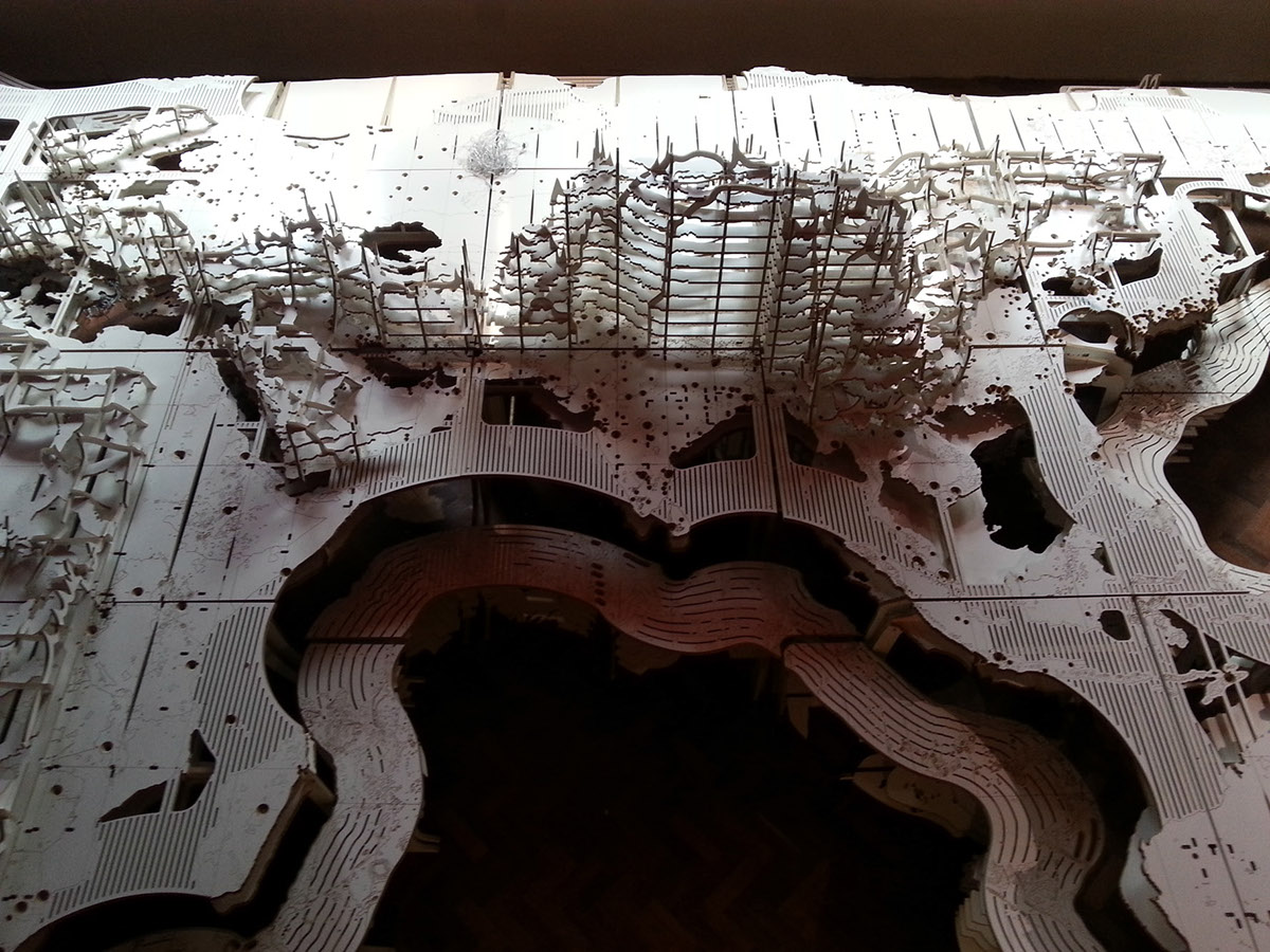
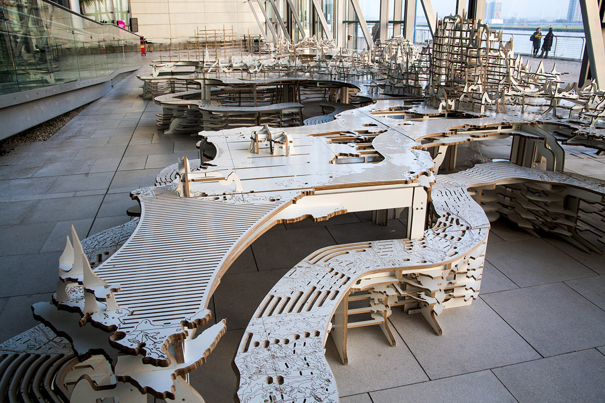
The table maps world contours onto the readily-available shapes of industrial materials. The 360-degree length of the map is divided into 12, each strip measuring 30 terrestrial degrees in width, mapping perfectly onto 4-foot-wide sheets of melamine-faced plywood. These sheets are carved with contours - outlines of the world’s geography cut at 500-metre intervals – using digital fabrication to cut straight from the computer with ultimate speed and exactitude. The table is thus divided into a grid of 35 generally-square modules of irregularly-shaped landmasses, each deeply individual yet linking together to form a collective occupiable landscape.
The table uses all the world contours, from both above and below sea level, stretching their vertical relationship – like an engineer’s section of a bridge – to best fit the body. Diners sit inside the sea - astride a collective semi-transparent bench running the length of the ocean trench, 2 kilometres beneath the ocean surface - and eat off the sea-level coastline – the image we all recognise as a world map. Table and bench interlock together, their structural front edges describing a local sectional cut through the world.
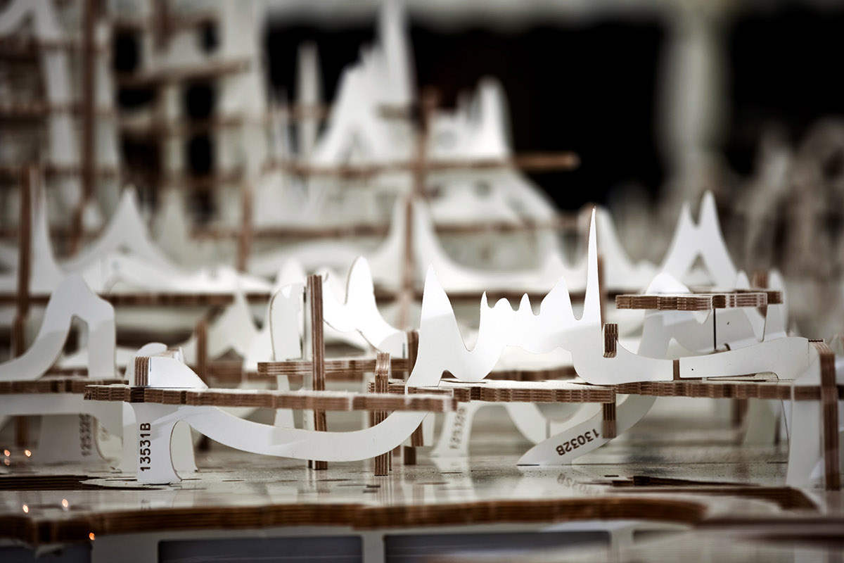
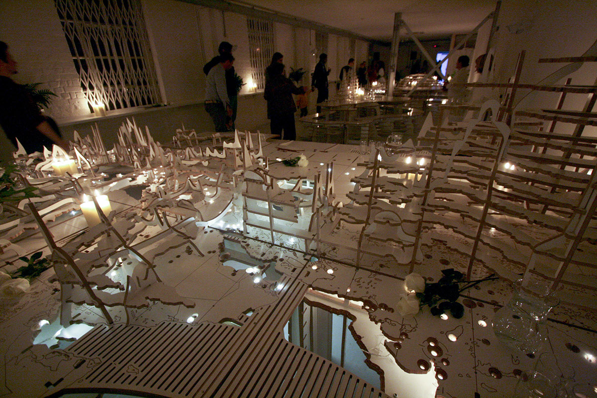
Ocean contours cascade away beneath the seats, terminating at 5 kilometres below sea level as they hit the venue floor – while the mountains rise up above the table to peak at the Himalayas – 2.1 metres tall – making Worldscape the tallest table in (and of) the world. The main surfaces at sea level are striated by the longitudinal lines that compartmentalise our event calendar, and perforated with the patterns of global cities. Each table cradles multiple light sources which illuminates these urban constellations; the view from above thus replicates the satellite view of the Earth at Night, diners illuminated by our collective inhabitation of the Earth.
The carved modules can interlink or detach, unfolding and unscrewing to pack flat as carry-away demountables. Their complex geometries all conform to the terrestrial grid, meaning longitudinal slices can be swapped out and recombined to create new map forms; indeed any grid square could connect to any other, creating entirely new world organisations and creative cartographic mashups. The tables can be pulled apart to create café-style seating, and each packs away into a slim stack of easy-assemble components – both a unique designer object, and a portable slice of the world.


