I recently completed this project for the Ford Parking Lot 2.0 challenge:
“How can Los Angeles outdoor surface parking lots be repurposed to increase their variety of uses, or aesthetic value, while enabling parking in the city?”
Park Here L.A. is an idea to retrofit existing parking spaces into pedestrian-friendly information hubs that include kiosks for information, payment, and wayfinding. This project won second place in the Ford-sponsored Mobility competition. Here's an article about the project.
Parking lots are the places where drivers become pedestrians.
My initial idea for this challenge was to repurpose select parking lots to encourage the use of public transportation and walking in downtown L.A. and other urban centers of Los Angeles county.
My initial idea for this challenge was to repurpose select parking lots to encourage the use of public transportation and walking in downtown L.A. and other urban centers of Los Angeles county.
There are many steps in the driver’s journey and they will use several system to navigate to their desired destination. Park Here L.A. is designed with an awareness of this overall experience.
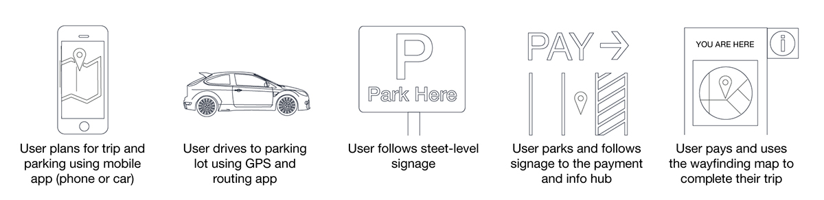
The wayfinding step, which is the person’s ability to orient their self in space and get around the city, is one of the last steps in the process.
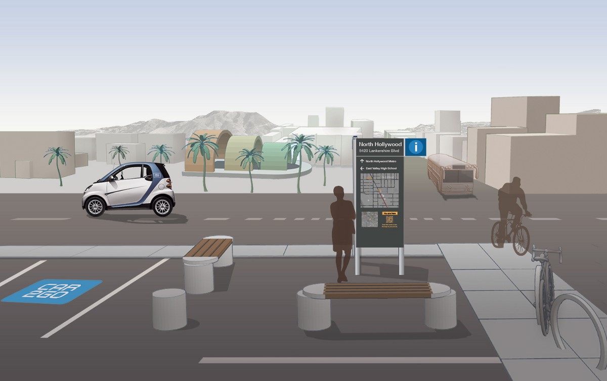
Here is an illustration the final concept:
Physical Design
In Park Here L.A., two parking spaces become a micro transit terminal, connecting cars, public transportation, cyclists, and pedestrians.
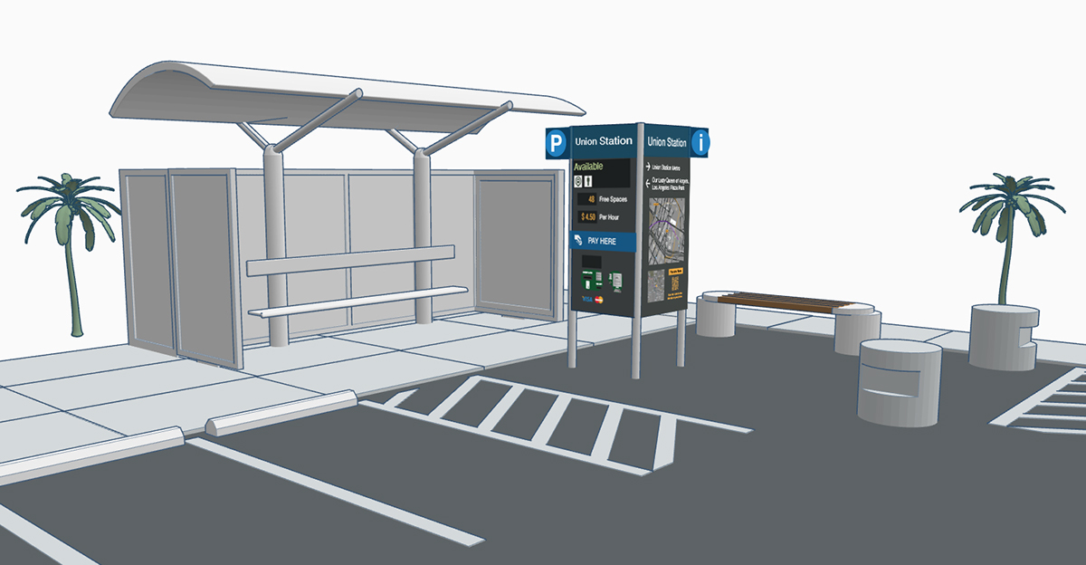
I think it is important that the exact physical design of the payment and information area be modular and configurable depending upon the parking lot and location in the city.
Here are some other configurations:


I wrote software for two kiosk screens, which can be viewed at http://la-parking.herokuapp.com:
1. Wayfinding Map and Info
Dynamic wayfinding map with nearby places and transit information
Dynamic wayfinding map with nearby places and transit information
2. Parking Availability and Info
Real-time parking availability and information
Real-time parking availability and information

The kiosk interface is designed to be visible from far away and is oriented as a heads-up display for standing or seated users.
Interface Design
The wayfinding map displays the user’s current location in relation to their nearby surroundings. I created the visual design of the scalable map using Mapbox Studio. This map will actually work for any major city in the United States. Specifically for Los Angeles, I added several transit layers using theL.A. county GIS data portal and the L.A. Metro developer portal. The online map could include live bus and transit information.
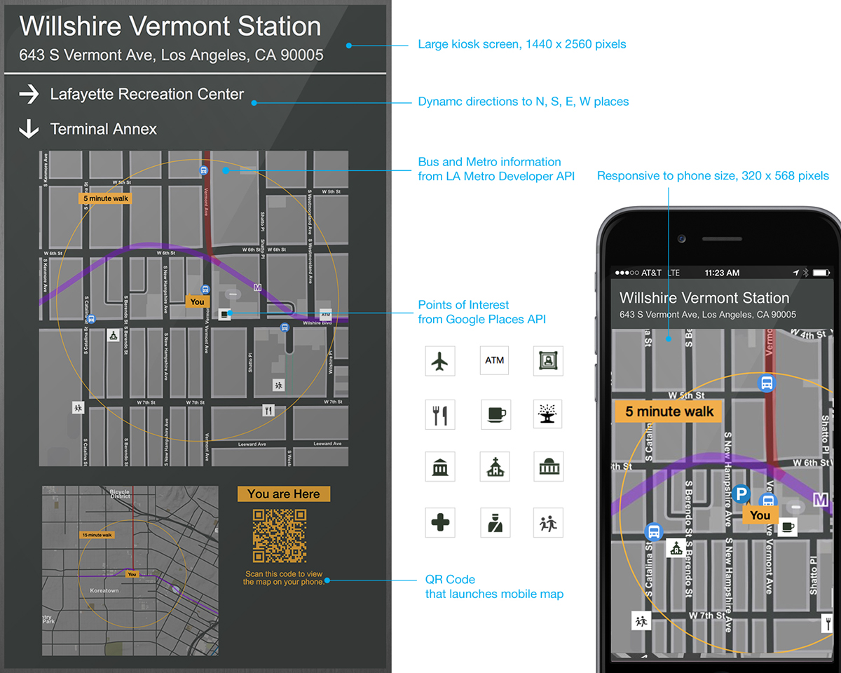
Mega responsive: Illustration of how the same map system scales to vastly different displays


