

I created this simple demo to experiment with using AR to show data in a way that is immersive and interactive to people. I believe AR is not just the future of storytelling but also the future of how we show data, prototype, and present Ideas.
To start I collected data from Open NYC Data. I chose to use NYC, particularly Manhattan for this demo because of the wealth of open data and the familiarity people have with Manhattan and its iconic island shape.
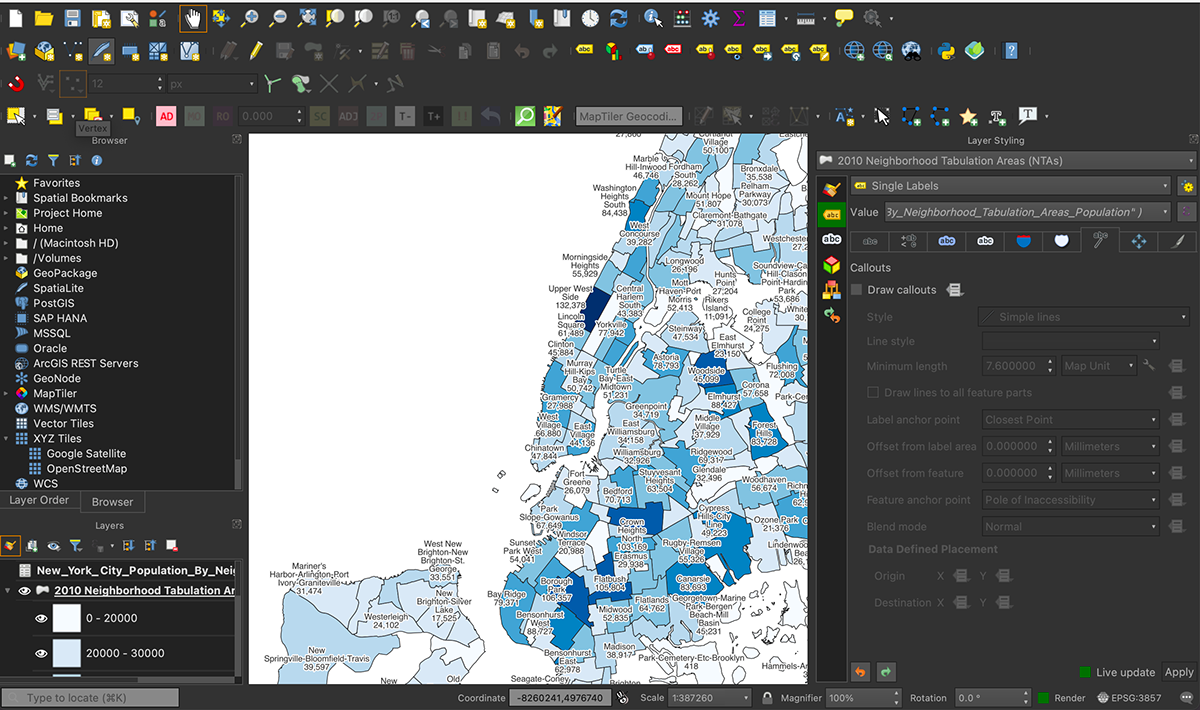
I then imported that data into QGIS an open-source Graphical Information Software. The process involved joining data tables, converting strings, and simple syntax formatting.

The map was utilized as a reference for creating a 3D model based on the data. A shape file with neighborhood outlines was imported, and each neighborhood was extruded individually, with population data converted into decimal heights on the Z axis.
Material colors were assigned to match the map, and supplementary text labels and a key were included.
After completing the model, it was incorporated into Adobe Aero for the creation of a mobile AR experience.

You can Scan the QR Code to experience the demo for yourself.
You will need to download the adobe Aero app available on the Apple and Android app stores.


