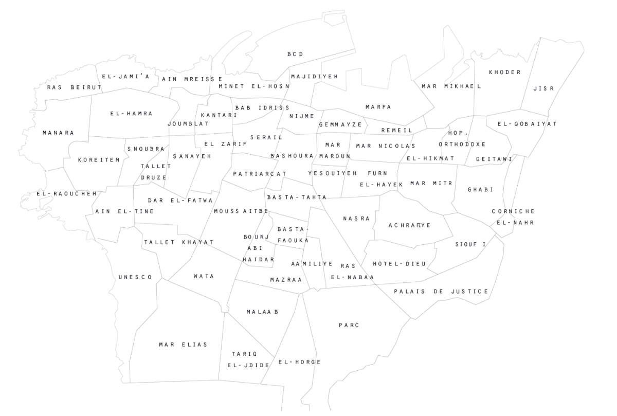
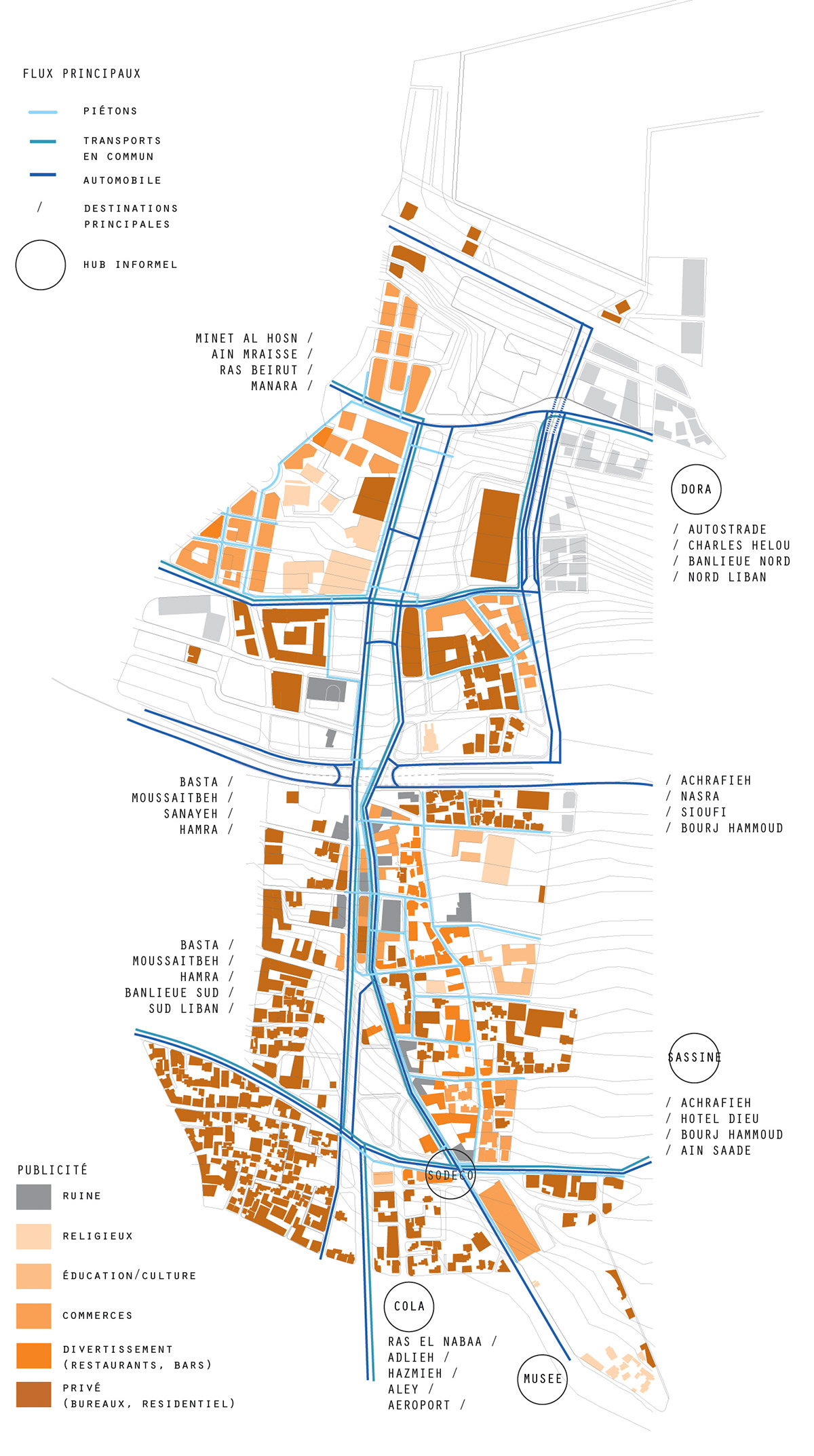
neighborhoods of beirut
planned public spaces of beirut
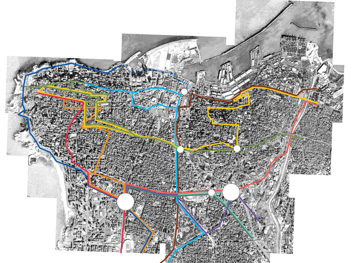
beirut informal bus network
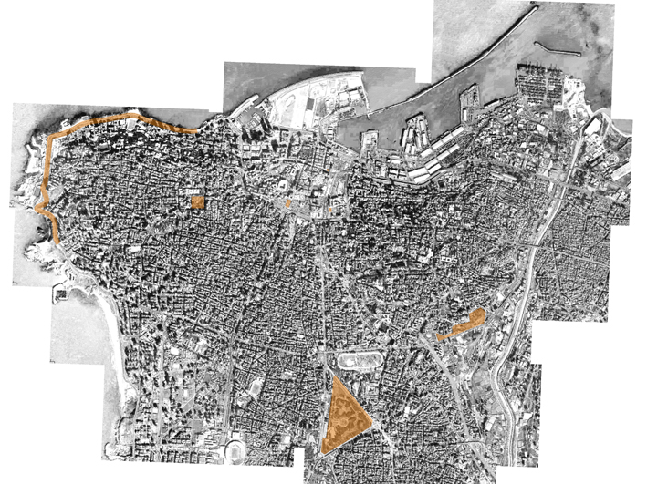
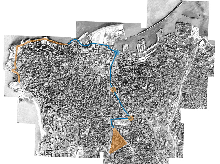
liminal space - beirut green line (front line of civil war 1975-1991)
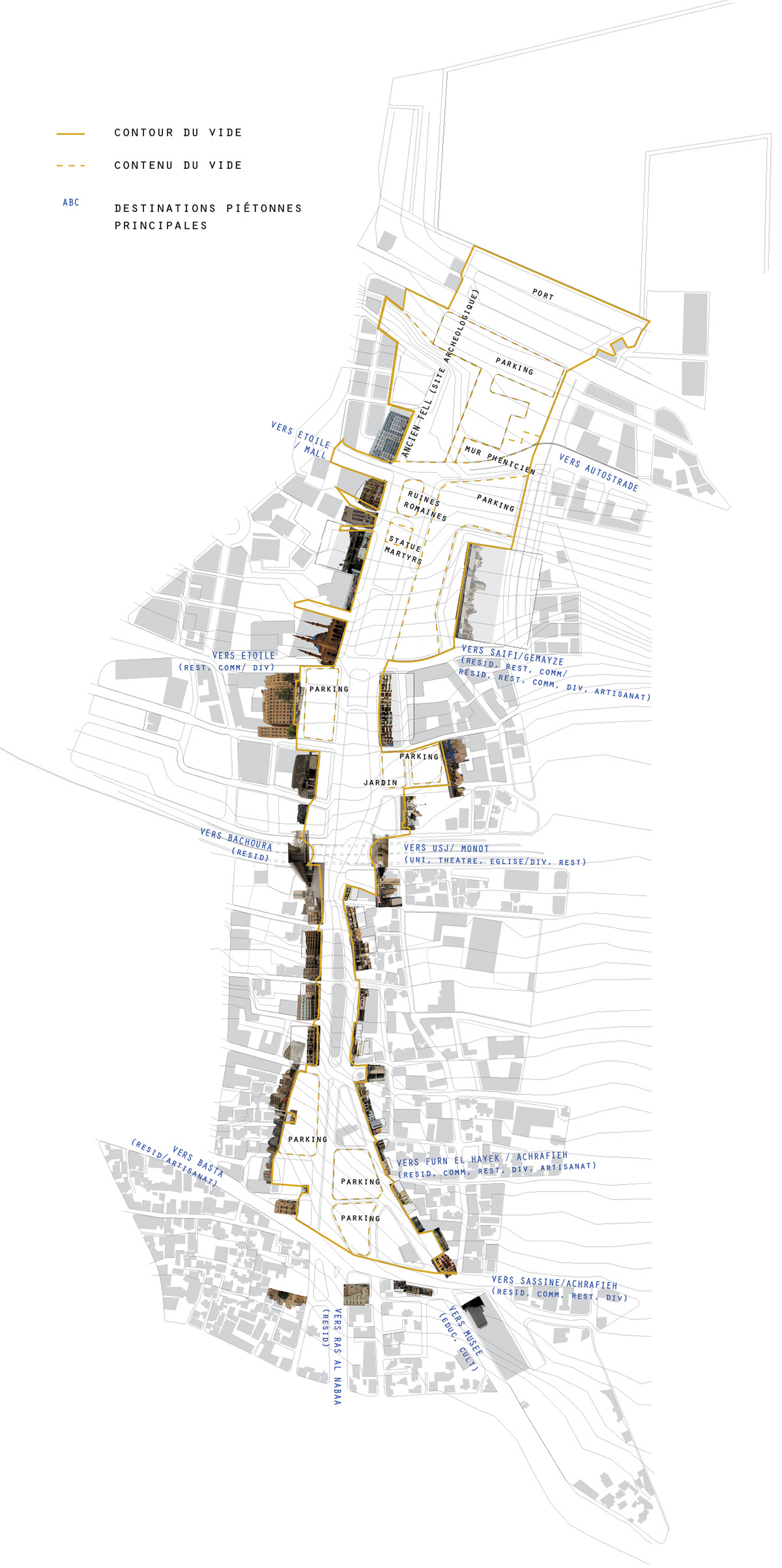
BOUNDARY AS SHARED SPACE
Reinterpreting the “Green Line”, Beirut, Lebanon
The intervention is located for the most part along the green line, the demarcation line separating east beirut from west beirut during the war of 1975. Today this limit has become as invisible boundary, a psychological barrier that conditions the user’s relation to the city.
The project seeks to foster the boundary as something that is as unifying as it is dividing, being the only common element and eventual shared space between different autonomous entities.
The goal is to generate a specific type of public space, which would stem from the friction between territorial attachment and the need for mobility. in that sense, it is born of the confrontation of scales : that of the city, and that of the site context.
At the scale of the city, the intervention consists of a soft mobility connection between the two major public spaces of the city. This promenade is fuelled by 3 transport hubs corresponding to existing informal nodes. Like an urban procession, the promenade runs along the threshold, framing the contrasts of the city.
The void in the center of the city is redefined as a public cultural park where the promenade is oriented towards historical and cultural interest points. The void is protected by redefining the perimeter : the city is allowed to grow within a planned limit, the void is preserved and no longer perceived as a residual space of transit, but rather as a programmatically, culturally, and historically relevant and human-scale public space.
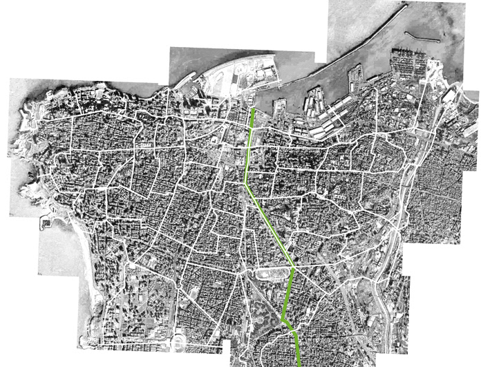
connecting the park to the sea : soft mobility path running through intermodal nodes, feeding into a public park in the center (see next image)
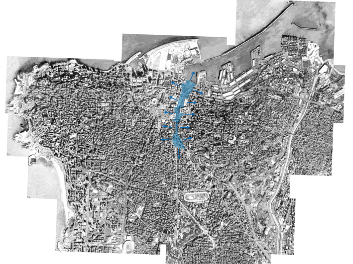
park site : the void in the center
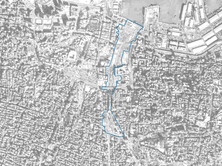
the void in the center (zoom)
analyzing the void : residual space
analyzing the void : residual space
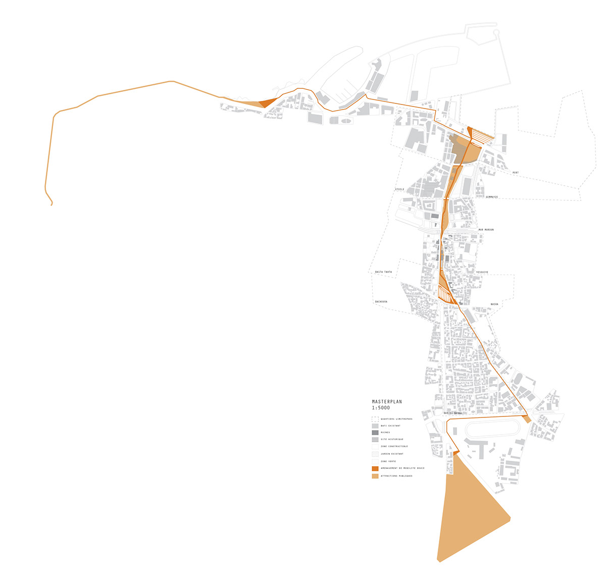
masterplan, the path from woods to sea
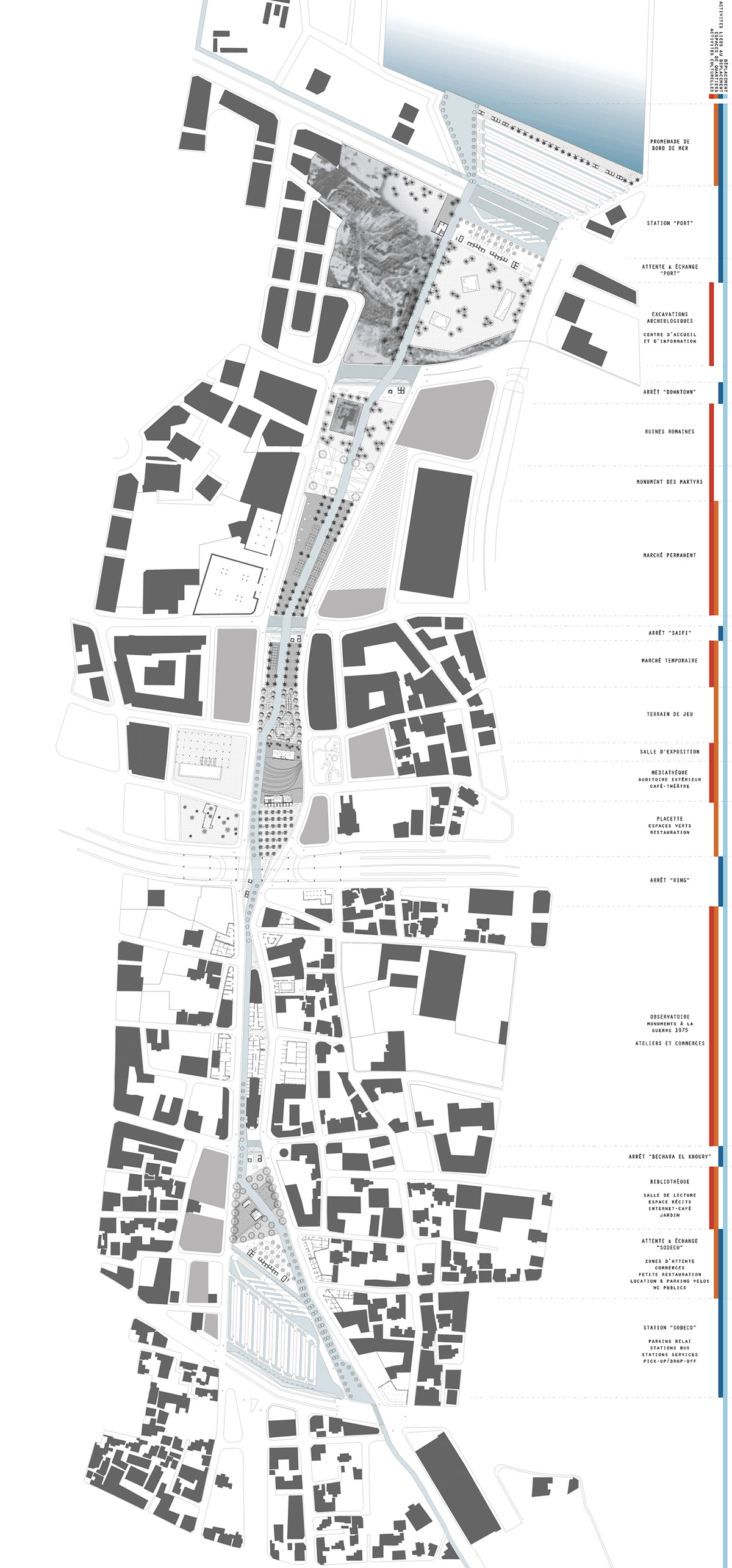
site plan : the public procession
MOBILITY
The two existing informal nodes are organised into intermodal transport platforms where cars, buses, taxi-services converge. A third node is created by the sea, and intermediate stops along the path, corresponding to frequent stops of the informal public transport system. Waiting spaces equipped with commercial spaces and other convenience and grocery stores are linked to the stations.
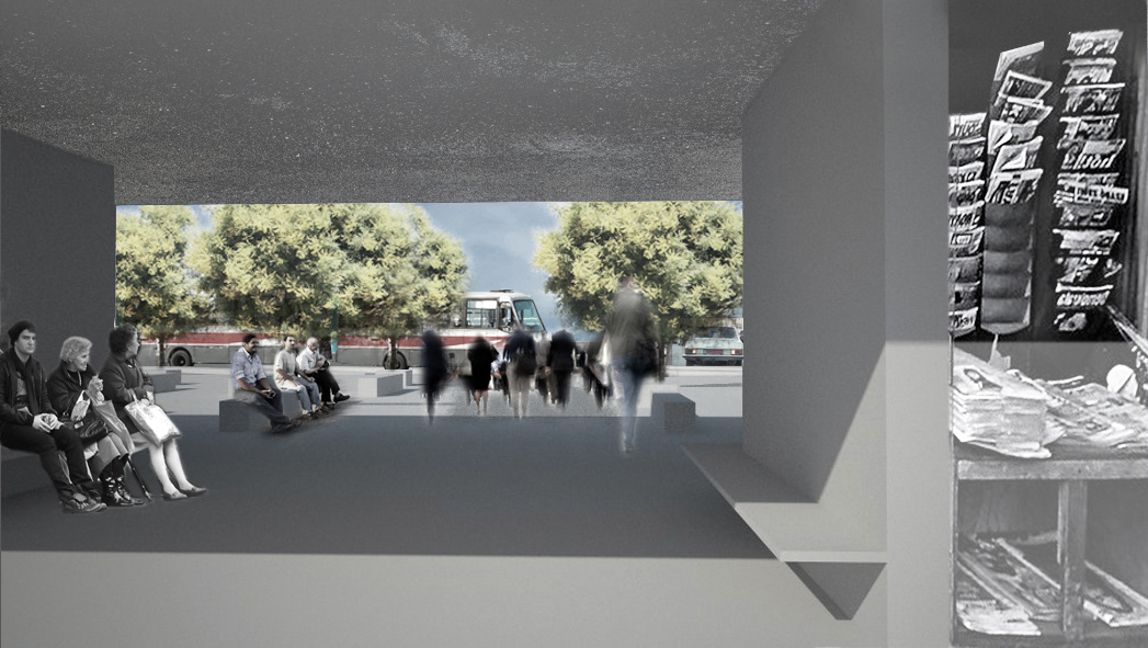
transit hubs
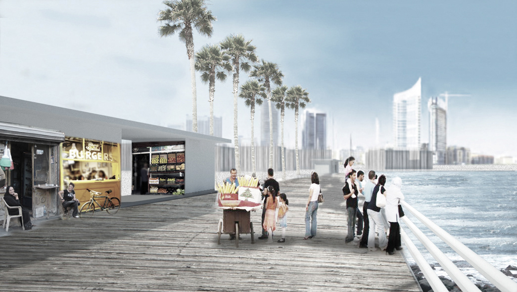
seaside promenade
CULTURE
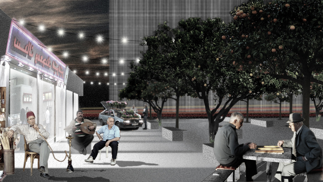
A permanent cultural program completes the temporary and seasonal activites that usually take place in close proximity to the site. Neighborhood-oriented public spaces are also part of the cultural park. These spaces act as social condensers that try to create friction through simultaneous meeting points for very contrasted social, economical and cultural spheres. They become a series of tableaux-vivants, where the essence of Beirut’s public space can survive : a space of friction between scales, between speeds, and between social spheres.
exhibition space
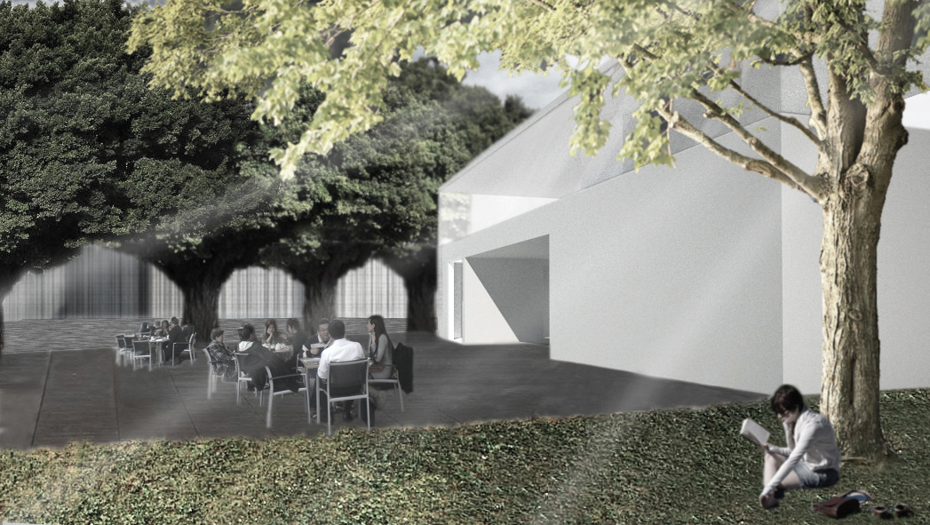
neighborhood space
public library on the history of place
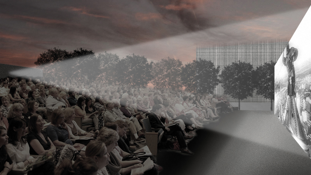
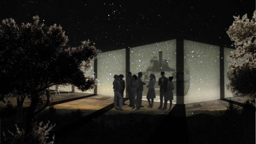
outdoor auditorium
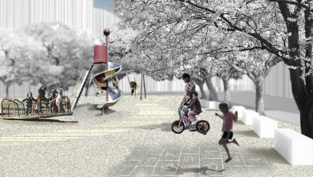
children's playground
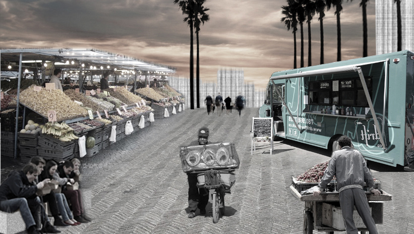
popular formal + informal markets
HISTORY
History as palimpsest is made visible. The ancient archeological sites are protected and reinvested as seasonal performance spaces where some parts are accessible to tours. In the same spirit of a self-contained museum, other points are framed on site : the martyrs monument, the decaying ruins of the 1975 war. Some are made accessible as temporary cultural venues, others are framed as-found objects, objects isolated in time and space.
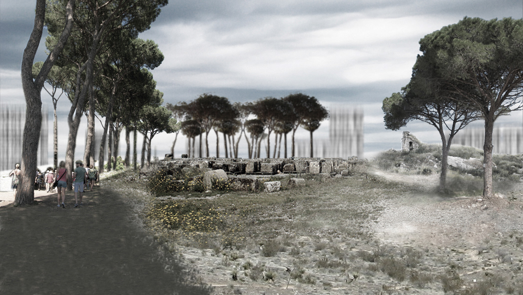
open archeological site
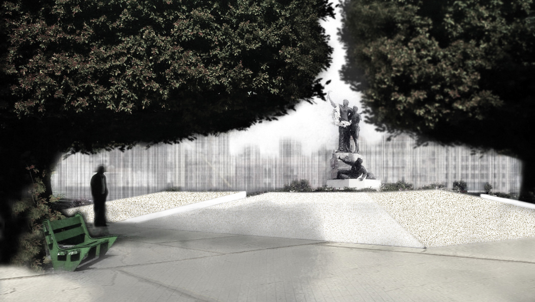
martyrs square
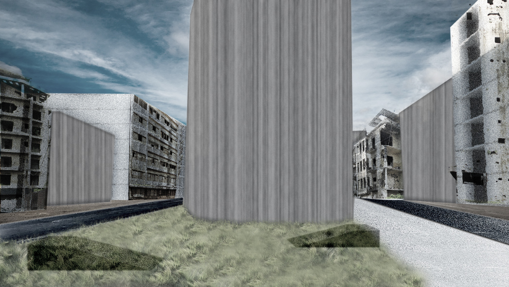
urban observatories of decay
