
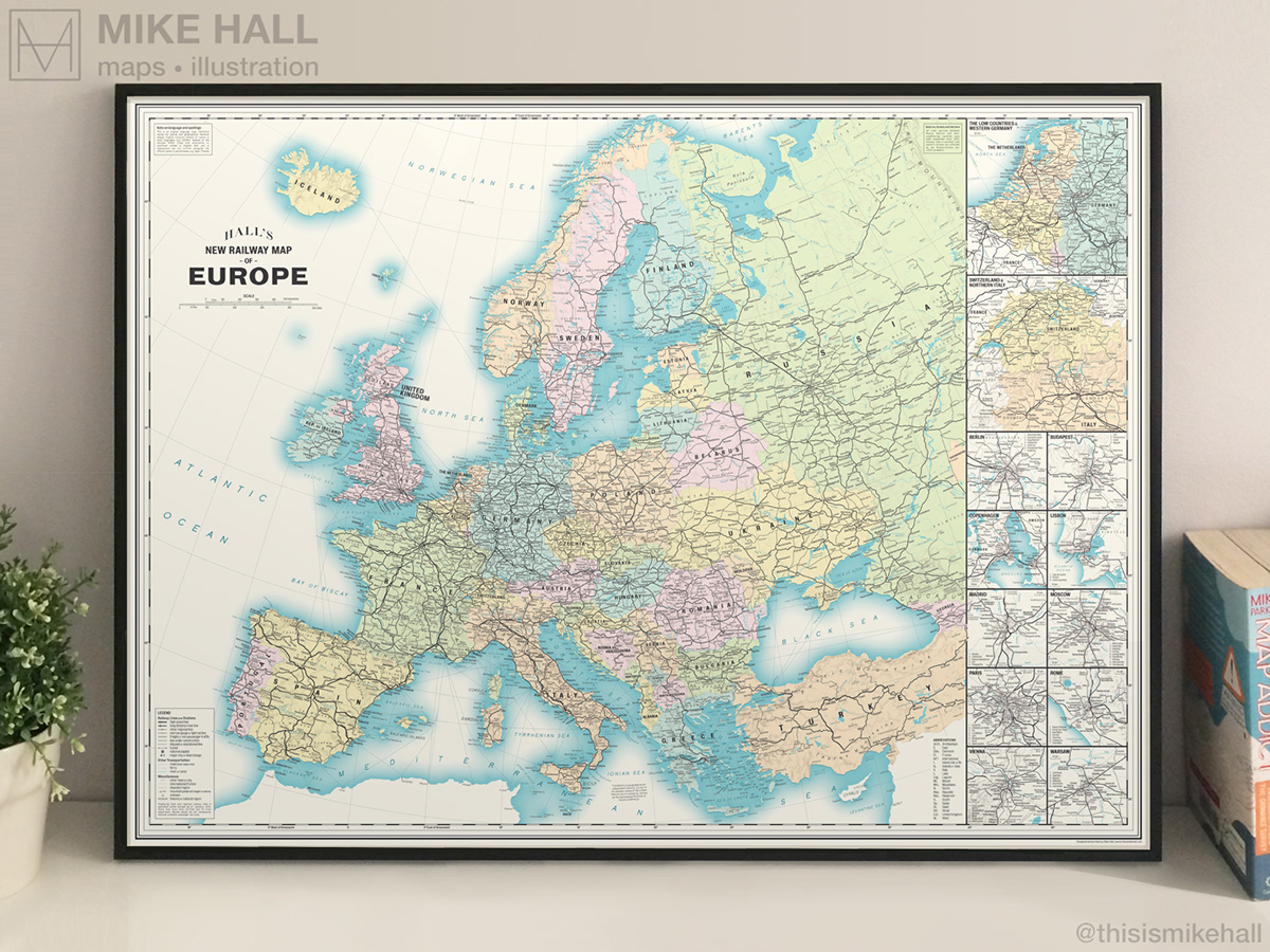
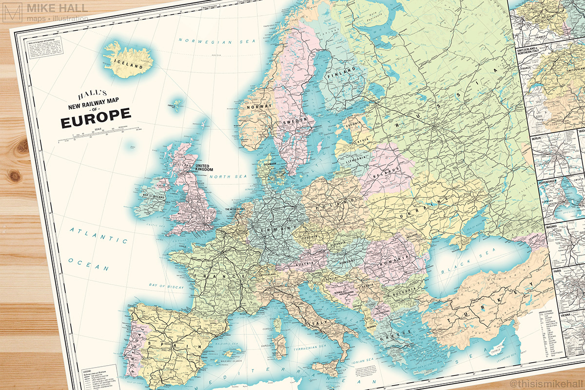
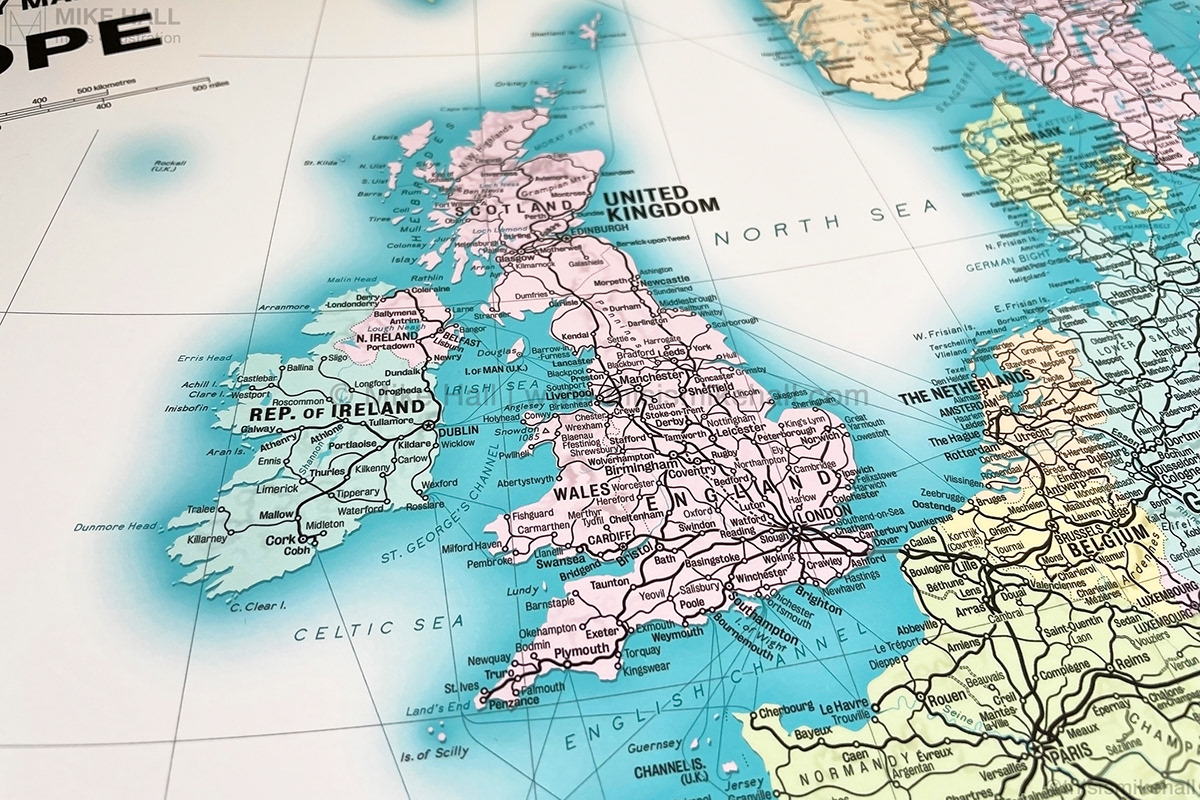
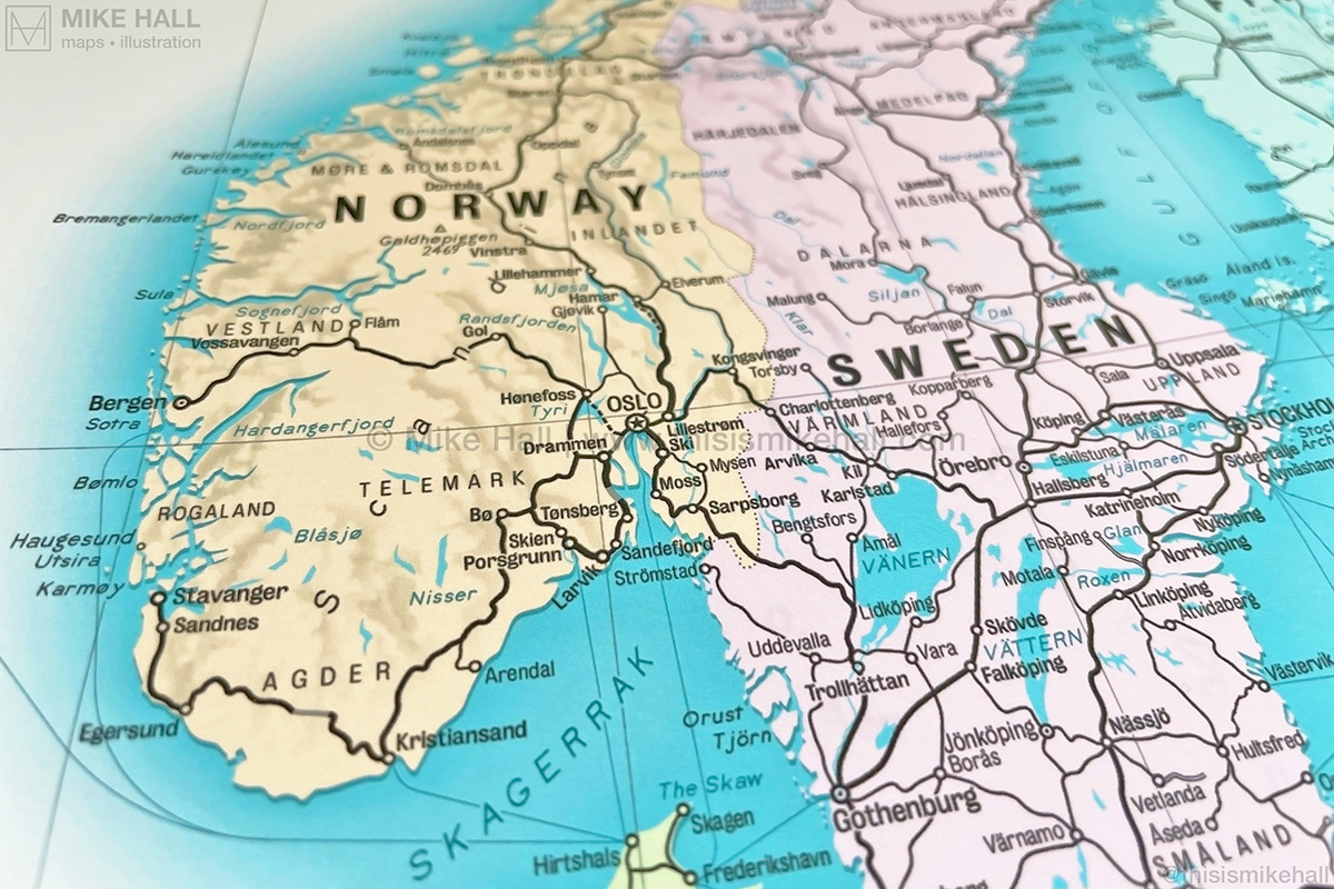
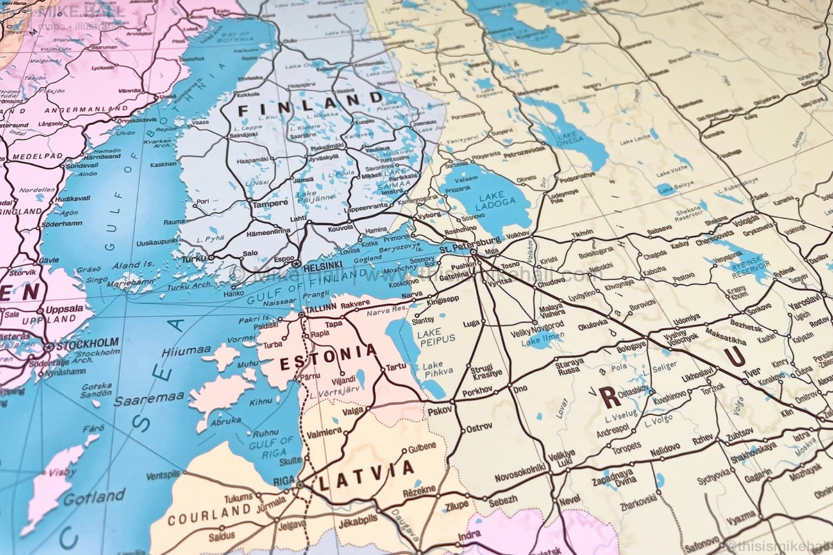
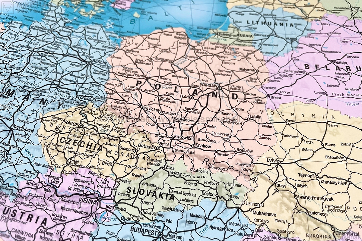
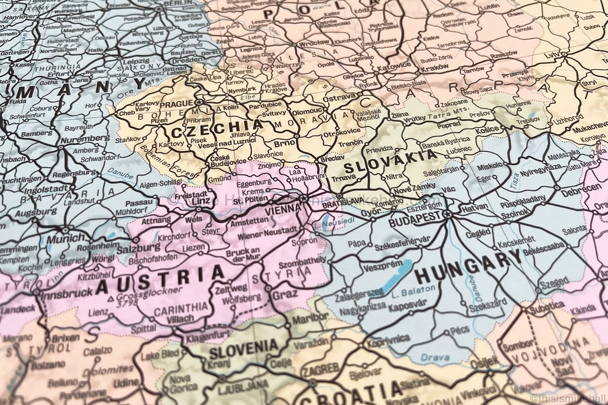
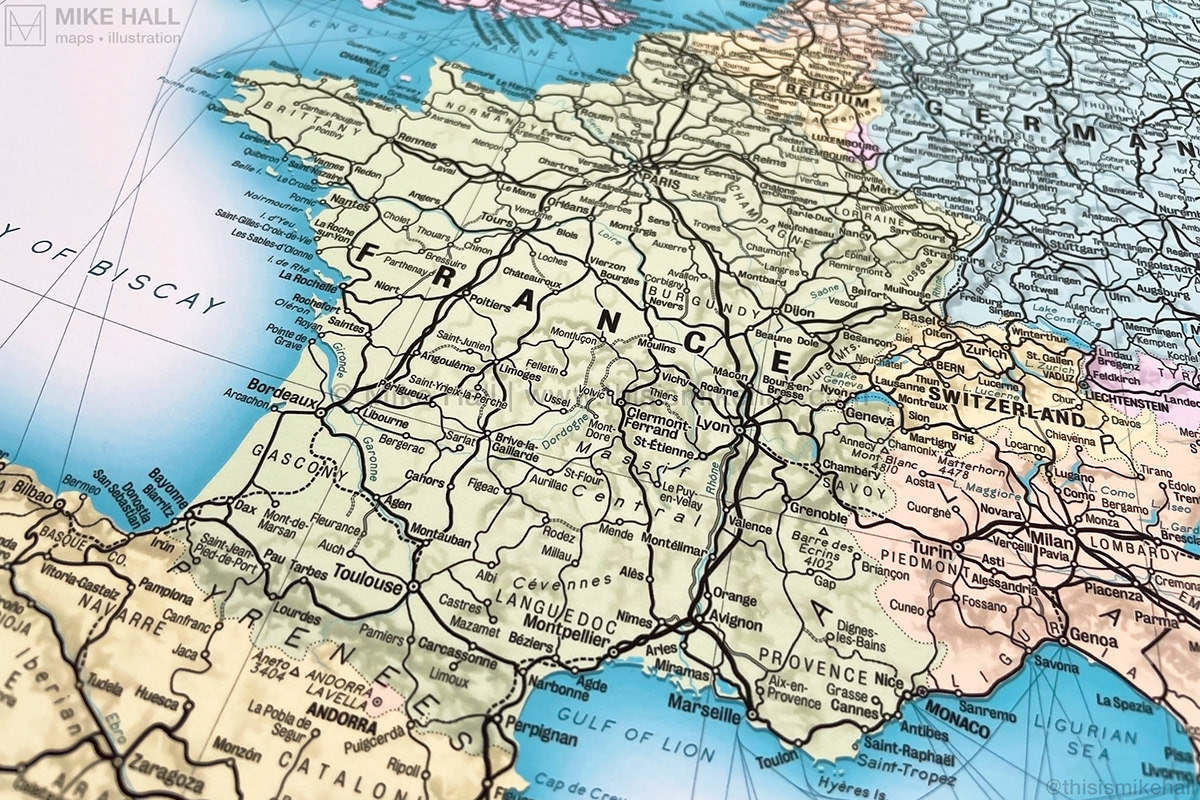
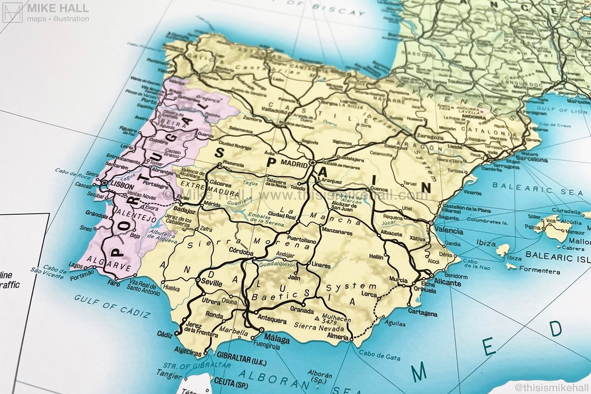
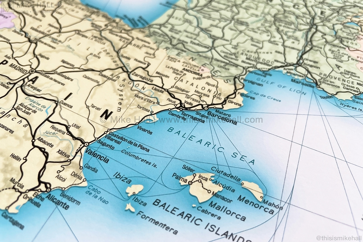
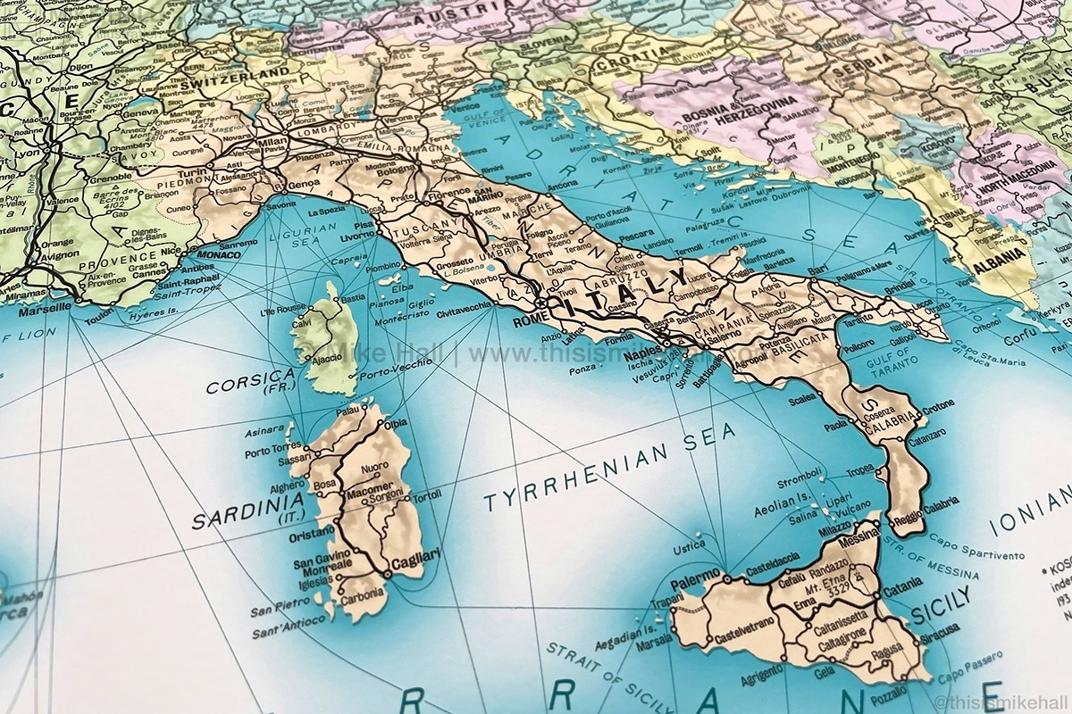
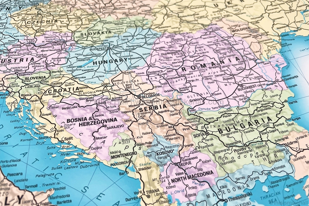
Railway Map of Europe
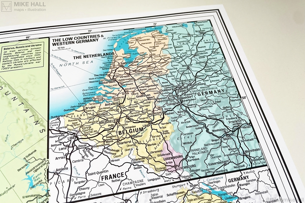
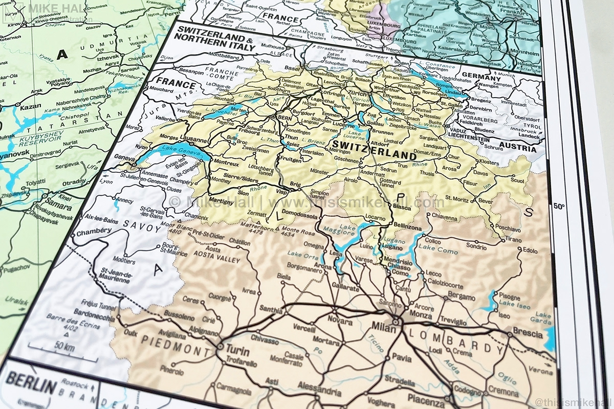
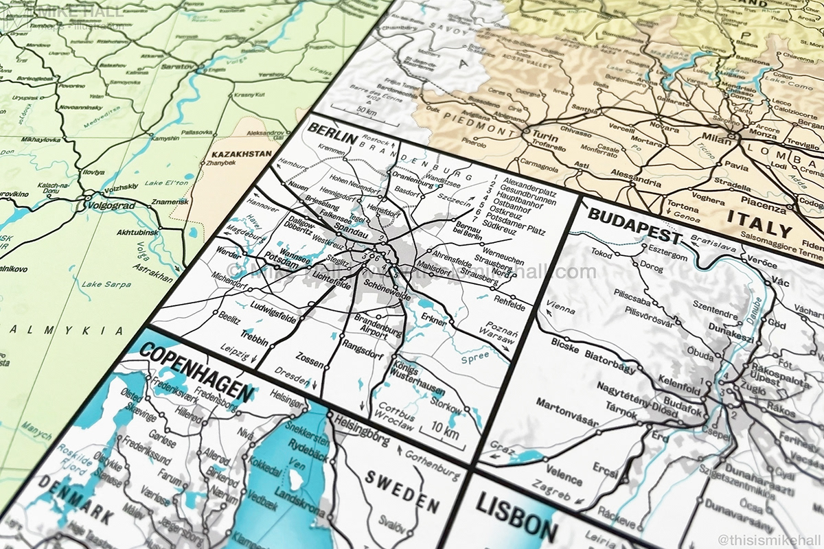
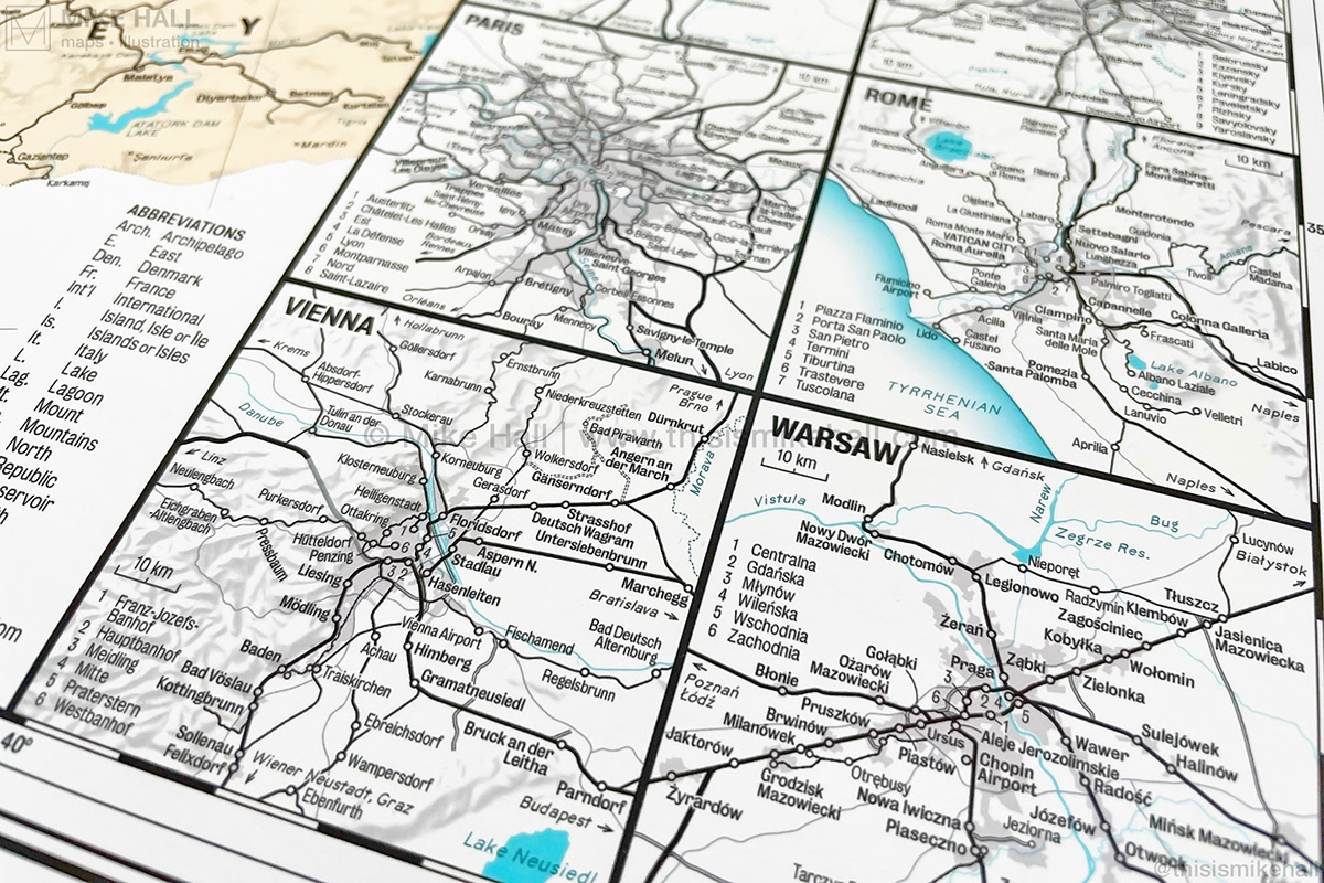
A map of the present day railway network in Europe (as of January 2024) designed in a retro mid-20th century style, showing all the major intercity lines as well as most regional lines across the entire continent including Turkey. It features enlargements of two densely-populated regions (the Low Countries and western Germany, and Switzerland and northern Italy) and ten capital cities including Berlin, Madrid, Paris, Rome and Vienna.
Each type of railway is represented by a variety of stroke widths and styles, graduating from the thickest (high speed lines) to the thinnest (light rail and narrow gauge lines). Major towns and cities are marked by circles, with larger circles representing important interchanges. Ferry routes between important ports connected to the rail network are also shown.
Available as a print from my online store: bit.ly/EurRail24


Designed in Adobe Illustrator with terrain effects in the inset maps created using Eduard.
Information sources: bazakolejowa.pl, bueker.net, Eurail, OpenRailwayMap, OpenStreetMap, Google Maps, Railway Gazette, SNCF, urbanrail.net, viaggiandoavapore.wordpress.com, Wikipedia
Many thanks to Carlos Alonso, Peter Broad, Rémi Cardona, Mariano Casas, Mark Dowling, Florian Ellebrecht, Carlos Espada, Helen Ilus, Lukas Knöfler, Hans van der Maarel, Arnold Platon, Olivier Przybylski, Stergios Roumeliotis, Frank Simonis, Charlie Walker, Stanley Wilkinson and X users Dr Hastings Bandstand, @felixdoublev, @mi_ka_el_, @minmagnesite, @PoloniusCrambe and @subfuscous for their help with corrections to the detail.

