


As part of the public process a concise, informative and visually captivating vision map capturing the breadth and depth of the process was developed. Elements include the project's primary goals and objectives, general project focus area, key landmarks and points of interest, and basic physical and topographical features. Imperative in the creation of this map was knowing the public would have a strong sense of ownership and familiarity with it.
Tools Used: ArcGIS, Adobe Illustrator, Adobe Photoshop, and Adobe InDesign
Actual Dimensions - 42" x 82"
Actual Dimensions - 42" x 82"
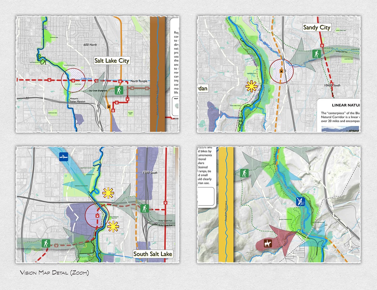
Vision map detailed close-ups.

Complimenting the vision map were large-format posters showing the major opportunity areas developed with input gathered during the public workshop phase of the project. The three areas of focus were environmental, recreation and tourism, and economic development.
Tools Used: ArcGIS, Adobe Illustrator, Adobe Photoshop, and Adobe InDesign
Actual Dimensions - 42" x 82"
Actual Dimensions - 42" x 82"

The Blueprint Jordan River final report provides a detailed summation of the process including background information, overview of the process, vision principles, scenario maps, action plans, and an implementation framework to help forward the vision. An 8-1/2" x 14" landscaped format was chosen for the report to best reflect the physical beauty of the river corridor.
Tools Used: Adobe Illustrator, Photoshop, and InDesign.

Due to the technical nature of the document, consistency in design, color, font selection, and layout was important. The amount of information presented called for a simple yet visually captivating way to direct the reader to the appropriate chapter. The "Table of Contents" was part of the solution with the use of unique colors and design elements.
Tools Used: Adobe Illustrator, Photoshop, and InDesign.

One challenge was to maintain consistency of look and clarity in message between the large-format visuals used in public workshops and the same information as would be presented in the final project report. A large amount of information had to fit in a limited amount of space. To accomplish this the study area was split into two sections, north and south, each of which took up a full spread (8-1/2" x 28"). Shown here is the "Recreation & Tourism Opportunities" graphic as shown in the report.
Tools Used: ArcGIS, Adobe Illustrator, Photoshop, and InDesign.
Tools Used: ArcGIS, Adobe Illustrator, Photoshop, and InDesign.

In the effort to provide as much information as possible the sidebar of each page was utilized whenever feasible. Content was both informative and visually captivating and included examples such as case studies, glossary of terminology, implementation tools, polling results of questions asked of the public during the process, and other relevant material.
Tools Used: Adobe Illustrator, Adobe Photoshop, and Adobe InDesign


