MAPS
A collection of cartographic materials
Romania's Transport Programme
The official maps used by the Ministry of Transport in showcasing the status of the program.
Road vectors previously processed in the GIS environment to obtain 45-degree angle values between lines .


Earthquakes in Gorj County
A brief analysis of seismicity in the context of the largest earthquake ever recorded in the area.

Giurgiu - historical centre
A tourist map of the most important sights and facilities in the city.

Forest area dynamics
A map illustrating the area of forest that has remained, disappeared or appeared within 80 years.

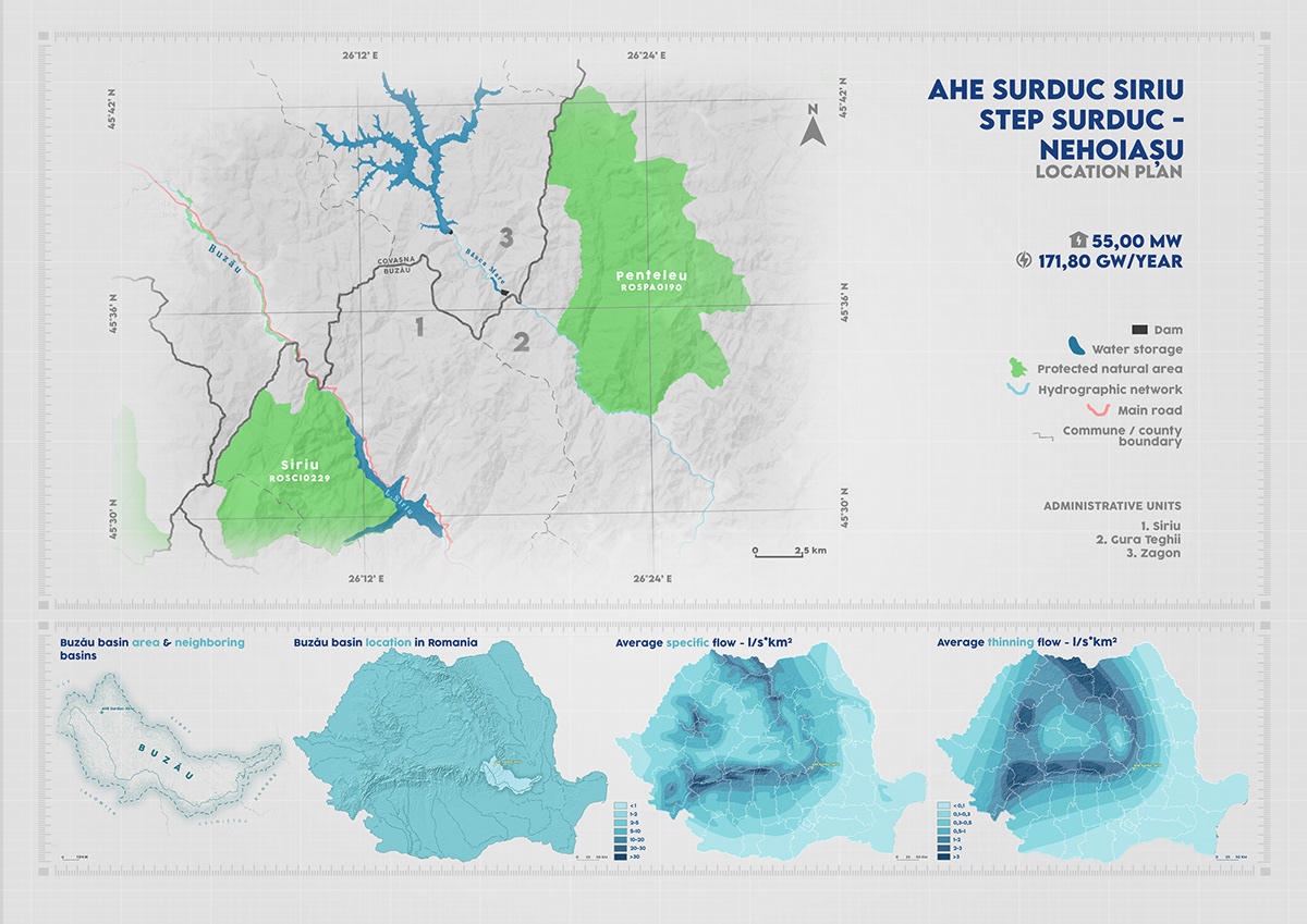
Ministry of investment and european projects maps
Some of the maps used for projects funded under the national Recovery and Resilience Programme, RePowerEU Directive


Geomorfology maps
Some of the maps used in the master thesis, showcasing: altitude, soil gleization, slope, road categroy, protected areas and 2 proposals for a new road.


Historical maps
Some of the maps used in the bachelor thesis, showcasing the administrative territorial units and the lost/incorporated settlements in the study area


Crovu - Spatial evolution
The space built in the village during 156 years


Greening project
Maps made to announce the areas in Bucharest to be greened


TreasureHunt maps


Romania On Rails - Personal project
Thematic maps illustrating the route of that edition