[2014 ACSA Steel Competition Entry]
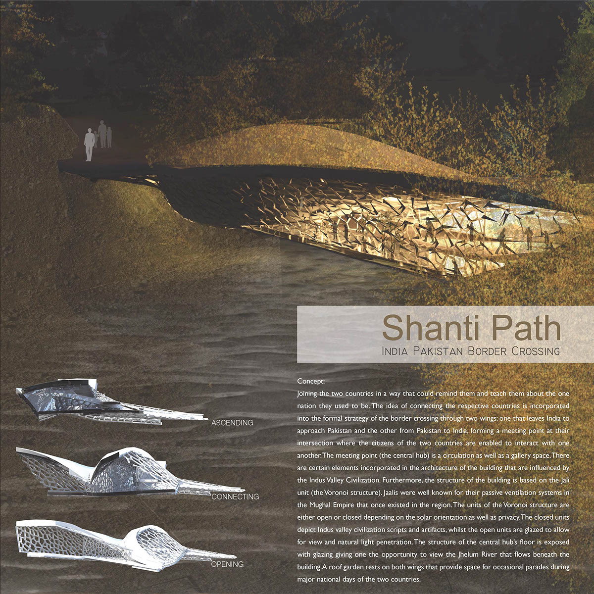
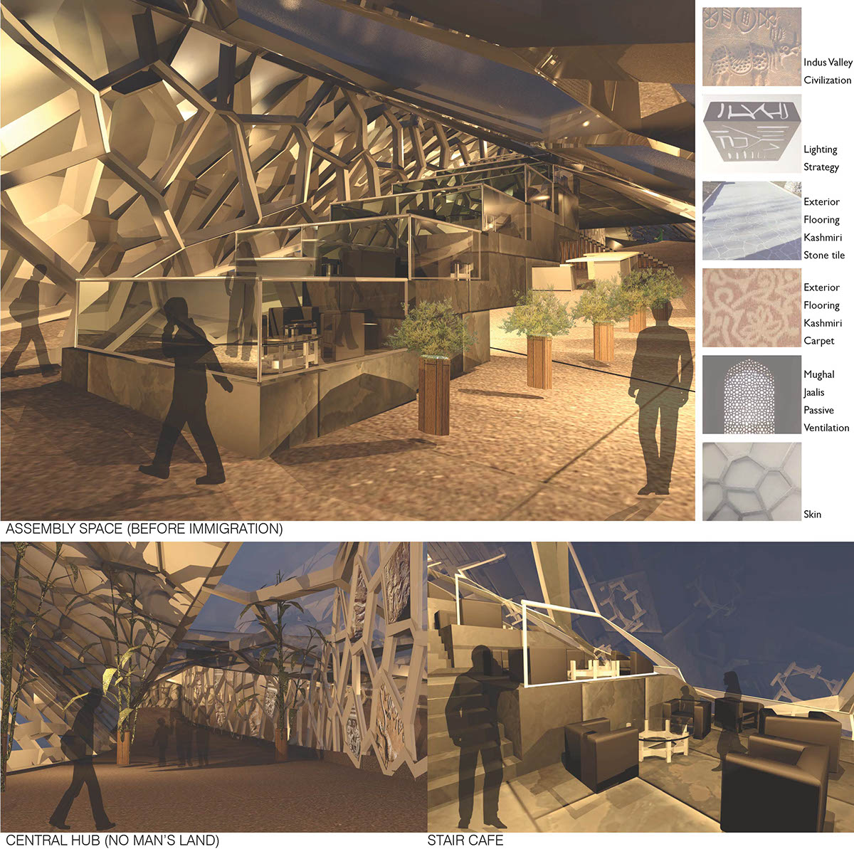
Joining the two countries in a way that could remind them and teach them about the one nation they used to be. The idea of connecting the respective countries is incorporated into the formal strategy of the border crossing through two wings: one that leaves India to approach Pakistan and the other from Pakistan to India, forming a meeting point at their intersection where the citizens of the two countries are enabled to interact with one another. The meeting point (the central hub) is a circulation as well as a gallery space. There are certain elements incorporated in the architecture of the building that are influenced by the Indus Valley Civilization. Furthermore, the structure of the building is based on the Jali unit (the Voronoi structure). Jaalis were well known for their passive ventilation systems in the Mughal Empire that once existed in the region. The units of the Voronoi structure are either open or closed depending on the solar orientation as well as privacy. The closed units depict Indus valley civilization scripts and artifacts, whilst the open units are glazed to allow for view and natural light penetration. The structure of the central hub’s floor is exposed with glazing giving one the opportunity to view the Jhelum River that flows beneath the building. A roof garden rests on both wings that provide space for occasional parades during major national days of the two countries.
Entry to the Indian Wing of the Shanti Path
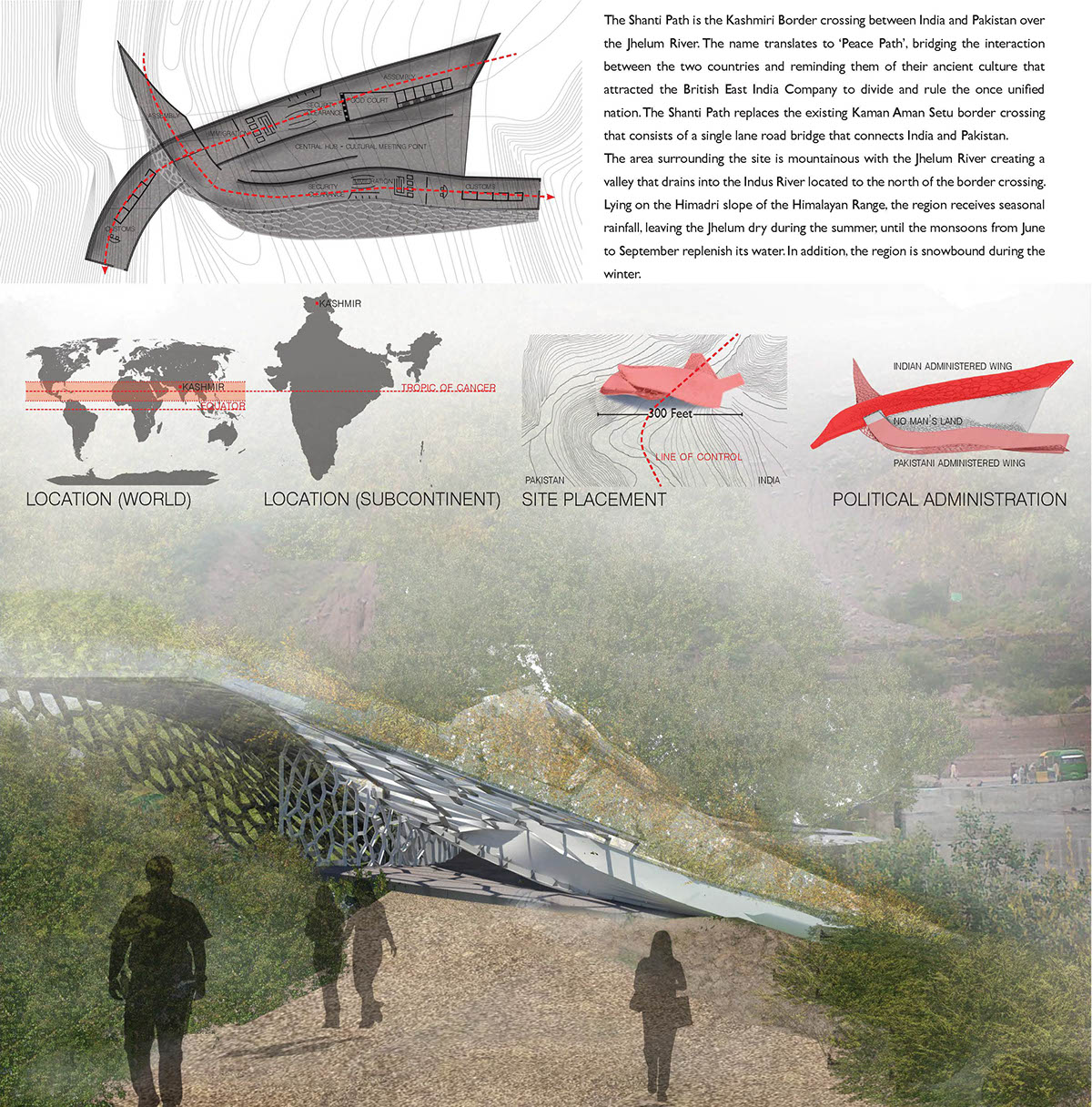
The Shanti Path is the Kashmiri Border crossing between India and Pakistan over the Jhelum River. The name translates to ‘Peace Path’, bridging the interaction between the two countries and reminding them of their ancient culture that attracted the British East India Company to divide and rule the once unified nation. The Shanti Path replaces the existing Kaman Aman Setu border crossing that consists of a single lane road bridge that connects India and Pakistan. The area surrounding the site is mountainous with the Jhelum River creating a valley that drains into the Indus River located to the north of the border crossing. Lying on the Himadri slope of the Himalayan Range, the region receives seasonal rainfall, leaving the Jhelum dry during the summer, until the Monsoons from June to September replenish its water. In addition, the region is snowbound during the winter.
Both pedestrians as well as vehicles access the Shanti Path from the existing Srinagar–Muzaffarbad Highway. Vehicles are parked at the entrance of the border crossing while goods are unloaded and circulated to the other country. Humans circulate through the building and are enabled to explore the central hub. Before the Shanti Path border crossing, the 300 feet long Kanan Aman Setu bridge existed. However, the bridge only allowed for one vehicle to pass at one point of time due to its narrow 20ft width. It was supported by lofty masonry pillars that rested on the river bed, however experienced erosion over half a century that was potentially at a risk of failure. As a result, the current Shanti Path structure is spanned by tubular steel pipes that are anchored to the landmass on either side and not to the river bed, providing long term stability to the border crossing. Furthermore, the Indian law prohibits the entry of Pakistani vehicles in the country, similarly vice versa. Hence the Shanti Path facilitates the movement of goods rather than vehicles across the two countries.

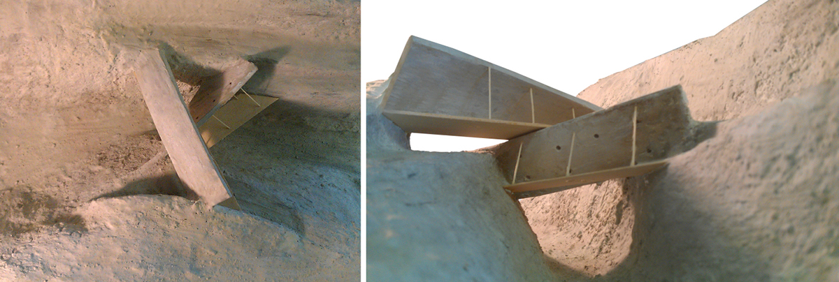
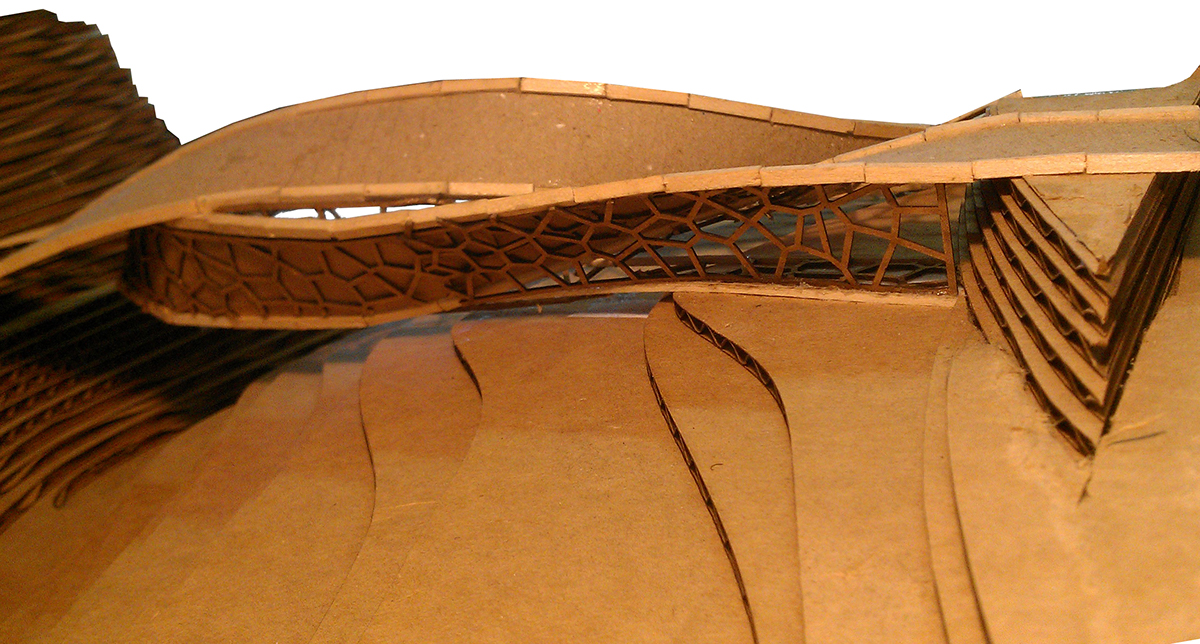
Process Model - Concrete
Understanding the gentle slope of the Indian terrain and the swale that exists on the Pakistani terrain
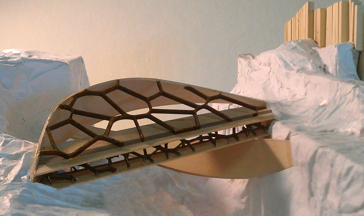
Voronoi supported floor grows into a skin system
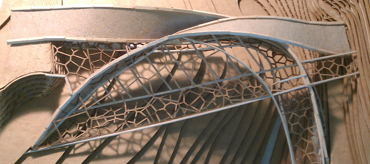
Exporing the Voronoi Structure