

Retro style maps of Spanish Provinces (2021-22)
These are the first twelve in a new series of maps of every province in Spain, of which there are fifty in total, beginning with the ten located on the Mediterranean coast (Alicante, Almería, Barcelona, Castellón, Girona, Granada, Málaga, Murcia, Tarragona and Valencia), plus the Balearic Islands and the two provinces within the Canary Islands (Las Palmas and Santa Cruz de Tenerife). Maps of the remaining provinces will follow in the near future.
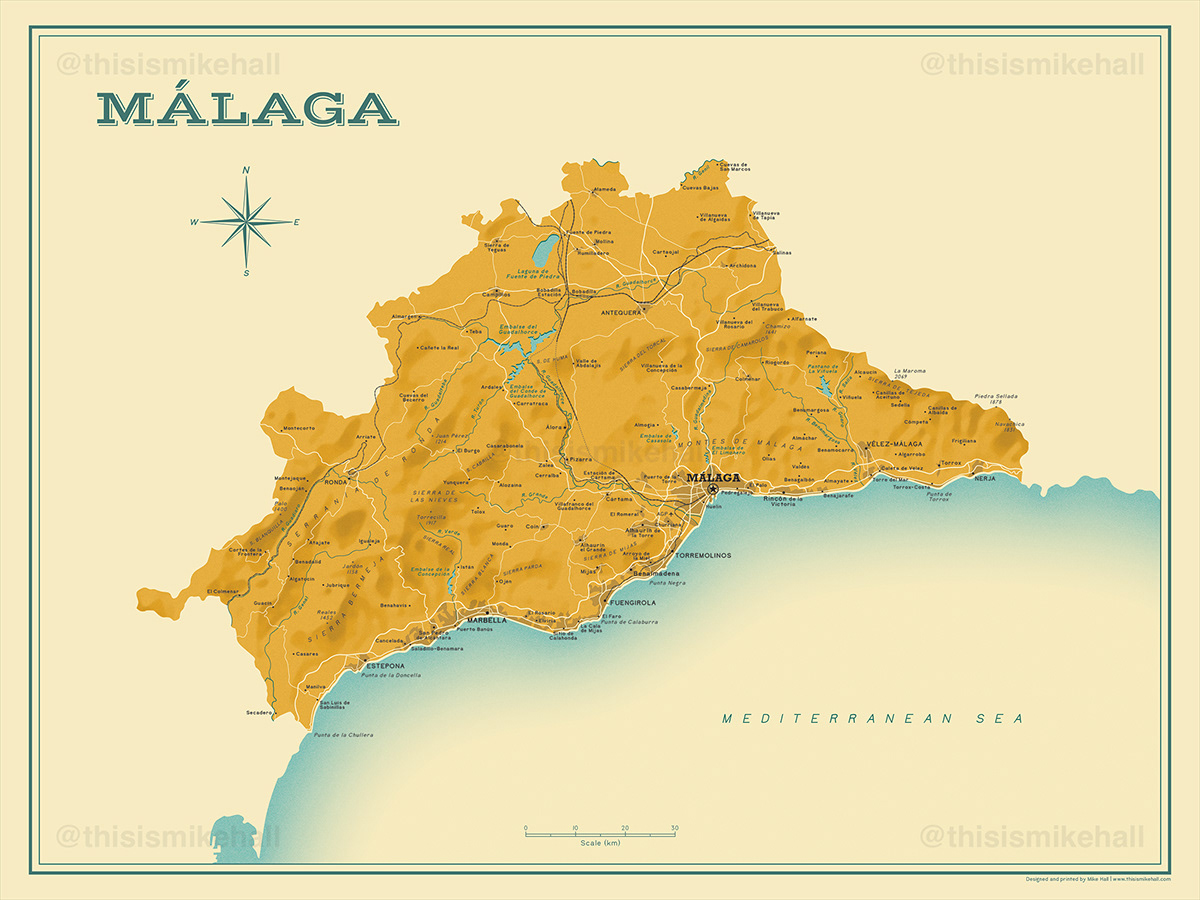
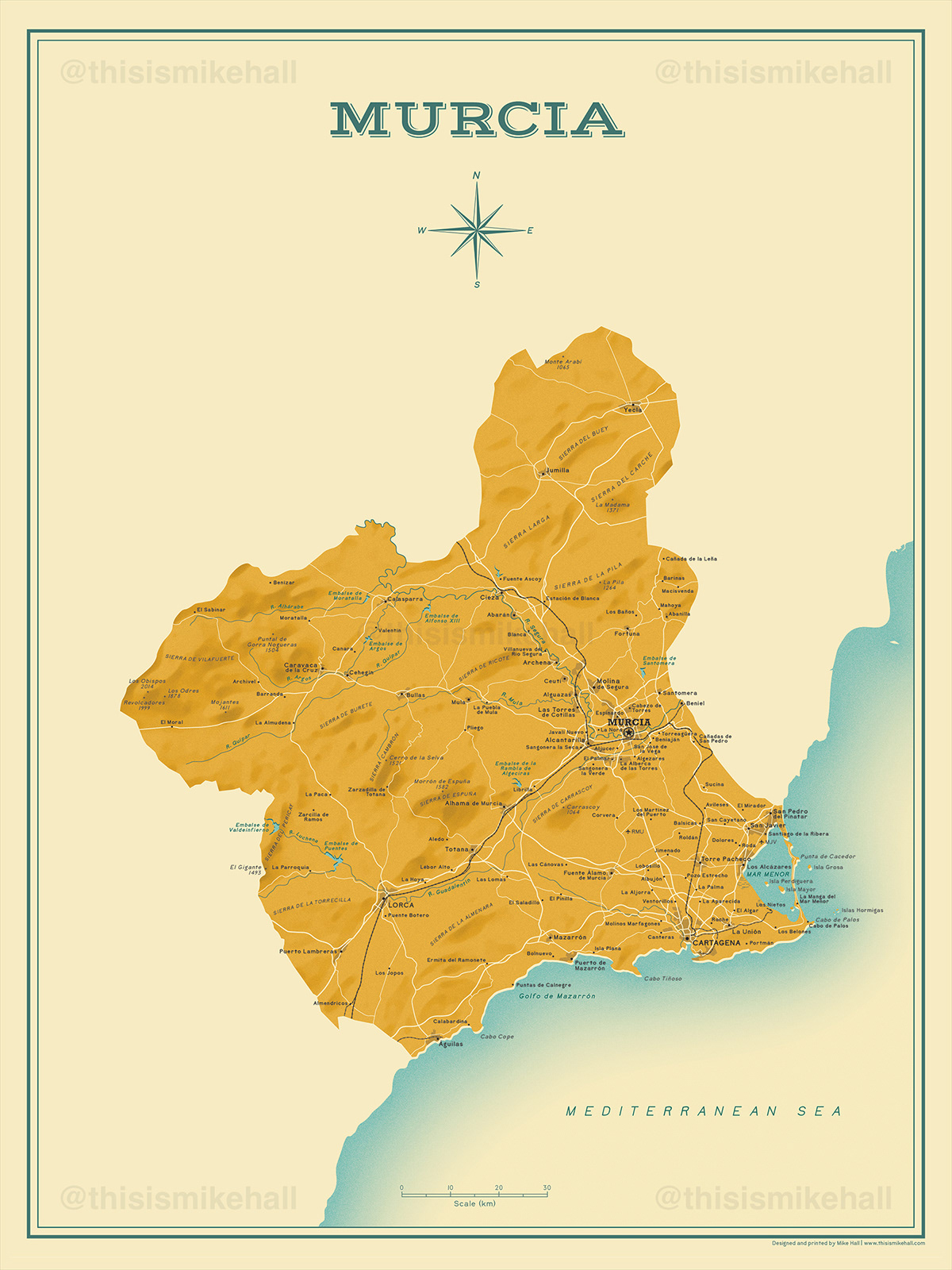
Each map has been designed in a retro, mid-century style with period-style typefaces and a minimal colour palette of bright, summery tones. Separate versions with spellings in International English (using customary exonyms), Spanish and regional languages (such as Catalan or Valencian) exist for each map.
Prints of these designs are available to order from my online store.


Detail from the English version of the Valencia map, using exonyms for place names and natural features. The primary typeface used throughout is Bell Topo Sans; Rockwell Bold is used for the provincial capitals.

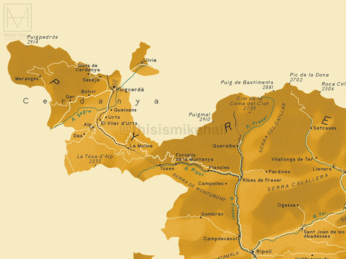
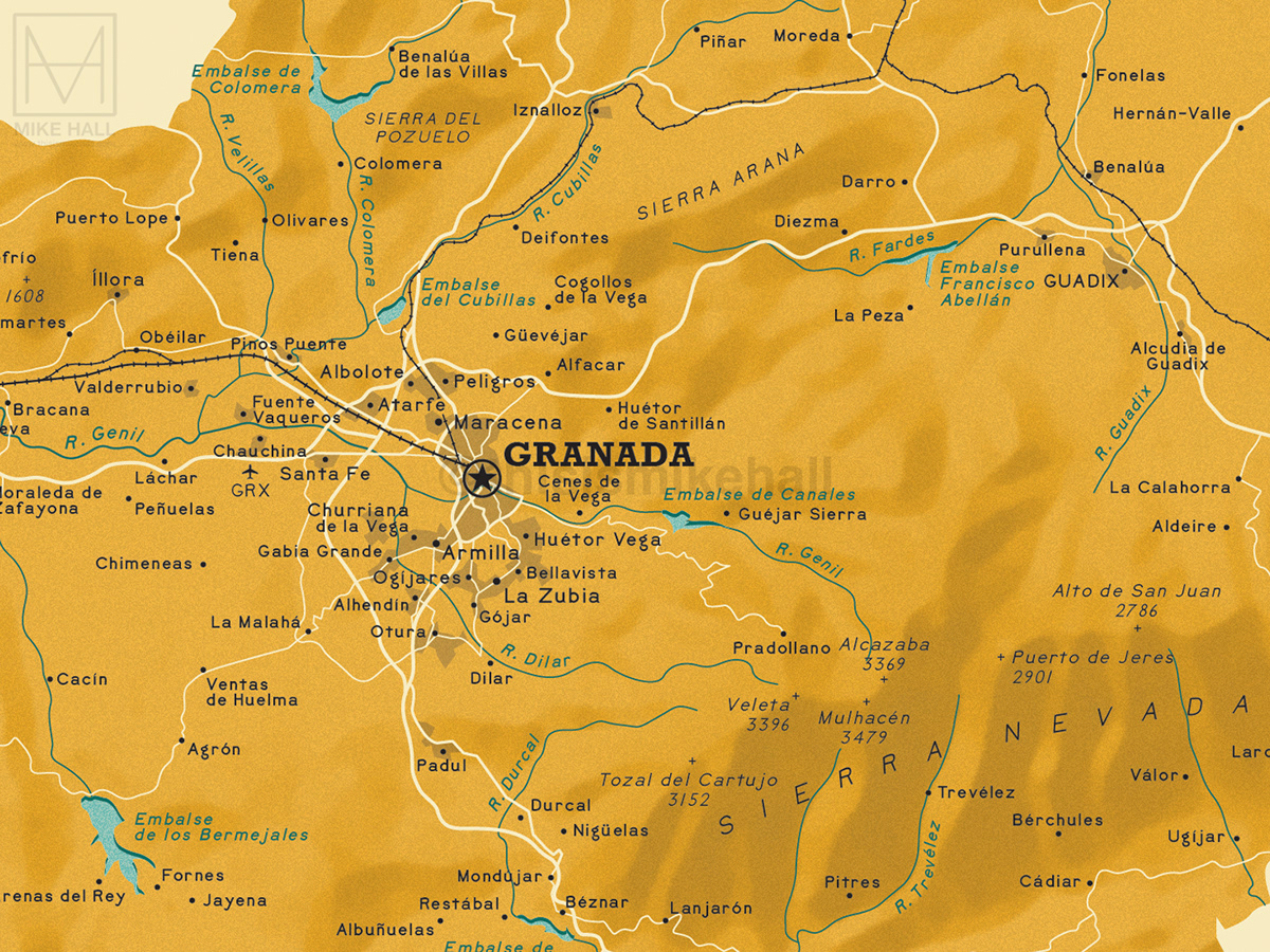
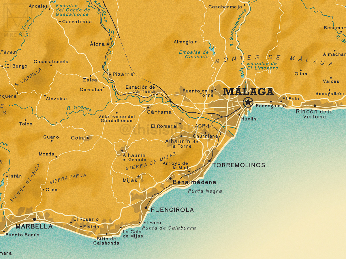
Besides major settlements, each map displays: the primary road and railway networks as of 2022; ferry connections to other Spanish locations or territories; mountain ranges and prominent peaks with their height in metres; courses of major rivers and streams; and other natural features such as headlands, islands, lakes, wetlands and reservoirs.

Detail of a map title and compass rose which appears in each design. Vast Shadow is the typeface used for the title.

The map of the Canary Islands, an overseas territory of Spain located off the west coast of Africa divided into two provinces: Santa Cruz de Tenerife and Las Palmas. This is the only design that displays more than one province in a single map.
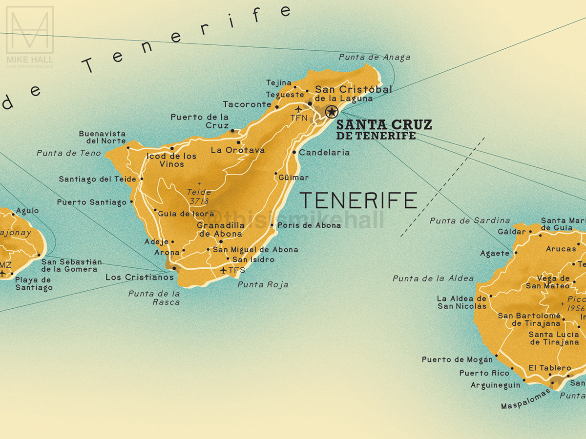
A detail from the Canary Islands map. The minimal colour palette is intended to evoke a bright, warm climate and memories of summer holidays. A light grain effect, terrain shading and the slightly offset positioning of the sea colour in relation to the coastline enhance the period feel.

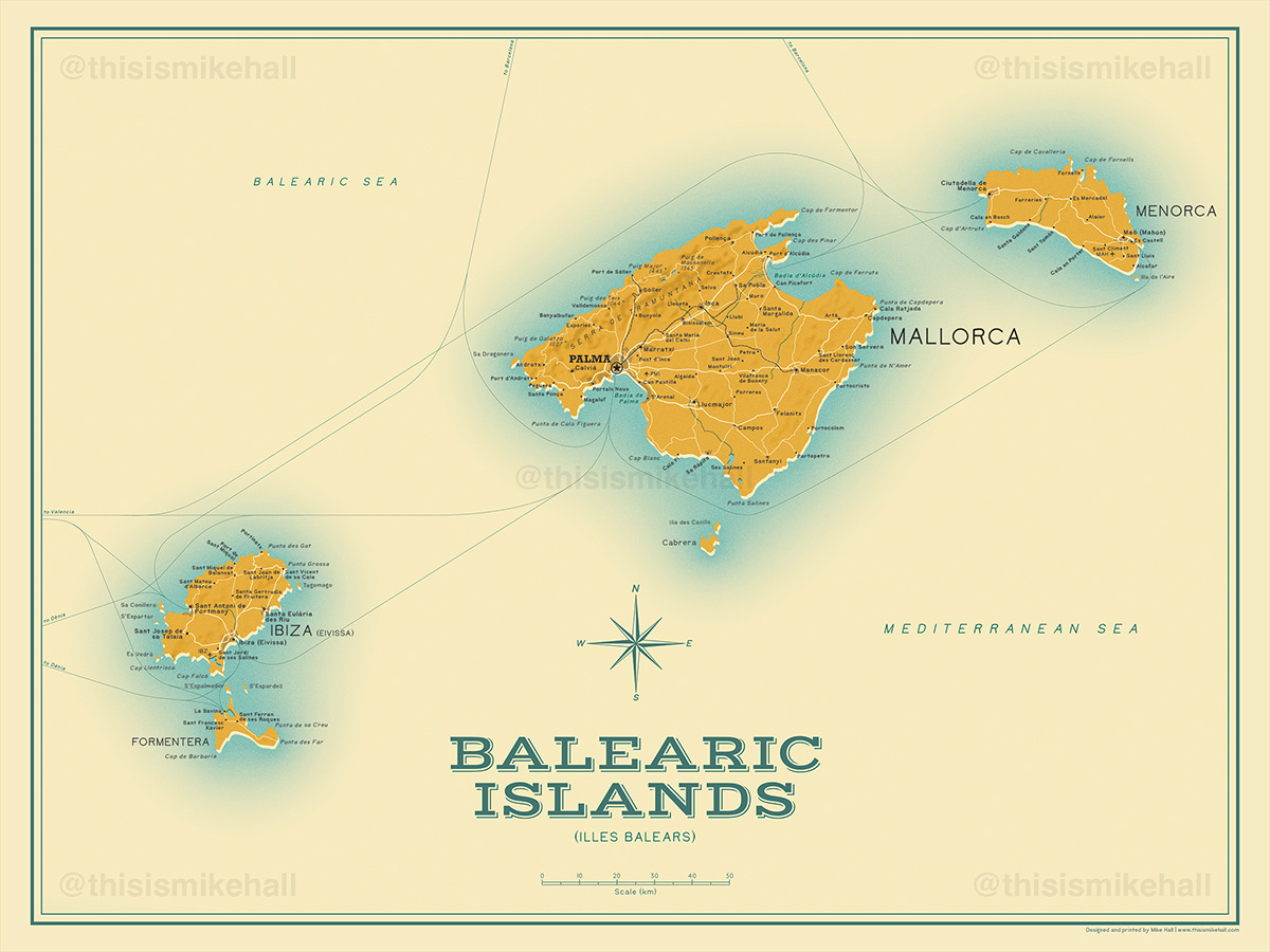
An example of the various versions of a map in different languages, in this case the Balearic Islands map which comes in three versions: international (English exonyms), Spanish and Catalan (Balearic). Each version uses correct place name and title spellings for each language.

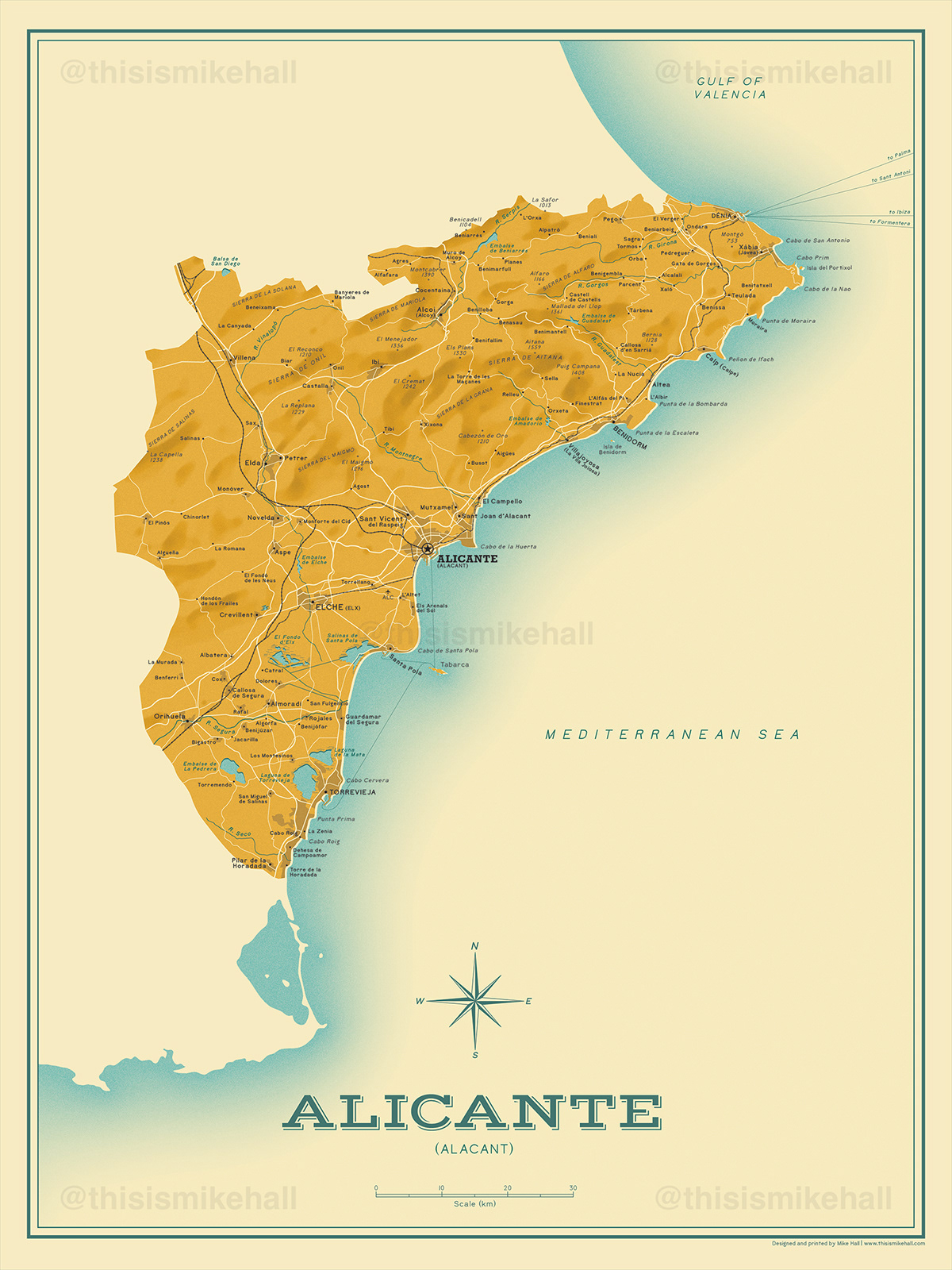
This animated GIF showing a section of the map of Alicante demonstrates the differences in spelling in each language version: international (English exonyms), Valencian and Spanish.
The maps
Below are listed all of the maps in sequence, with close-up details from each.


Remaining to be added to the series: Álava, Albacete, Asturias, Ávila, Badajoz, Burgos, Cáceres, Cádiz, Cantabria, Ciudad Real, Córdoba, Cuenca, Guadalajara, Guipúzcoa, Huelva, Huesca, Jaén, La Coruña, La Rioja, León, Lleida, Lugo, Madrid, Navarra, Orense, Palencia, Pontevedra, Salamanca, Segovia, Sevilla, Soria, Teruel, Toledo, Valladolid, Vizcaya, Zamora and Zaragoza.
Software used: Adobe Illustrator and Photoshop
Fonts used: Bell Topo Sans, Rockwell Bold and Vast Shadow
Reference sources: Google Maps, OpenStreetMap, Instituto Geográfico Nacional, Wikipedia


