
In the previous two parts of Skypark wayfinding project description we wrote about research and concept parts of it as well as design solutions for the way to the park and the parking lot. This part is about the wayfinding inside the park and design solutions for the attractions.

First we had to transfer all CJMs onto the location map. It was important to mark all the main and additional routes for various visitor types and visiting scenarios. This map would be used on the final stages to check the accuracy of information on the elements of the wayfinding system.
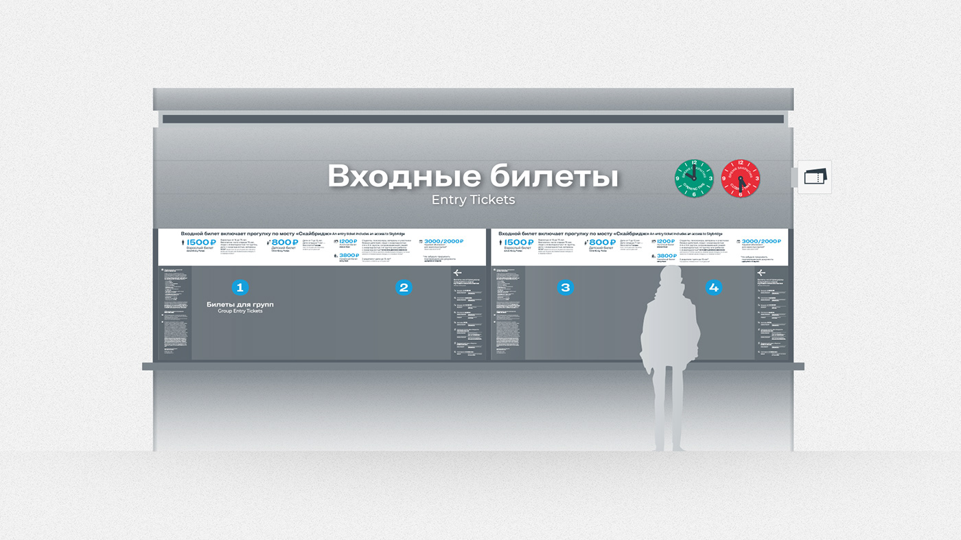
The starting point of the route was the ticket office where visitors could pay for admission. Here we showed all the existing entrance fees and fees for attractions as well as the park rules and the map to conveniently plan the route inside the park.

On the map we marked all points where visitors might need a hint. Depending on the question, navigation elements could be different: to plan the route and choose direction visitors would use monument signs, to check the correctness of the route – monument signs all along the route, to confirm that the end point was reached – signs and design elements on the attractions and other destination points.

Information on all the objects should match the location and create the most logical and consistent path. Besides, it was important to solve all the additional questions that may arise, for instance, where to find a ticket office or a cafe.
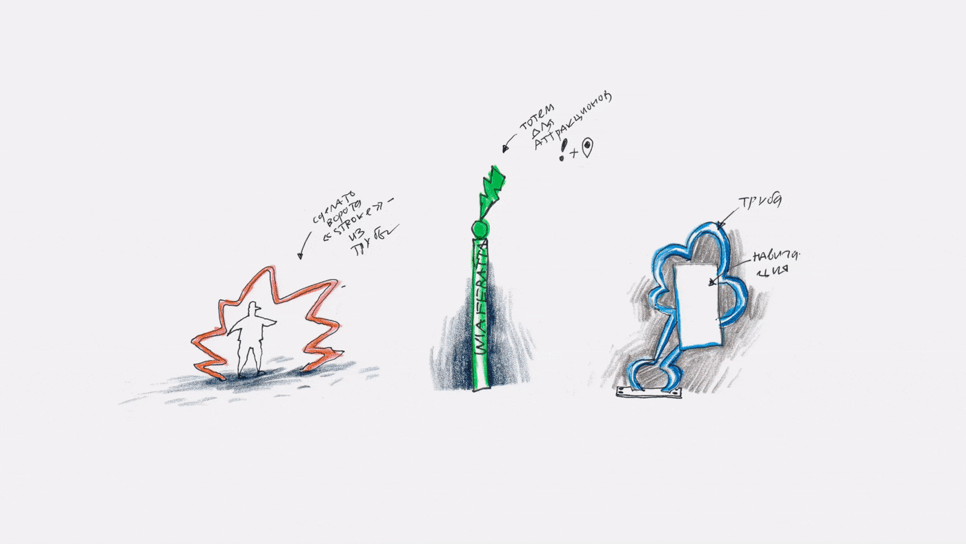
After organizing all the information and sorting out its hierarchy, we began looking for a design solution. It had to be in tune with the concept and be easily matched with all types of layouts. When looking for the solution, we had to take into account the park architecture and the environment. The result had to blend in with the surroundings but still stand out.

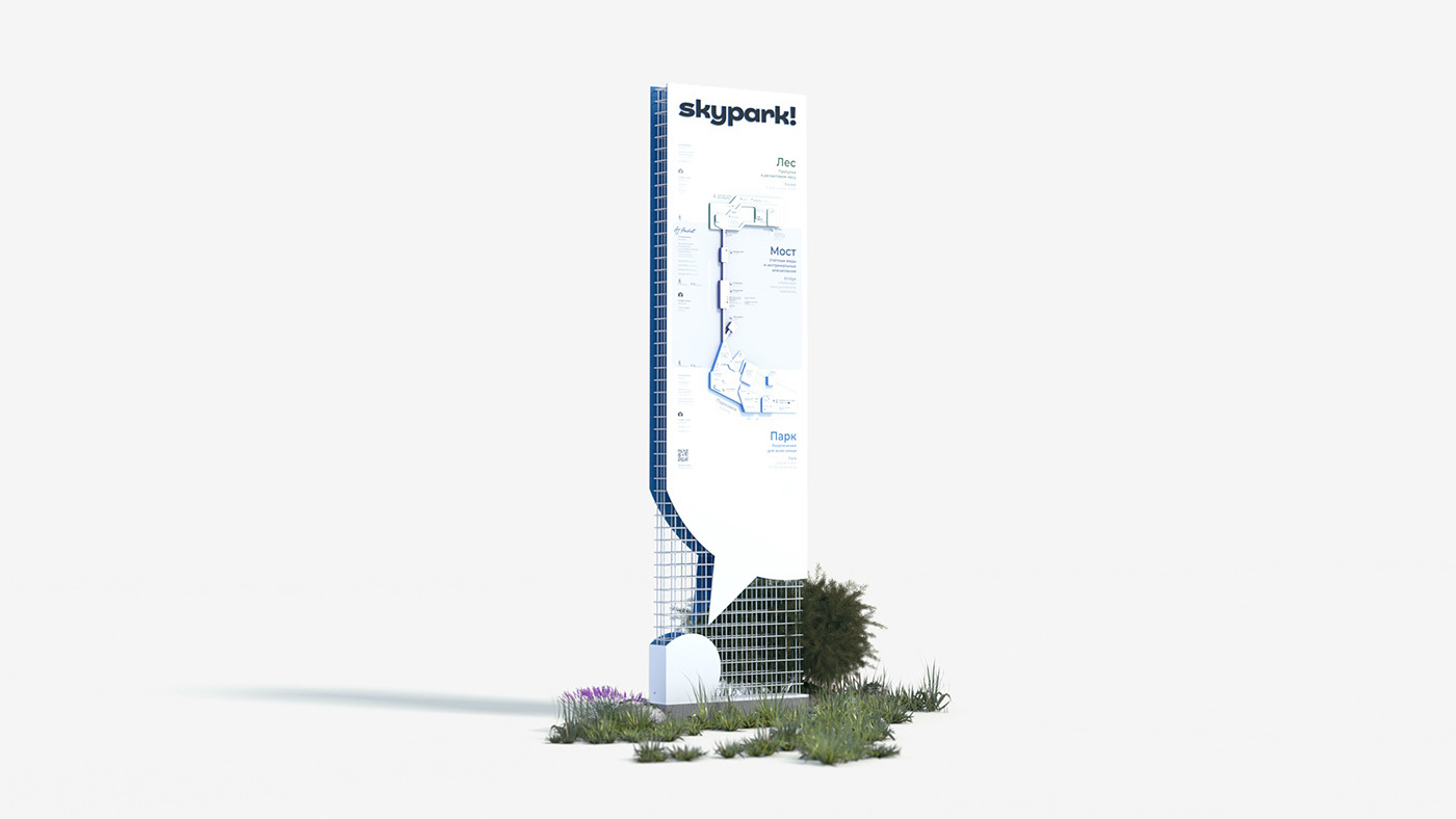
The monument sign with a map was the first and the most important sign that greeted visitors after they entered the park. Our task here was to explain to all visitors how the park worked, where he/she was, what activities were offered and where he/she could find them. We wanted visitors to plan they routes themselves and be able to choose any direction. We left quite a lot of space in front of the first monument sign so several people could study it.

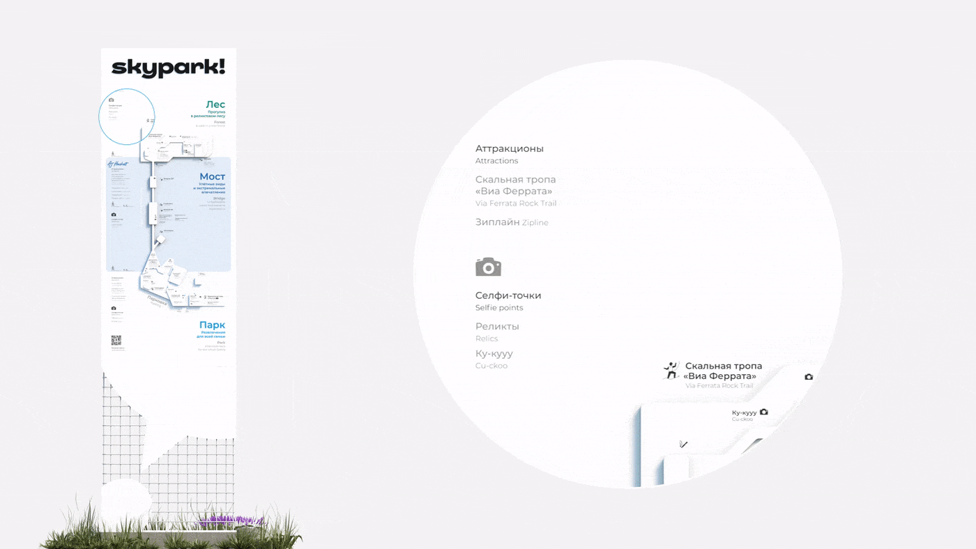
Wayfinding in the park has always been different from wayfinding in the subway, because here visitors never need the fastest way to get from A to B. So, In Skypark people could choose different routes, each of them offering cool selfie points and messages we created. In order for visitors to evaluate the duration of the route, we mentioned the distance from all points to the main places of interest in minutes.


After visitors decided where to go and started moving, we tried to follow them and inform them about points where they could get lost or change their mind and leave the route. In case someone forgot to read the park rules, we reminded about them using icons on the sides of monument signs.

For places not suitable for monument signs we placed hints and pointers on the glass surfaces.
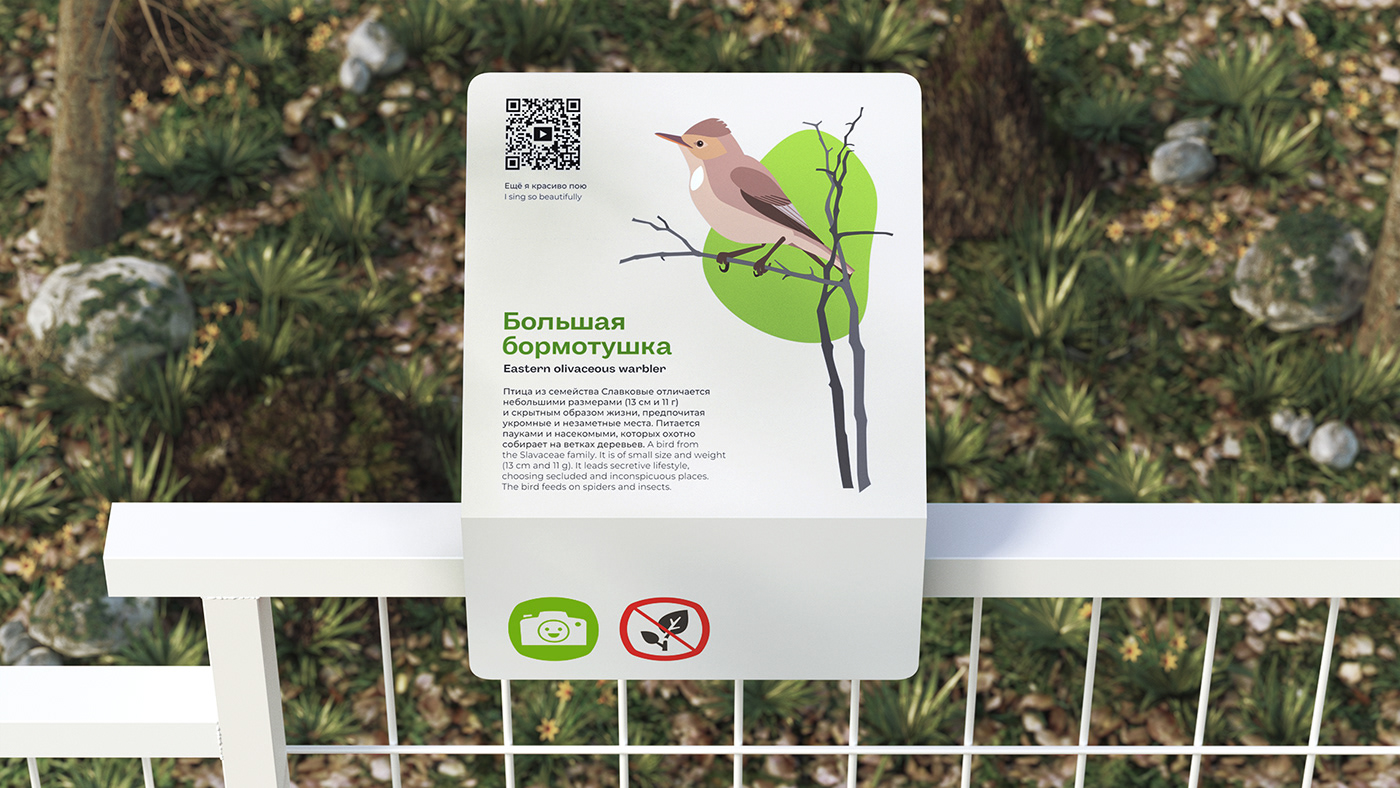

Additional information about the route, like facts about the landscape, flora and fauna, could be found on the info stands. A good reason to rest a bit and learn something new.


The end points of each route, like attractions, were designed in the same logic. One could read about the attraction on the special stand next to it and learn everything from working hours to rules. QR-codes lead to videos from each attraction.
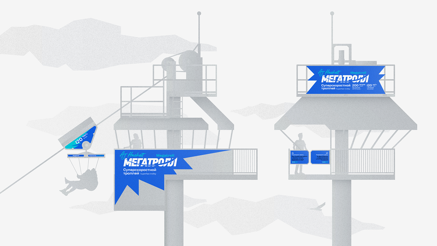

Each attraction was designed using the brand’s visual style that helped to find starting points around you.

One other task was to create a wayfinding system for an outstanding and huge part of the park – Mowgli Rope Park. Its wayfinding system wasn’t part of the main system but had its own structure, like a park inside a park. All routes were indicated on the entrance stand.

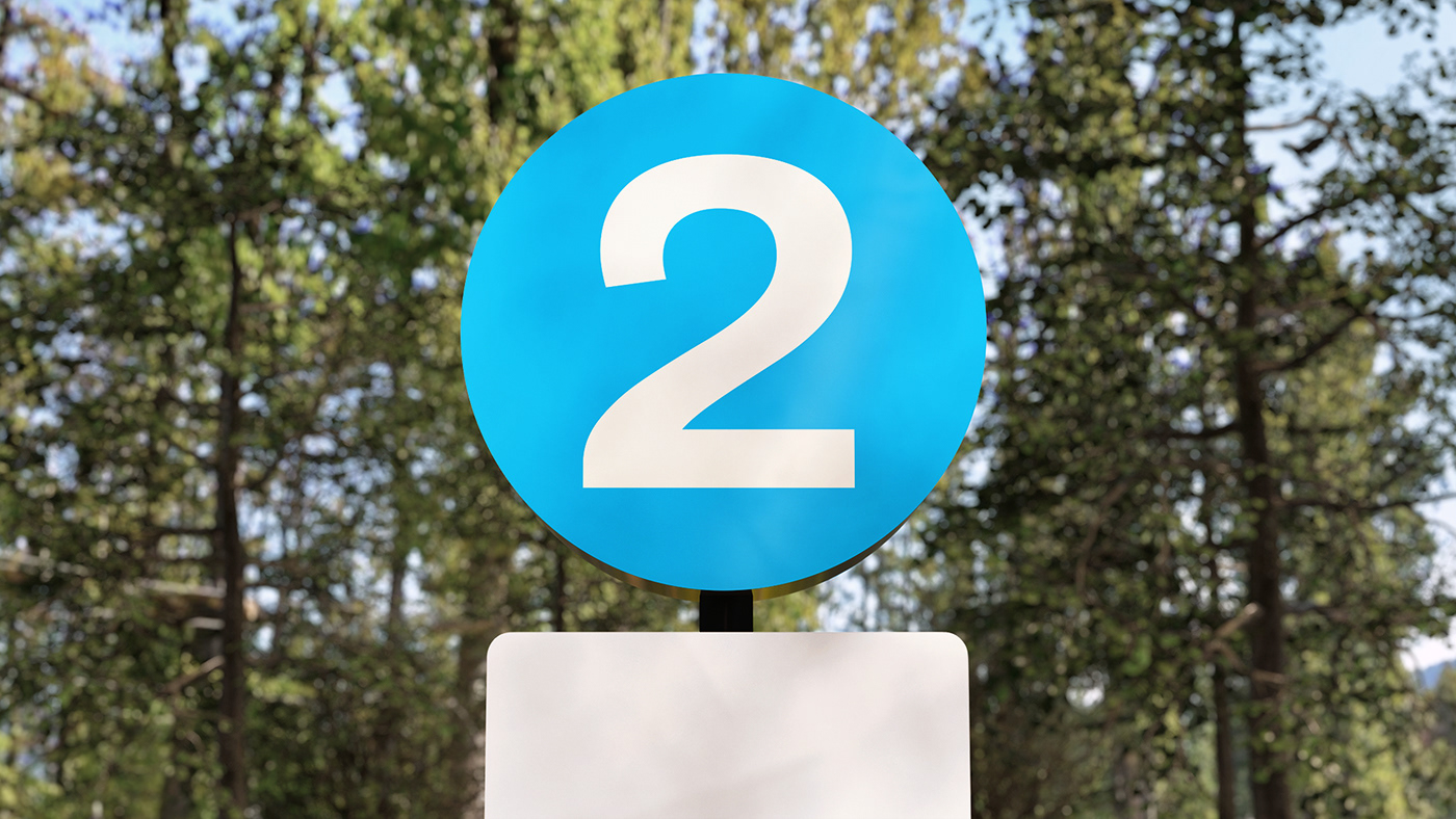

Monument signs with large numbers marked the start and end points of each route. We also gave them names inspired by Kipling’s The Jungle Book: Brave Panther Path, Treacherous Tiger Path, Wise Python Path, etc.
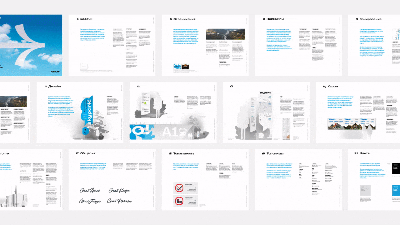
All information regarding the wayfinding system was collected in the document, including concept description, hierarchy, design elements, etc. It would help to support and develop the system, so the system stayed up to date and convenient for visitors.

All elements are in tune with each other regarding design, tone of voice and architectural solutions. To ensure we didn’t make mistakes we tested all the wayfinding elements inside the park to find the right places for them.
See you in Skypark!
Project team
Alyona Naumova, Producer
Egor Myznik, Creative Director
Mikhail Ivanov, Art Director
Maria Sinyutina, Art Director
Alia Karnaukhova, Designer
Irina Purtova, Designer
Evgeniya Khludentsova, Designer
Nikita Boldyrev, Architect
Oleg Ahn, Content Producer
Anna Volkova, Motion Designer
Artyom Leontyev, Head of Marketing and Sales, Skypark
Olga Troyanova, Advertising Manager, Skypark


