Visitors Learn About Water Conservation and the Environment on Multitouch Displays
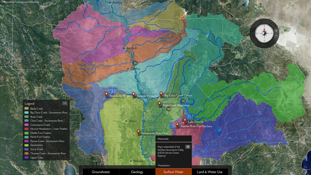
The Butte County Department of Water and Resource Conservation, theCalifornia Department of Water Resources, and Gateway Science Museum at California State University, Chico teamed together with Ideum to create an interactive watershed map exhibit. Using layered maps of Northern California, this application, designed for public education, allows users to explore in-depth data about watersheds and water conservation in the I-5 corridor from Williams to Redding, CA.
Ideum worked closely with the project partners to create a multitouch user interface that easily conveys detailed technical data in an engaging and social manner. The exhibit facilitates multiple users interacting simultaneously. The exhibit includes: moveable pop-up menus, album views that are tethered to pushpins on the map, and a physics driven compass with user zoom control. Gestures used include tap, drag, pinch and zoom, and rotate. Image and media content, driven by Flickr, are used to further illustrate watershed information about groundwater, surface water, geology, and land and water use.
This multitouch map application runs on both an Ideum Pro multitouch table and Presenter 55 touch wall and was created with the GestureWorks FlashSDK with Flickr acting as the content management system. The application will be available to the public at the Gateway Science Museum at California State University, Chico.