
This collection of 11 images are the result of two walks high up in the Bolivian Andes.
I arrived on a Wednesday to one of the highest airports in the world at 4061.5 meters over sea level. The air is very thin at that altitude.
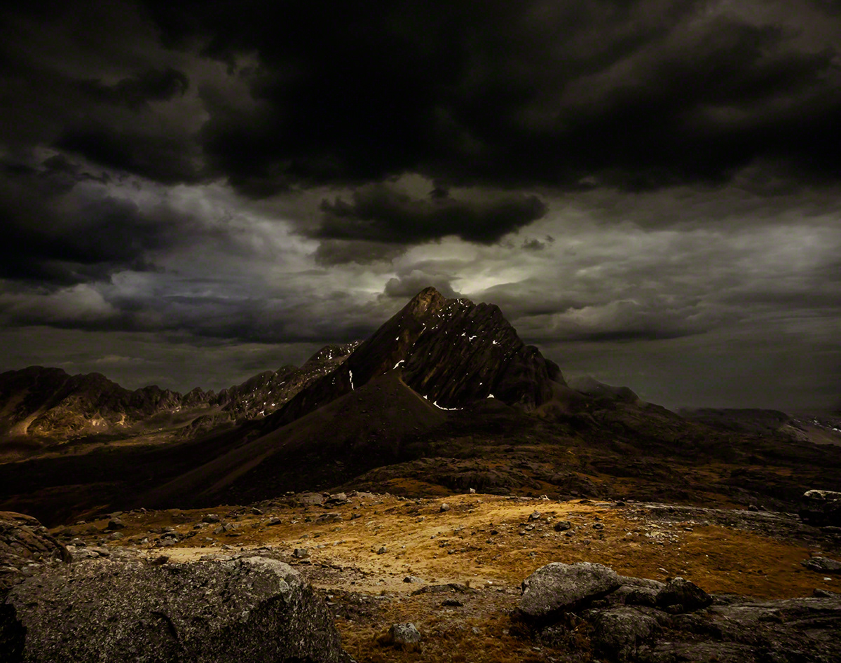
Three days later on Sunday, two friends invited me to walk to view the great mountain range Serranías de Murillo, you can see it on the third image.
We left at 4:00AM and drove to the furthest accesible road, several kilometres below the first image. We climbed in a slow ascent up to 5100 meters over sea level. Remembering what I was told when exercising to push over the pain, I tried that... bad advice at that altitude because of the lack of oxygen: I felt my heart stop for a couple of beats and my lungs seemed to freeze... not a pleasant experience.
A few weeks later we walked the section at the foot of the mountain range: the marshlands or bofedales.
I have very many more images of both of these journeys, I selected this few to share with you.

The Highlands or Altiplano, at 4.065 meters over sea level, just above the red horizon and the city of La Paz below.The sun is rising behind the viewer.

Coming down on the second trip

A section of the mountain range: Serranias de Murillo

Ch'iyar Pullu. We walked to the right of this mountain on the second trip.
Serkhe Khollu, almost at the summit of the second walk

Bofedales or marshlands and a settlement.

We walked to the right of the mountain (Serkhe Khollu), past the lake to the very edge by the snow peak. That day the temperature was well below freezing with a wind that froze the clouds on the bowlders.


Two iconic and sacred mountains of the Bolivian Andes: Mururata and Illimani

Mururata

Illimani


