
3D Cartography of Norway
Another chapter of our journey through the time and space of Norway discovering Fjords and cities.
This print is a combination of vintage map and 3D model digitally rendered to show the relief of the territory, through the elaboration of Digital Elevation Model.
If you like our work, want to see our daily work or want to say hello to our studio, consider to follow our Instagram account.
Otherwise if are interested in our prints or have a custom request check our shop Vizcart.io
Otherwise if are interested in our prints or have a custom request check our shop Vizcart.io
For inqueries or commission, feel free to contact us at hello @ vizart . io


Kristiania amt nr 77: Kart over Kristiania. Amtskartsamling, Oslo 1901. Norsk Lithgr. officin, Oppmaalingsvæsenet i Kristiania
Source: kartverket

J10 Vestvaagø, Gradteigskart, Nordland 1907; Ukjent.
Source: kartverket
Source: kartverket

M711-Norge50, Nordland, 1952. Norges Geografiske Oppmåling, Svart-hvit, blått vann
Source: kartverket
Source: kartverket

Map info: Salta, Landgeneralkart 1933, O. Engh, Bernh. Tolstad.
Source: Kartverket
Source: Kartverket

K11 nordøstre del, Einar C. I. N. Michelsen, 1902.
Source: Kartverket.
Source: Kartverket.


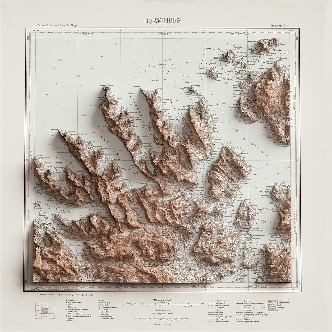
Topographic map of Norway, N6 Hekkingen, 1930
Source: Kartverket
Source: Kartverket


Topographic map of Norway, 1830-1 Lofotodden, Norge, 2009
Source: Kartverket