3D Cartography of Italy
a journey through the time and space of Italy through the discovery of its territory.
This print is a combination of vintage map and 3D model digitally rendered to show the relief of the territory, through the elaboration of Digital Elevation Model.
If you like our work, want to see our daily work or want to say hello to our studio, consider to follow our Instagram account.
Otherwise if are interested in our prints or have a custom request check our shop Vizcart.io
Otherwise if are interested in our prints or have a custom request check our shop Vizcart.io
For inqueries or commission, feel free to contact us at hello @ vizart . io
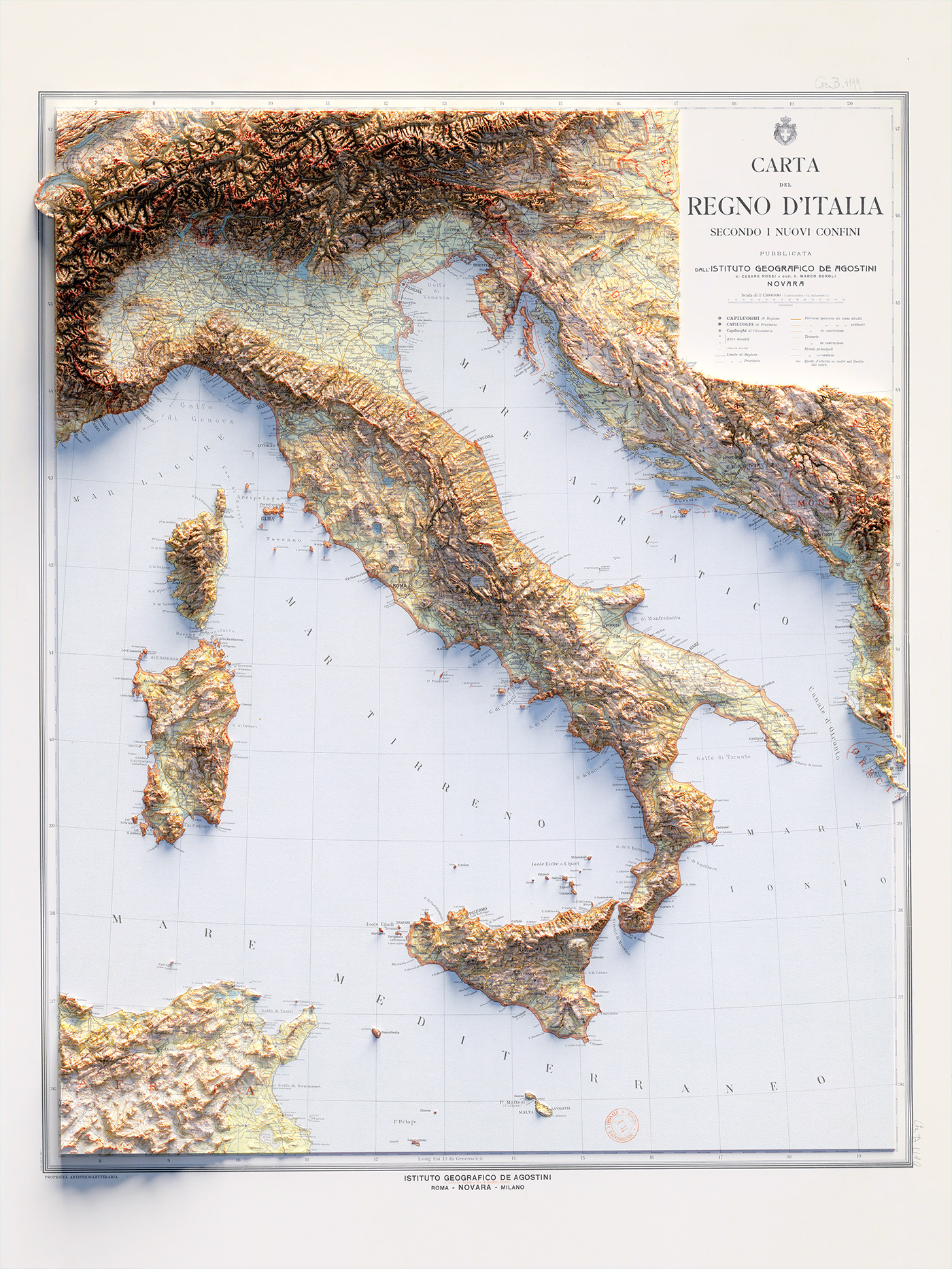
Map info: Carta del regno d'Italia secondo i nuovi confini, Istituto Geografico De Agostini; 1922.
Source: BnF Gallica
Source: BnF Gallica

Map info: Italy. (inset) Palermo. (inset) Venezia (Venice). Pergamon World Atlas. Pergamon Press, Ltd. & P.W.N. Poland 1967. Sluzba Topograficzna W.P.
source: David Ramsey collection
source: David Ramsey collection
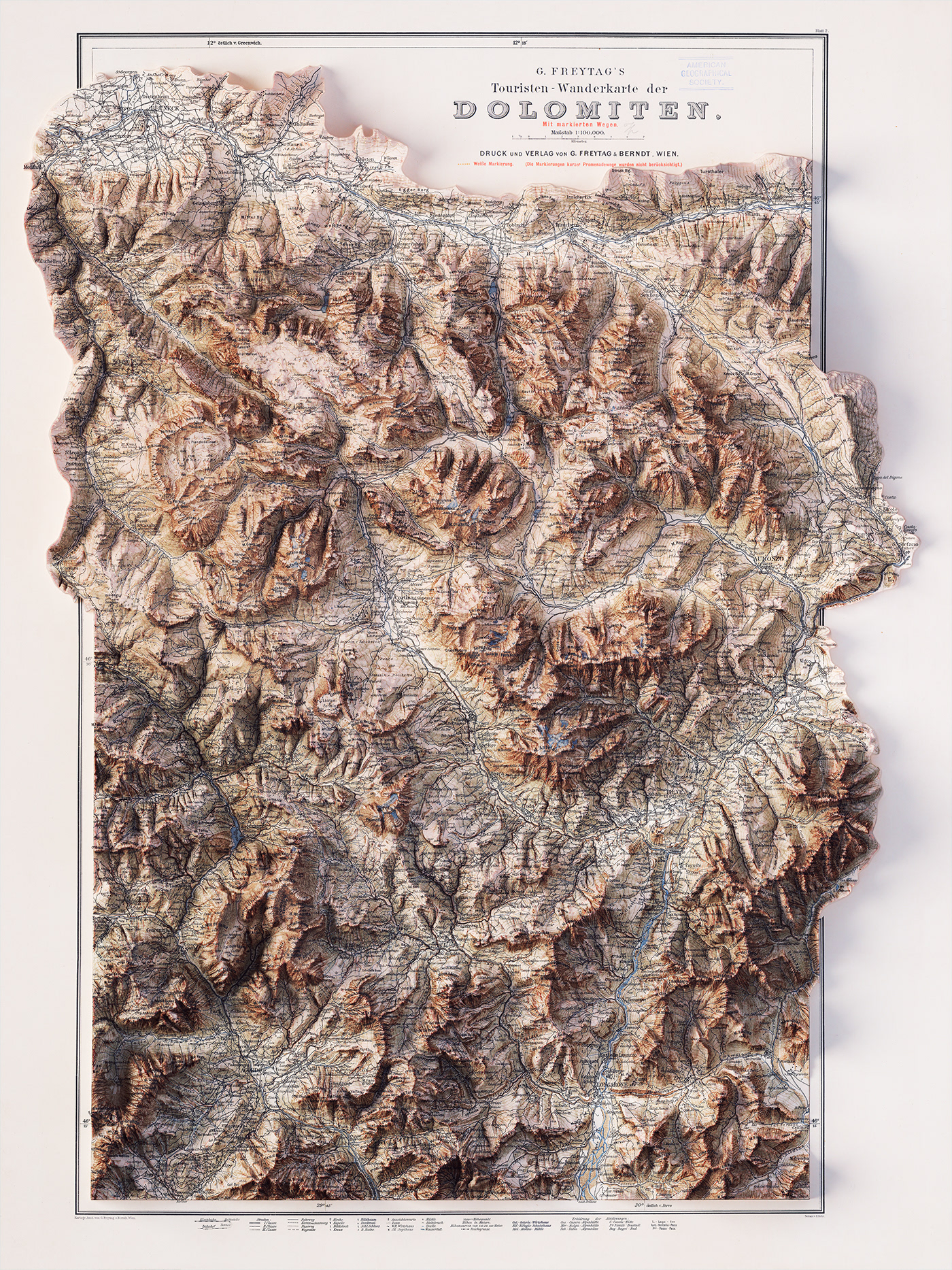
Touristen Wanderkarte der Dolomiten. Dolomite Alps, Italy 1904.Druck und Verlag von G. Freytag & Berndt
Source: UWM Libraries
Source: UWM Libraries
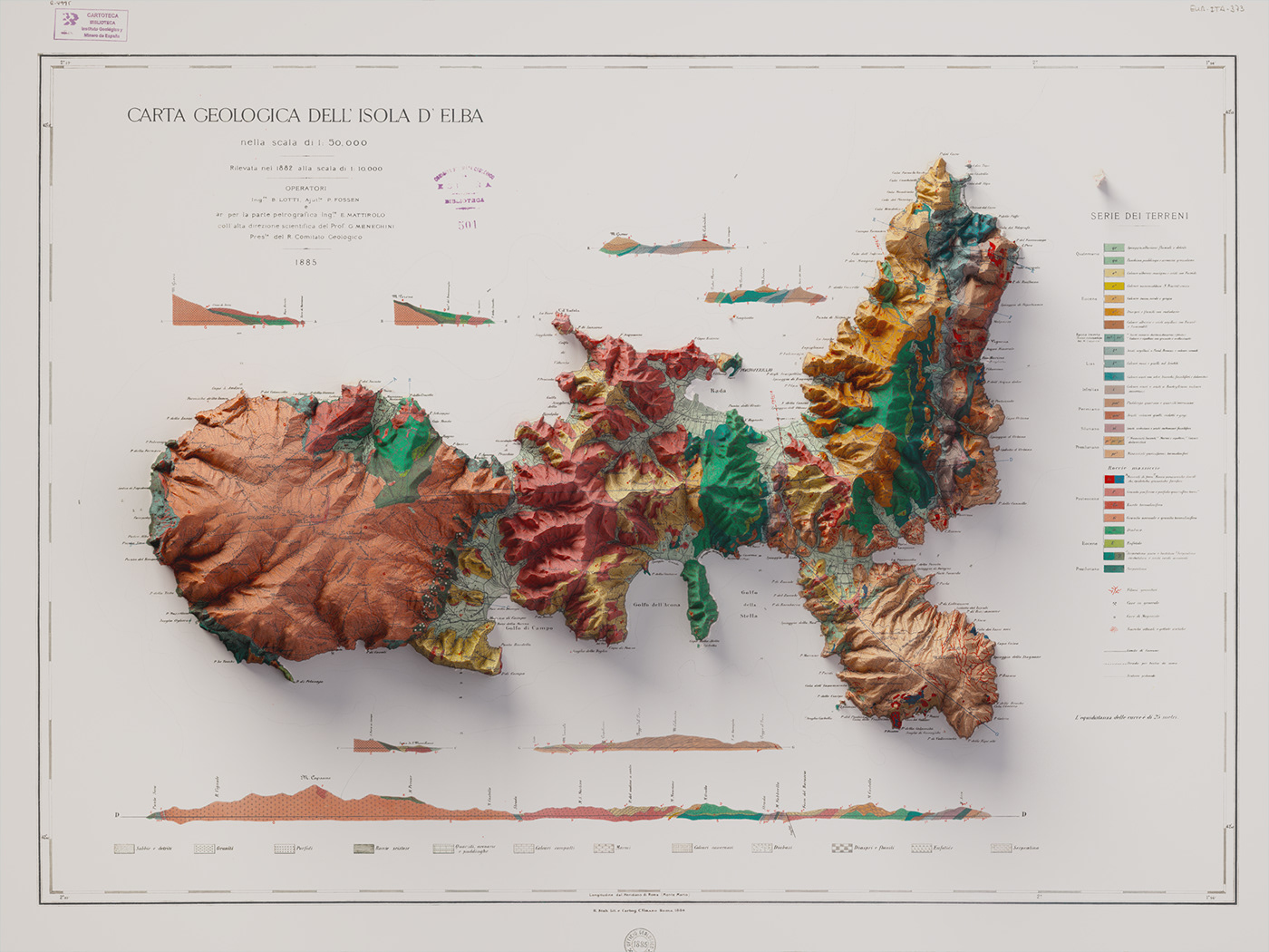
Map: Carta geologica dell'Isola d'Elba, B. Lotti, P. Fossen, E. Mattirolo, G. Meneghini, 1885.
Source: IGME
Source: IGME
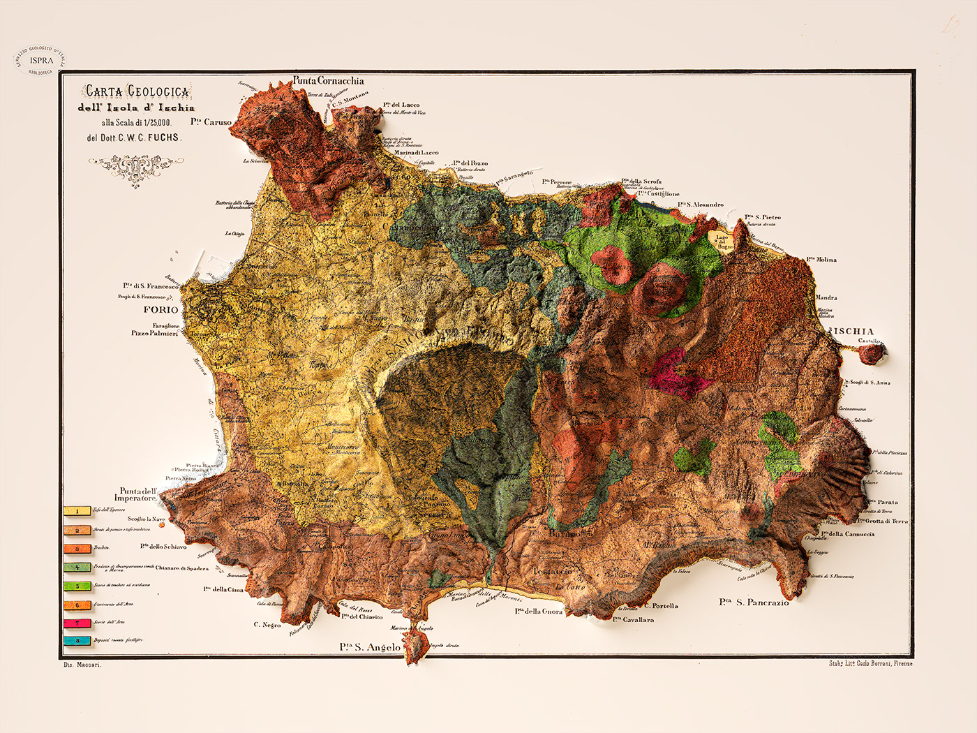
Carta geologica dell'isola d'Ischia alla scala 1/25.000
del R. Comitato Geologico del Regno d'Italia coordinata dal dott. Carl Wilhelm Casimir Fuchs, disegnata da Maccari; 1873.
Source: ISPRA
del R. Comitato Geologico del Regno d'Italia coordinata dal dott. Carl Wilhelm Casimir Fuchs, disegnata da Maccari; 1873.
Source: ISPRA
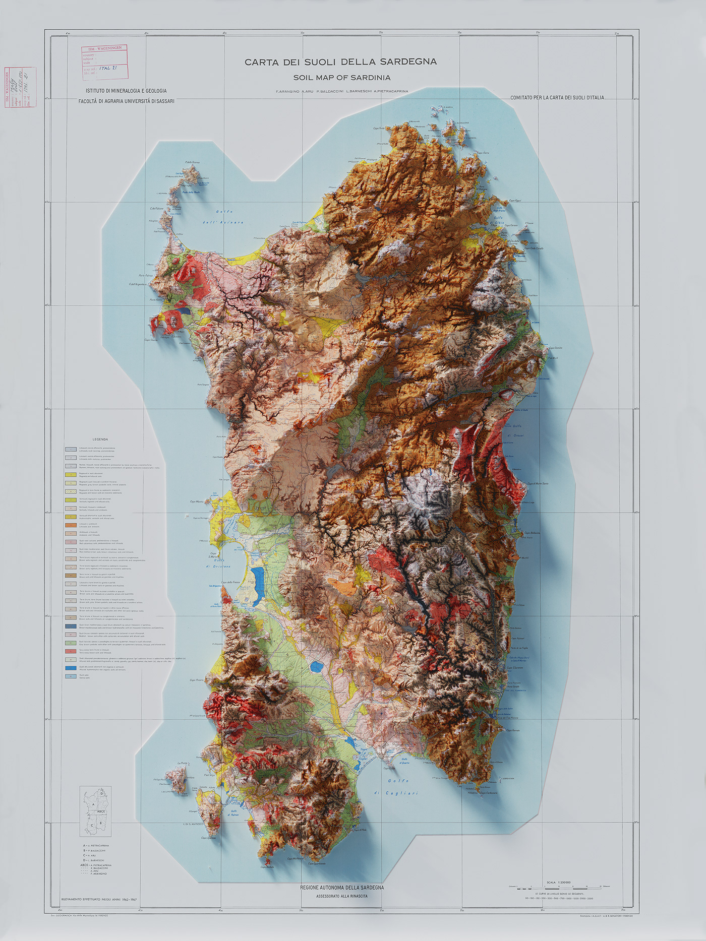
Map info: Soil map of Sardinia, F. Arangino, A. Aru, P. Baldaccini, L. Barneschi, A. Pietracaprina, Istituto di Minerologia e Geologia, Facoltà di Agraria, Università di Sassari. 1960.
Source: European Soil Data Centre (ESDAC)
Source: European Soil Data Centre (ESDAC)
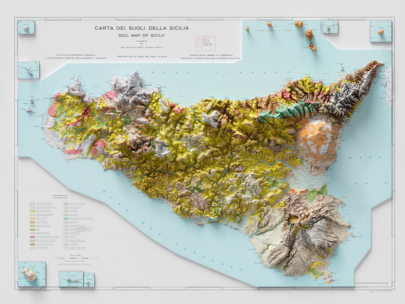
Map info: Soil map of Sicily, Gian Pietro Ballatore - Giovanni Fierotti, Istituto di Agronomia Generale e Coltivazioni Ebracee dell'Università di Palermo. 1967.
Source: European Soil Data Centre (ESDAC)
Source: European Soil Data Centre (ESDAC)
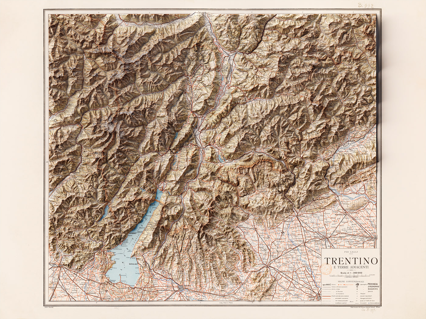
Trentino e terre adiacenti, Pio Galli. Ed. A. Vallardi (Milano); 1916.
Source: Gallica BnF
Source: Gallica BnF