
Personal narratives can show the nuances of war and occupation, and the messiness of human decisions. My objective with this project was to create a platform that centered Palestinian lives. #palestineishere utilizes the framework of co-design to explore the idea of design as protest. The project consists of a website and digital posters that participant-collaborators are encouraged to both interact with and create. Randomly-generated, crowdsourced images of Palestinian homes are displayed & overlaid on Palestine’s border, spanning pre-Bristish occupation in 1917 to heavy Israeli occupation in 2020.
Participant-collaborators are encouraged to upload an image of their home through a simple and user-friendly website design. Hand-drawn graphic elements are used to allude to the human-made and arbitrary lines that function as borders. The colors of the Palestinian flag--red, green, white, and black--are used as a unifying theme. The background pattern is a tatreez, a traditional Palestinian weaving, that has been blurred, erased, plotted, and contorted. Each home invites viewers to see how Palestinians live, and witness the effects of the ever-encroaching Israeli border. Hovering over each image will reveal information about Palestine and uncover the historical context of the image and its corresponding year.
Typeface: ABeeZee, Rhodium Libre, and Gotham
Size: Variable Digital Platforms, 18 in. x 24 in. Digital Poster
Images: Hatem Moussa
Mockup Live Link Here
Website Landing Page
Website Subpages: Randomly Generated Crowd-Sourced Images


UX Features on Website
Digital Poster Stills
18 in. x 24 in.


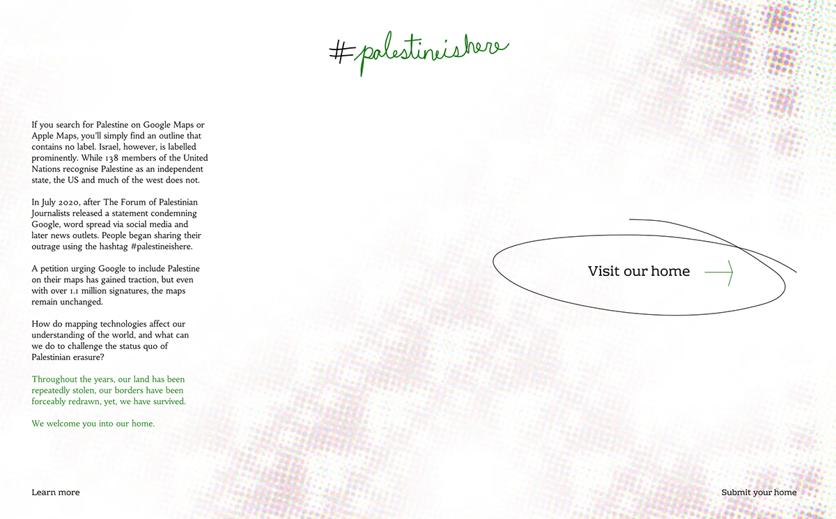
If you search for Palestine on Google Maps or Apple Maps, you’ll simply find an outline that contains no label. Israel, however, is labelled prominently. While 138 members of the United Nations recognise Palestine as an independent state, the US and much of the west does not. To do so would damage america’s power in the region. President-elect Joe Biden has said, “It’s about time we stop apologising for our support for Israel, it is the best $3bn investment we make. If there weren’t an Israel, the United States of America would have to invent an Israel to protect her interests in the region.”
In July 2020, after The Forum of Palestinian Journalists released a statement condemning Google for their actions, word spread via social media and later news outlets. People began sharing their outrage using the hashtag #palestineishere. Google’s official response was, “We take a neutral view when it comes to countries and borders; and use the overall consensus of all nations and how cartographers around the world depict such matters. As the world situation changes, so will Maps.” This statement contradicts what the tech giant does in similar border disputes, like in Crimea-Russia and Pakistan-India, among others. By not having Palestine on the map, Google and Apple are actively erasing an existing nation and its people. A petition urging Google to include Palestine on their maps has since gained traction, but even with over 1.1 million signatures, the maps remain unchanged.
Design is not neutral. While researching the matter, I found myself asking the following questions:
How do mapping technologies affect our understanding of the world?
What else changes when borders do?
What can we do to challenge the status quo of Palestinian erasure?
What can qualitative data do that statistics cannot?
How can I bring dignity and value to Palestinians, and what is my role as a designer if attempting to do so?
Links (Submit Your Home & Learn More)


Research


Early Sketches


