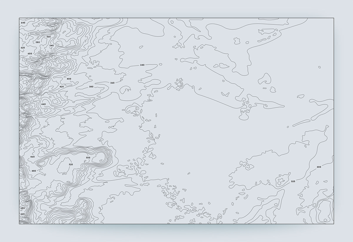
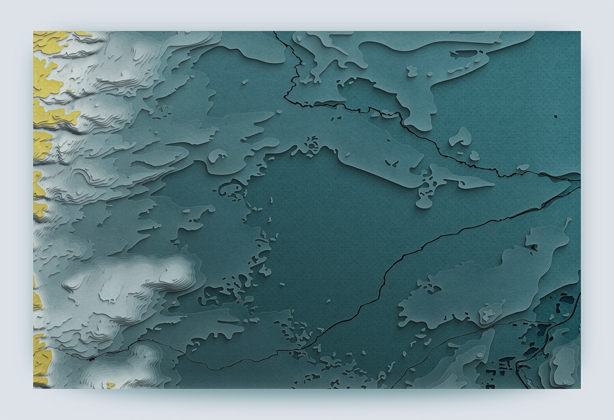
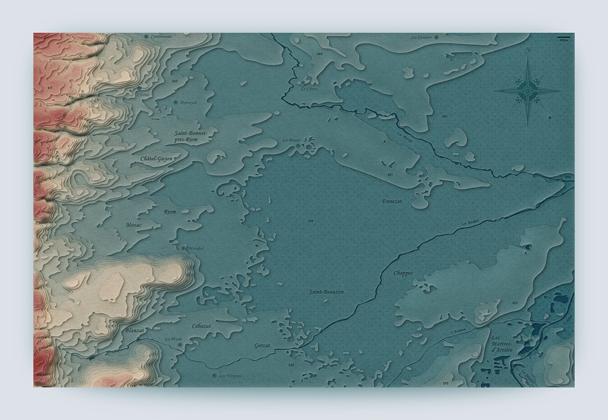
The Auvergne Region – A Topographic Map
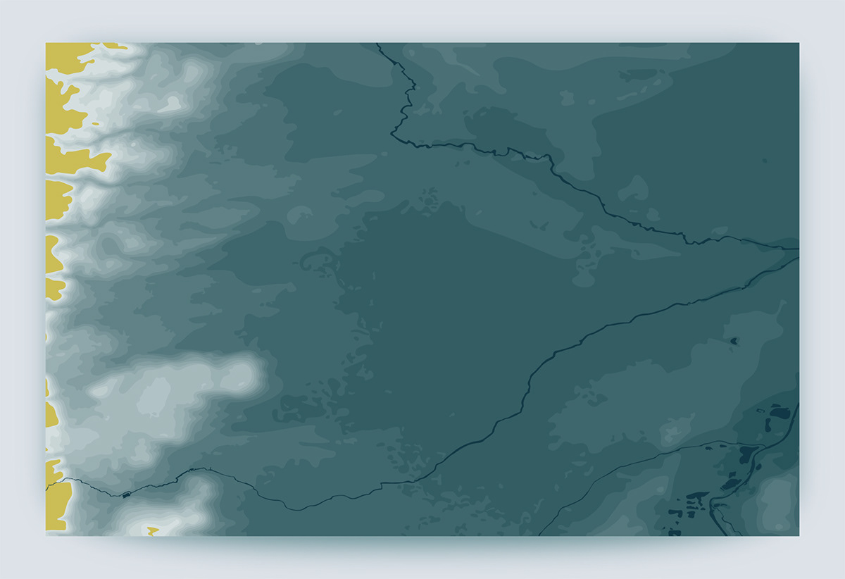
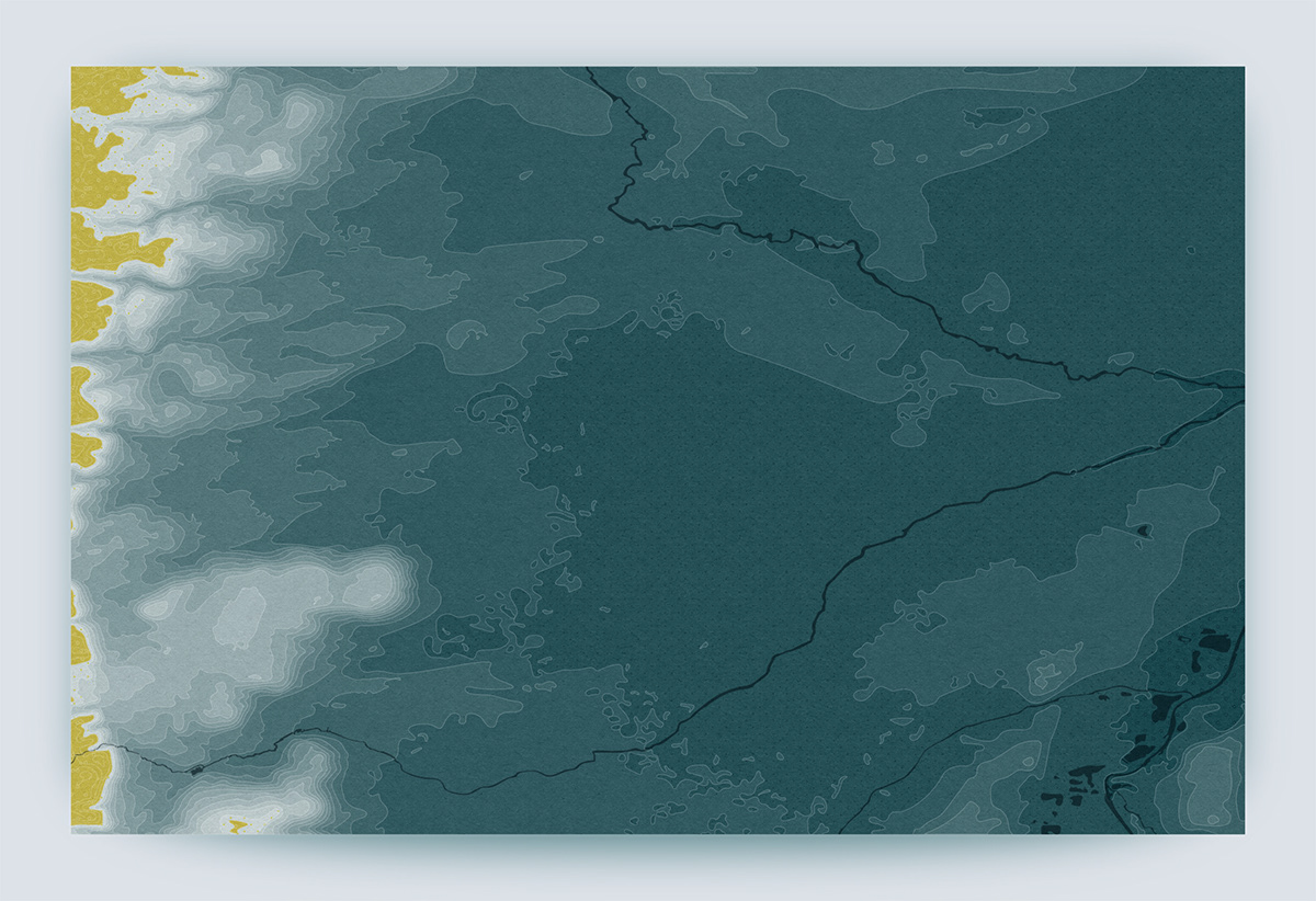
This is a map of my hometown in France, Saint-Beauzire, and its surroundings. It is located in a valley and is a short distance from Western reliefs – mostly volcanoes. To create the artwork, I gathered elevation data from the US Geological Survey database and organized it using geographic information software. The style is inspired by the works of Pr. Tanaka Kitiro and his topographic contour technique, where a simulated light source is used to bring depth to the design. As shown in the legend, elevation is color-coded in 20-meter increments.
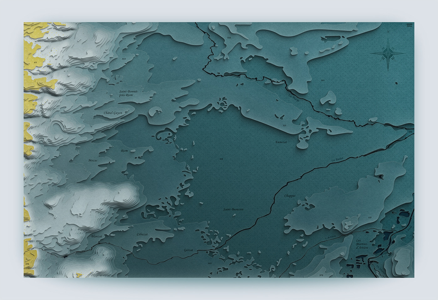

Workflow
After processing raw satellite imagery data in QGIS, I imported the vectorized map into Illustrator to arrange layers and worked further on textures and effects in Photoshop. Below, you can see important steps of the design process as well as an alternate version of the map.