
In 2017 I was commissioned by Dr. Gerard Wegemer, founder of the Center for Thomas More Studies based at the University of Dallas, Texas, to create two detailed illustrations for display on the Center's website and for inclusion in their publication The Essential Works of Thomas More (2018).
Part 1: Map of Thomas More's London

The first part of the commission involved the creation of this detailed historical view of London during Thomas More's lifetime (1478-1535), loosely based on the appearance of the city and its streets and buildings in the 16th century (click to enlarge).
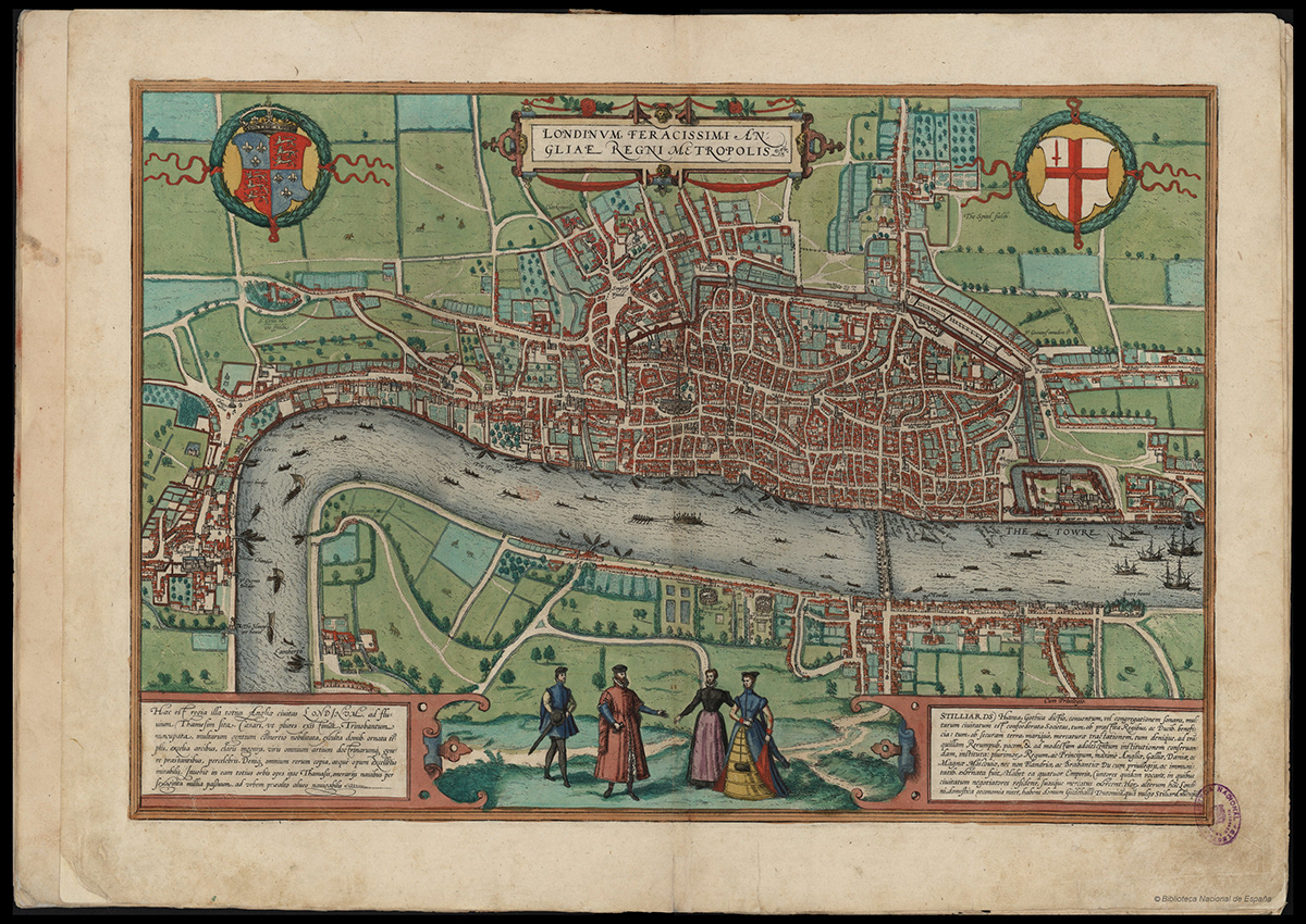
A view of London from Georg Braun and Frans Hogenberg's Civitates Orbis Terrarum (Cities of The World) of 1617, which inspired my map's style, composition and colour scheme.

Detail of Covent Garden, Drury Lane, Lincoln's Inn and Strand.

Detail of Holborn, Smithfield, Fleet Street and the Fleet river.

Detail of St. Paul's Cathedral, Blackfriars and Cheapside.

Detail of Bishopsgate, Houndsditch and Aldgate.

Detail of the Tower of London and the River Thames.

Detail of Southwark and Bankside.

Detail of Westminster, Whitehall and Lambeth.
My original concept sketch (click to enlarge).

Detail of my original concept sketch.

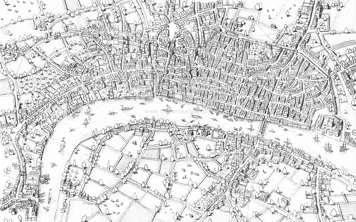
Ink version of More's London map in progress, November 2017.
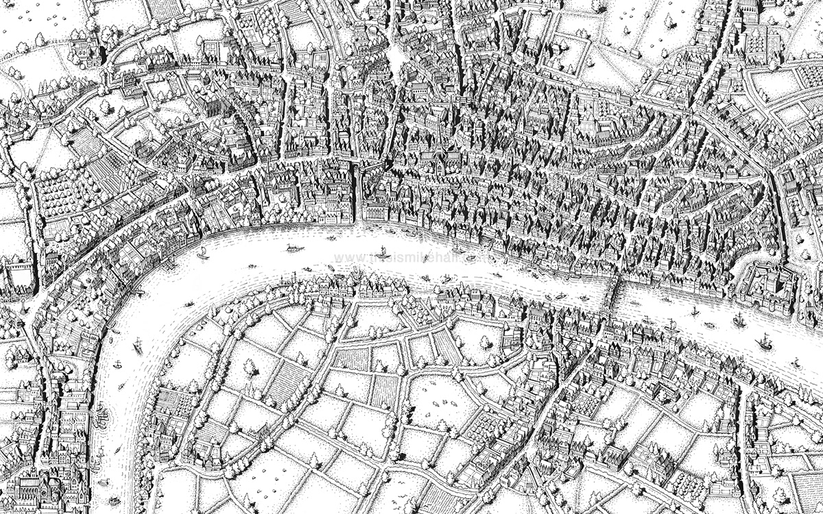
Completed ink version of More's London map (click to enlarge). Colour and text was subsequently added using Photoshop.
Part 2: Beaufort House, Thomas More's Chelsea Mansion

My detailed illustration of Beaufort House, Thomas More's mansion at Chelsea between 1520 and 1535, as it would have appeared in his lifetime.
The house was demolished in 1740 (a full history of the site can be read here: https://www.british-history.ac.uk/survey-london/vol4/pt2/pp18-27). Modern-day Beaufort Street now runs north-south directly through the middle of the site, following the line of the mansion's main driveway; Chelsea Old Church, shown at the bottom-right corner of the drawing, still exists beside the river today.

A view of Beaufort House engraved by Johannes Kip in 1708, one of several historic views of the house and grounds I used as reference for my illustration. (Source: https://www.rbkc.gov.uk/vmgallery/general/medium.asp?gallery=vm_history&img=history/thumb/vm_hs_0003.jpg&size=medium)

Work in progress, April 2018.

Detail of the house, driveway, surrounding walled gardens and stable yard.

Detail of the gardens and grounds to the north of the house.

Detail of the driveway entrance, river bank (modern-day Cheyne Walk) and pier.

Further detail of the river bank and Chelsea Old Church.

