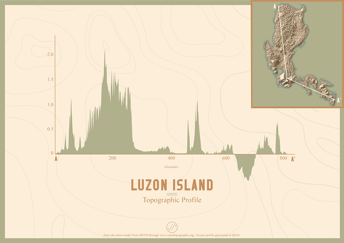
A visual graph study of the Philippine island’s varied topographic elevation and partial bathymetric depth. Dataset used is a digital elevation model from Shuttle Radar Topography Mission.
Присоединиться к Behance
Подписаться или Войтичтобы просматривать индивидуальные рекомендации, подписываться на авторов и пользоваться другими возможностями.
или
Присоединиться к Behance
Подписаться или Войтичтобы просматривать индивидуальные рекомендации, подписываться на авторов и пользоваться другими возможностями.