
Randstad Spoor
Trains in the City
Trains in the City
What happens when rail service in a large megalopolis receives the same treatment as a typical metro network? Suddenly the relationship between the city cores and surrounding villages becomes clear and the service on offer completely transparent.
The current rail map of the Netherlands produced by the Nederlandse Spoorwegen does not display the direct connections between stations, rather bunches all services together making it difficult to quickly gauge which trains goes where.
This map shows where every train, making which stops, travels. The 90 degree angles and the placement of the stations on a regimented grid makes the Randstad seem as structured on paper as it seems in real life. Though the distance between adjacent stations is kept set, the number of stops have a greater effect on travel time than the distance from beginning to end.
Focusing on the Randstad and showing continuing services with a small key and arrow place emphasis on the area with the greatest concentration of rail service and largest passenger numbers.

Larger stations are served by more services leading to a high-density of lines in a small space. Visually, this confirms the easy accessibility to the station and shows the focal points of the network.
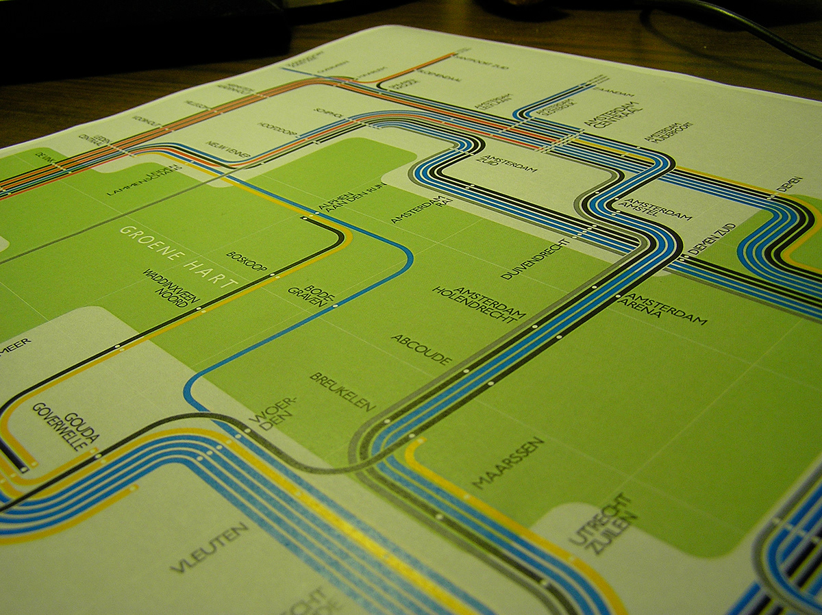
The Randstad is characterised by the "Groene Hart" or Green Hart which fills the areas between the cities. In recent years it has been further cut up by the expansion and merging of the large cities with the former villages that surround them. Still, its seen as an area of rest and relaxation; important to the city-dwellers looking for a place to escape.

Though the Randstad makes up only a portion of the entire country, the network in this area remains rather dense. Services which continue outside of the city, leave the ends of the map with a key showing the final destination of the service.

