Over the fall of 2012, I worked with six of my classmates to create a new plan for the Southwest neighborhood of Washington, DC. The area currently consists primarily of large office buildings, an interstate highway, and isolated pockets of housing, and is located between the south edge of the National Mall and the Potomac River.
Our desire was to create a plan that is more walkable, more sustainable, and can sustain a 24 hour life rather than only between 9 am and 5 pm. The seven of us are now individually designing different civic buildings within the site; I am designing a Community Theatre and Arts Center.
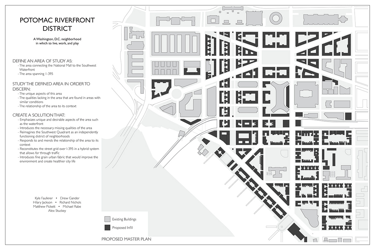
We broke our project down into three parts.
Define an Area of Study as:
-The area connecting the National Mall to the Southwest Waterfront
-The area spanning I-395
Study the Defined Area in order to discern:
-The unique aspects of the area
-The qualities lacking in the area that are found in areas with similar conditions
-The relationship of the area to its context
Create a solution that:
-Emphasizes unique and desirable aspects of the area such as the waterfront
-Introduces the necessary missing qualities of the area
-Reimagines the Southwest Quadrant as an independently functioning district of neighborhoods
-Responds to and mends the relationship of the area to its context
-Reconstitutes the street grid over I-395 in a hybrid system that allows for through traffic
-Introduces fine grain urban fabric that would improve the environment and create healthier city life

Site conditions in 1857
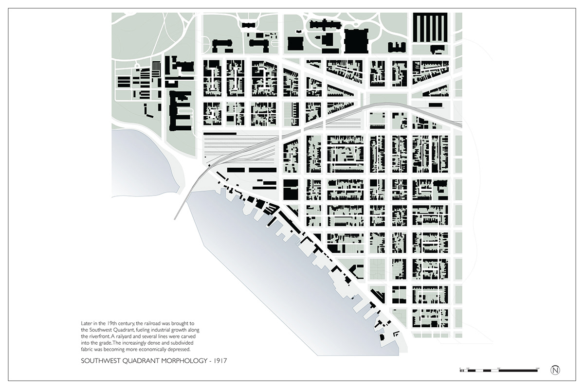
Site conditions in 1917
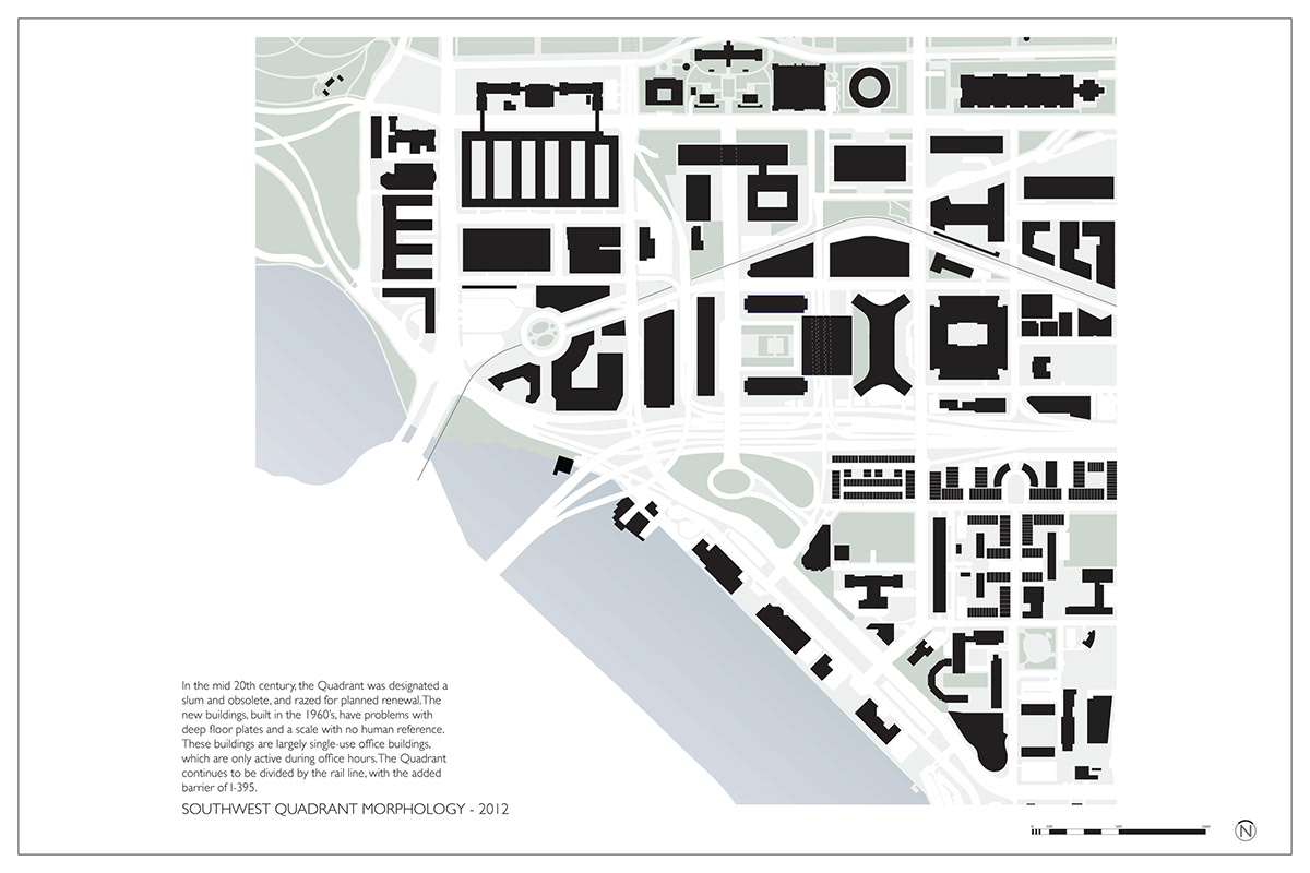
Site conditions as they currently are
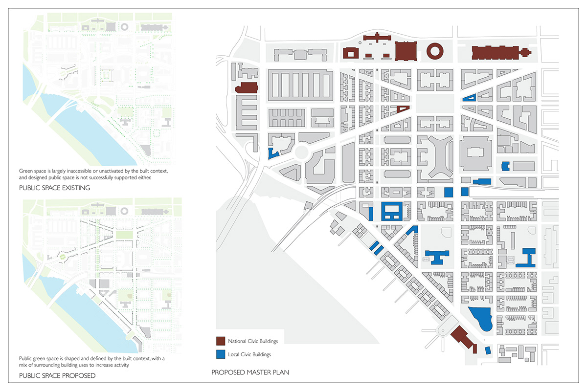
Rather than having all civic buildings grouped together on one or a few super-blocks, we have spread different civic buildings throughout the site, allowing the different parts of the Potomac Waterfront District to build their own identities and make unique contributions to the area. This thinking is heavily influenced by theorists such as Leon Krier and Andrés Duany.
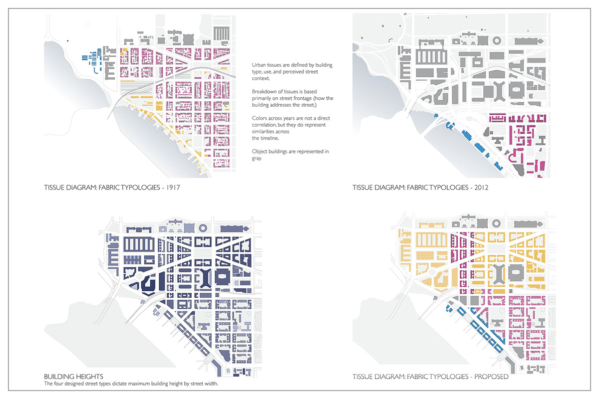
Past, current, and proposed Tissue Diagram
Building heights


Figure-ground study of (counter-clockwise from top left) the Dupont Circle Neighborhood, 1917 Southwest DC, 2012 Southwest DC, and our new proposed plan.
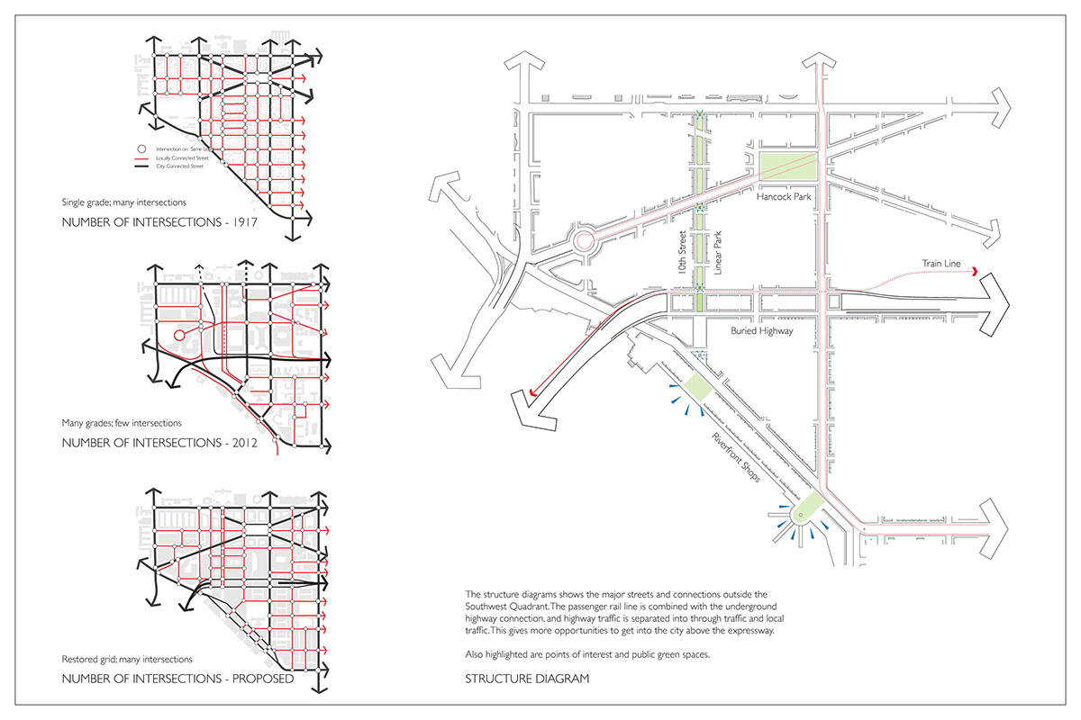
Structure Diagram

Block Sizes in 1917, 2012, and the proposed plan.
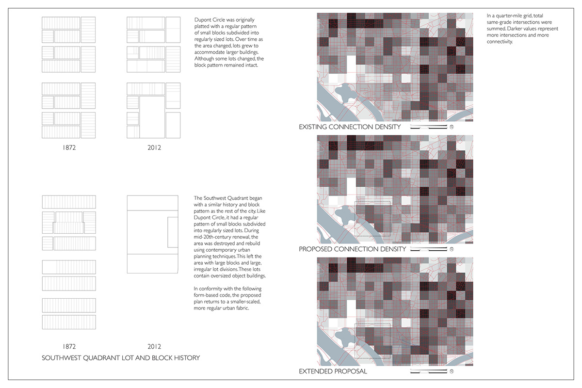
Block layouts in 1872 and 2012
Connection Density Diagrams: In a quarter-mile grid, total same grade intersections were summed. Darker values represent more intersections and more connectivity.

