
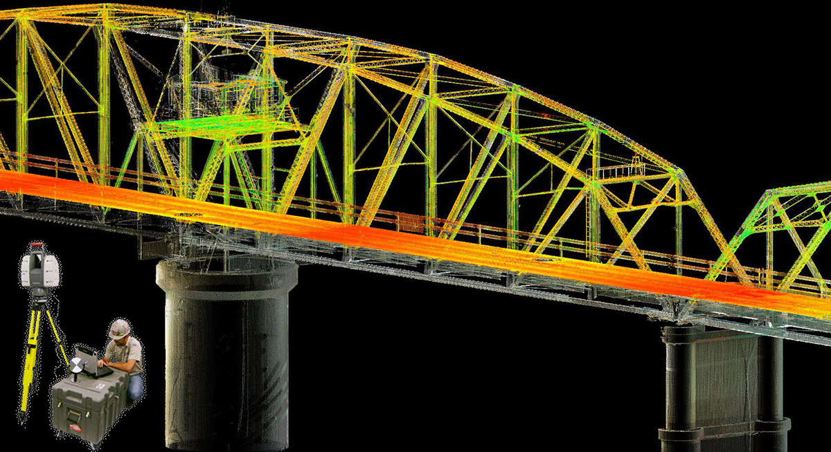
BRIDGE LASER SCAN POINT CLOUD
Harrisonburg Bridge
Long-term Structural Monitoring
Long-term Structural Monitoring
History:
Harrisonburg Bridge, owned and operated by the Louisiana Department of Transportation and Development, is located along LA Hwy 8 in Harrisonburg, LA. The bridge was constructed in 1932 and is classified as a "Riveted Parker Through Truss Swing Span" for channel navigation of large vessels in the Ouachita River. Due to its pier supported foundation and the location of the piers within the river, history has shown that the pier support structure is prone to barge collisions. As a result of the mechanical nature of the center swing span, it is critical that proper alignment exists between all mechanical elements to ensure the structural integrity and proper operation of the bridge. Dimensions:
Length of Largest Span: 319.8 ft
Total Length: 1,099.7 ft
Deck Width: 20.0 ft
Vertical Clearance above Deck: 14.0 ft
Average Daily Traffic: 2,100
Scope of Work:
My team conducted a baseline survey of bridge support piers, structural components and a roadway deck on a nationally recognized state plane coordinate system relative to NAVD88 vertical datum. We also completed a document deflection of the center pier, both in an open and closed swing span position. Finally, the team used Fenstermaker's SurvDMS (Data Mangement System) system to provide a comprehensive point cloud as-built interaction and portal for access to project control and critical monitoring points.
BRIDGE LASER SCAN POINT CLOUD

TITLE PLAN SHEET
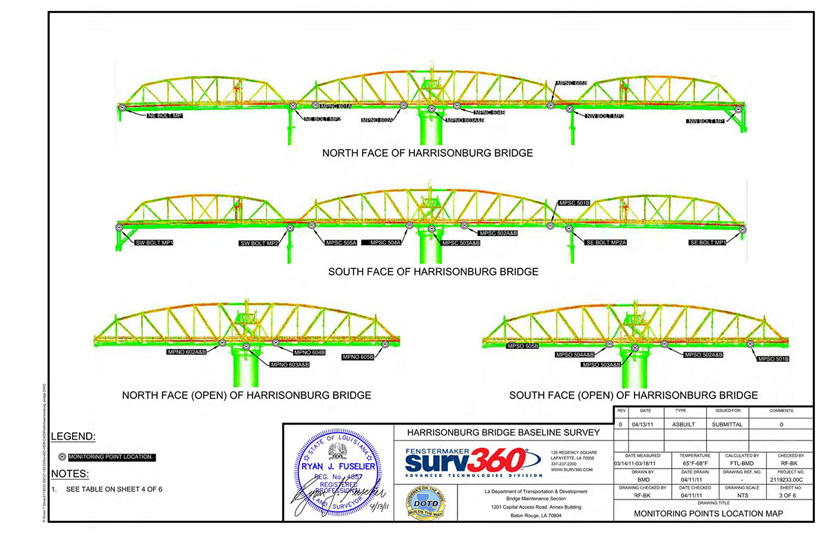
MONITORING POINTS LOCATION MAP

MONITORING POINTS COORDINATE DATA

PIER DETAIL REFERENCE PLAN

PIER DEVIATION DETAILS

TYPICAL MONUMENT DATA SHEET

MONUMENT INSTALLATION
