
JAPAN TRAVEL MAP ILLUSTRATION
editorial commission 2020
Format 70 x 100 cm
hand drawn illustrations on paper and Photoshop
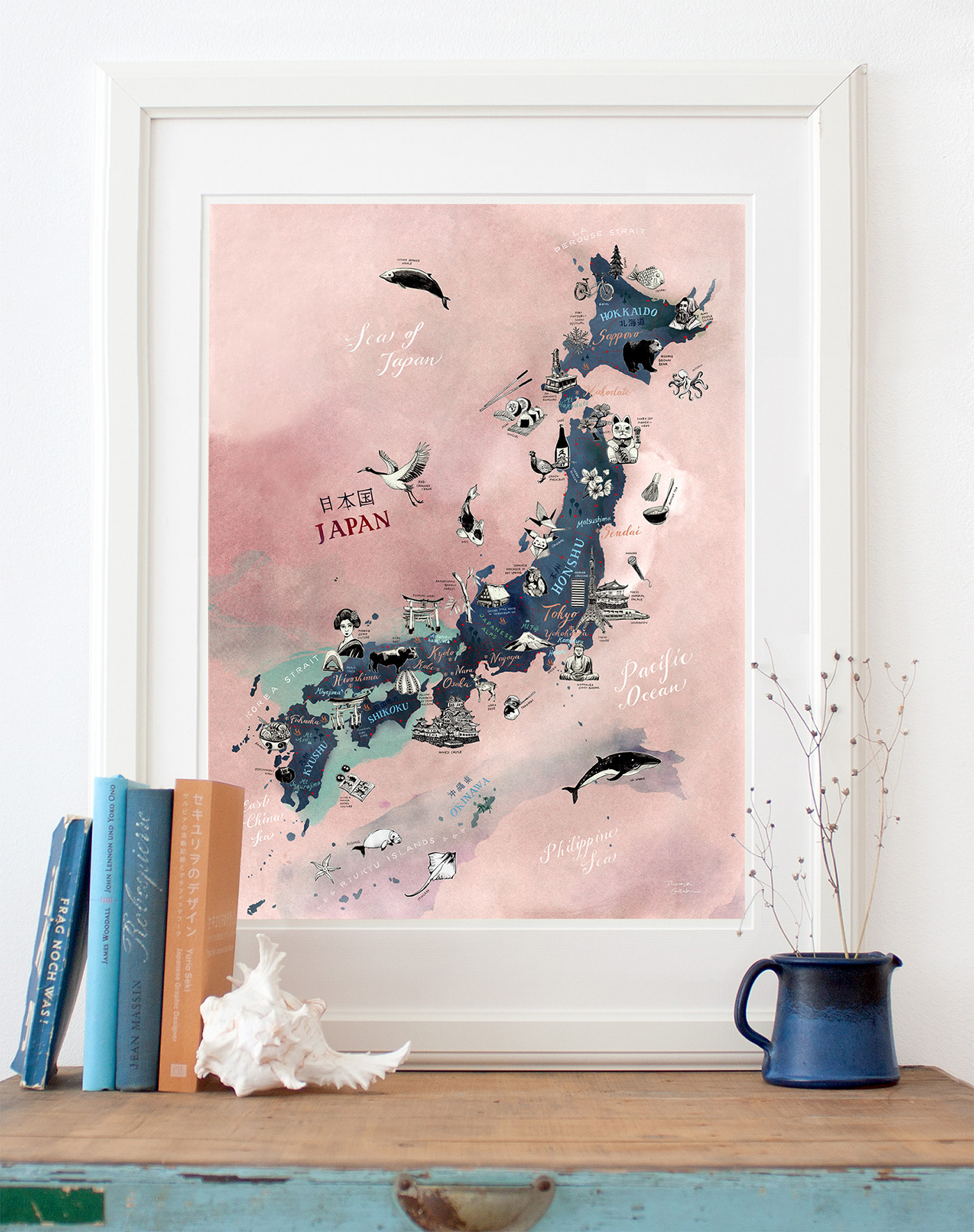
› This is my new illustrated map of Japan map.
I have illustrated all main islands as well as the
major cities, with a focus on famous landmarks,
typical Japanese food, wildlife and cultural
icons. The light rose color sheme evokes the
icons. The light rose color sheme evokes the
well known cherry blossom season. Take a look
at my preparatory black and white pencil drawings
for the icons and hand drawn lettering and callgrapy!
› Available as high quality art print in 3 sizes


JAPAN MAP – preparatory drawings
Format A6
hand drawn black and white pencil illustrations on paper
JAPAN MAP – high quality art print on Etsy
Format A4 / 30 x 40 cm / 42 x 60 cm
Giclée print on archival-quality, acid-free, eco-friendly 300 gsm © Mohawk Superfine Smooth warmwhite Paper and signed in the front

JAPAN MAP – high quality art print postcard on Etsy
Size 10 cm x 15 cm (3.93 x 5.90 inches)
Printed on 350 gsm © Metapaper extrasmooth warmwhite.


