
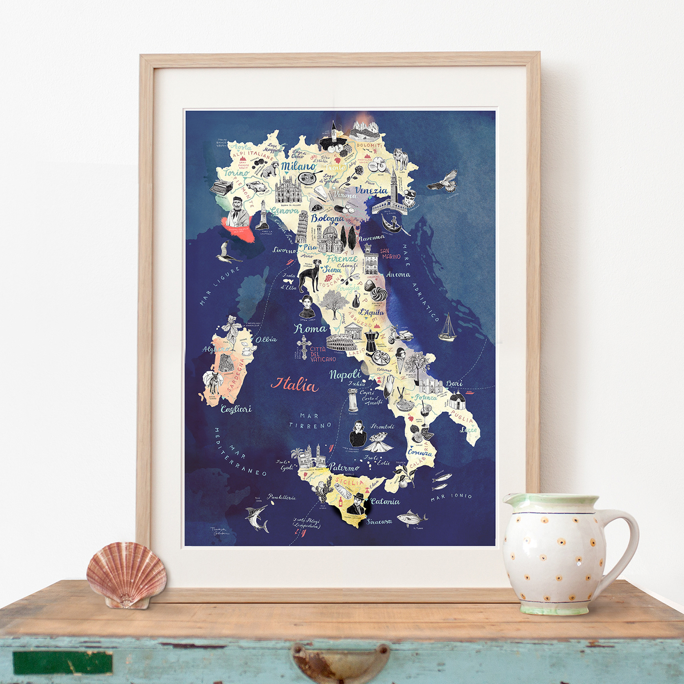
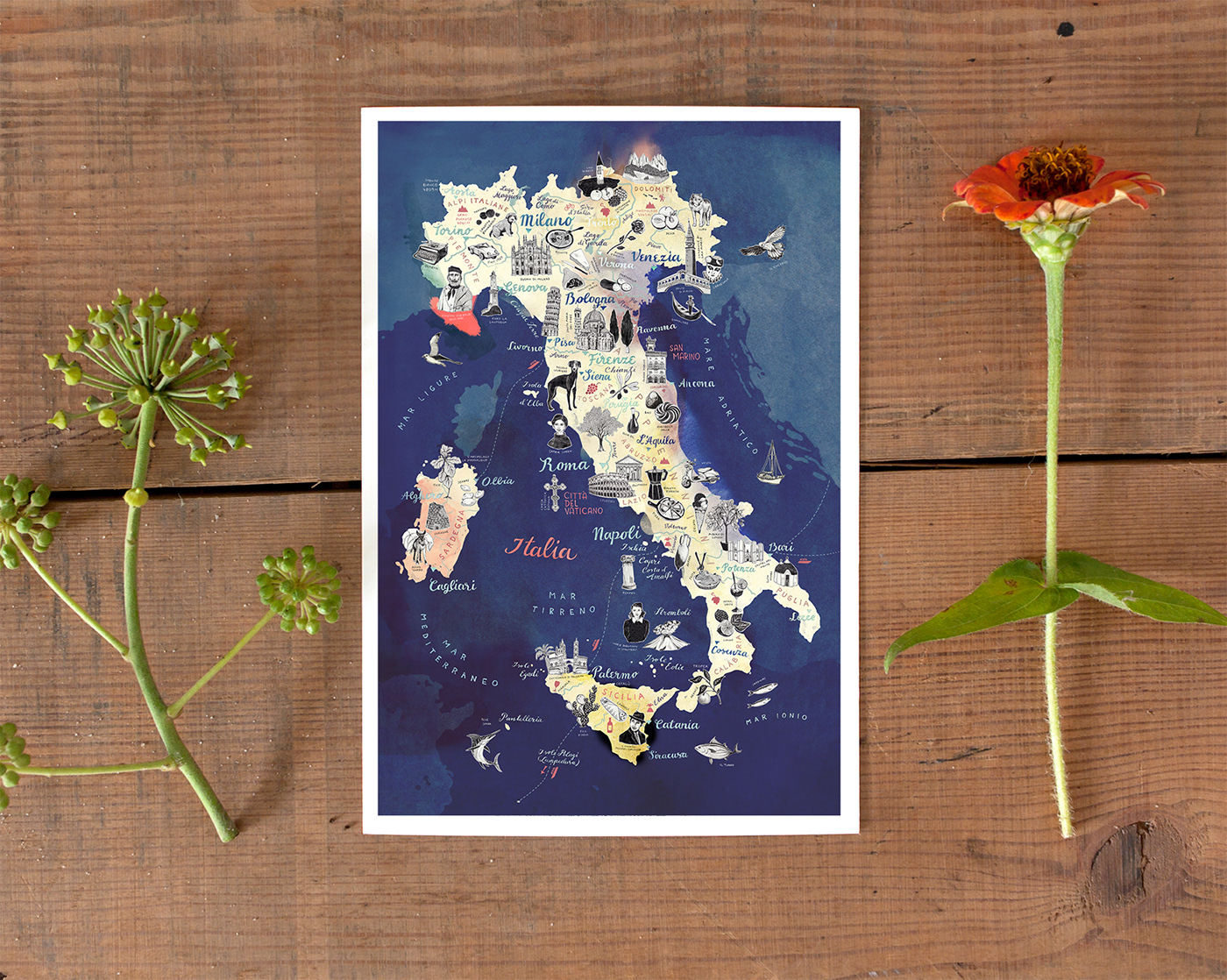
ITALY TRAVEL MAP ILLUSTRATION
editorial commission 2024
Format 70 x 100 cm
hand drawn illustrations on paper and Photoshop
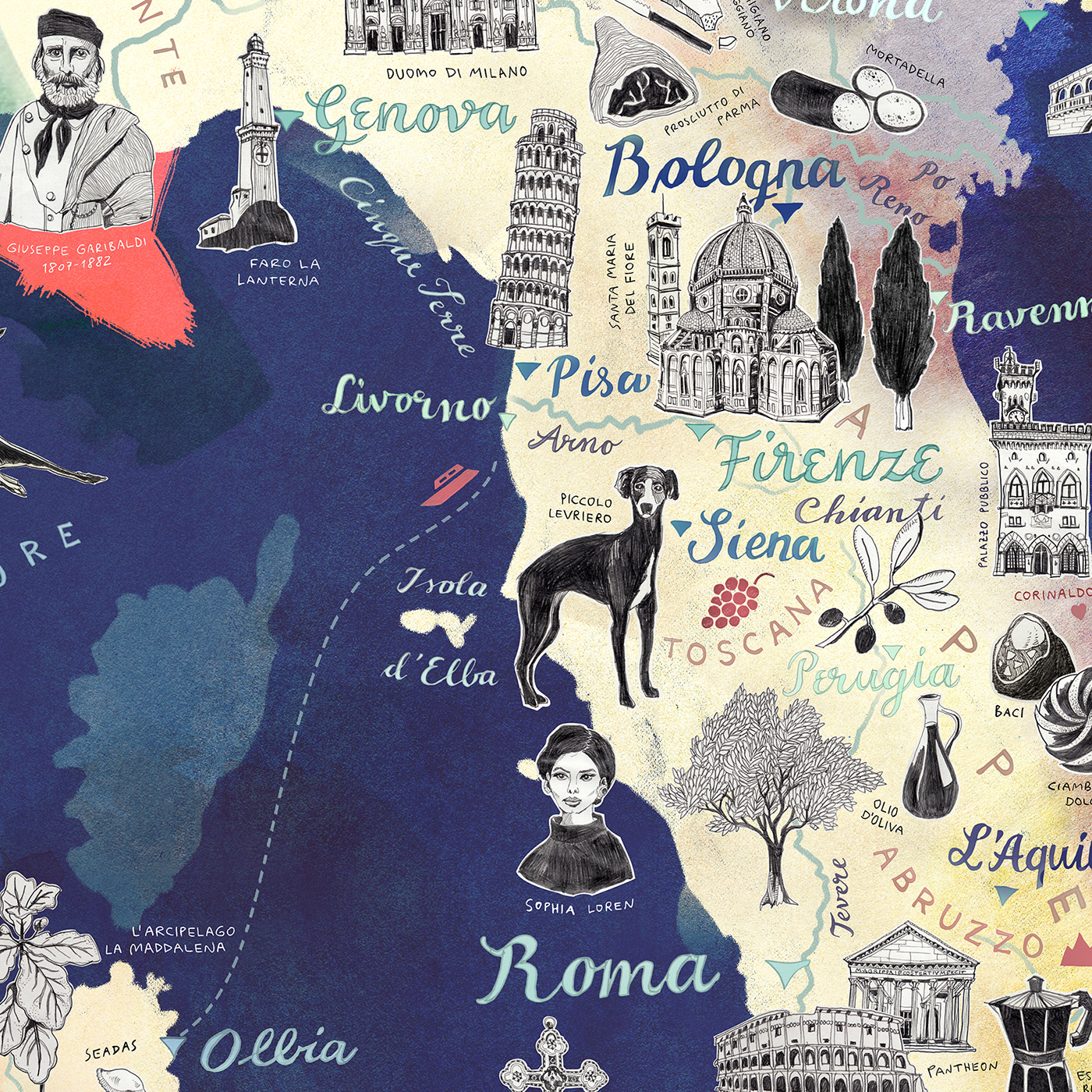
› Here comes my new map illustration of Italy!
I have traveled to Italy many times and this map shows
the memories of my road trips and train journeys through
the country. I have highlighted all the major cities from
North to South such as Milan, Turin, Venice, Florence,
Pisa, Rome and Naples as well as the beautiful islands
of Sardinia and Sicily. In my black and white icons I
have focused on the excellent Italian cuisine (featuring
of coursepizza, pasta, olive oil, gelato and many more)
together with the beautiful historical architecture,
nature, famous Talian people and personal favourites,
of which I show here my pencil preparatory hand drawings.


ITALY MAP – preparatory drawings
Format A4
hand drawn black and white pencil illustrations on paper

ITALY MAP – preparatory drawings
Format A4
hand drawn black and white pencil illustrations on paper
ITALY MAP – high quality art print on Etsy
Format A4 / 30 x 40 cm / 42 x 60 cm
Giclée print on archival-quality, acid-free, eco-friendly 300 gsm © Mohawk Superfine Smooth warmwhite Paper and signed in the front
ITALY MAP – high quality art print postcard on Etsy
Size 10 cm x 15 cm (3.93 x 5.90 inches)
Printed on 350 gsm © Metapaper extrasmooth warmwhite.


