
Mountain Biking DataViz
Trail Analytics
I made the switch from road cycling to mountain biking this year - well overdue and far more fun (when you stay on the bike!) There are some great trails around where I live in North Wales so I decided to start recording some Garmin data as I really wanted to make a stylised version of the route map.
Gwydir Mawr | Gwydir Forest Park, North Wales
I became fascinated with the metrics my Garmin recorded during the trail, not just HR and Speed but Grit & Flow which are specific MTYB related terms. Have a look at the below maps and their captions for an explanation of what Grit and Flow refer to. The bright orange segments of the trail refer to the single track off-road portions of the trail (the fun bits.) Grit tends to be higher on these sections and the speed and turns fluctuate massively compared to the easier riding fire road tracks (blue sections).

Grit measures the difficulty of a mountain bike trail. It takes into account factors such as the trail grade and the angle of turns along the trail. The Grit score of a given trail should remain fairly consistent from rider to rider. It’s a useful metric for comparing the difficulty of the different trails you ride.

Flow measures how well a rider maintains speed during a ride or sections of their ride. It takes into account factors such as your speed consistency throughout your ride, fluidity through turns and other factors

heart rate analysis is displayed here as coloured glassy fences with higher yellow portions showing the zones my hr was maxing out - usually a hill!
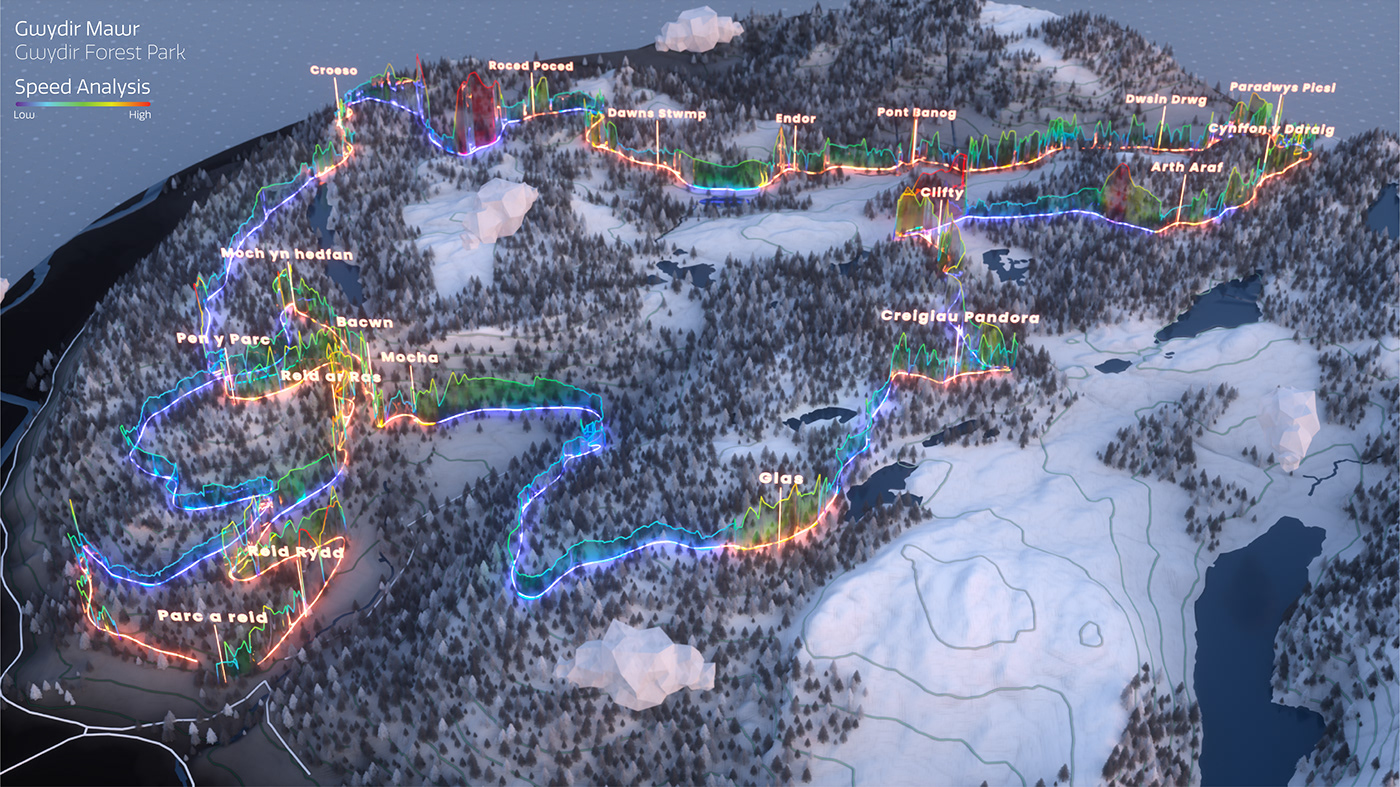
Speed, again, is shown via these glassy fences in a bit of a thermal gradient which I think looked quite nice. As fire tracks (blue) means climbing speed was obviously a lot lower on these portions.
Penmachno | Gwydir Forest Park, North Wales
Penmachno is another red-trail in the Gwydir Forest park, a far more technical and natural trail and, in my experience, a bike and back killer! I don;t think myself and my biking buddy Andy have come off this trail without a mechanical or biological failure. Still it's absolutely stunning and good fun to map!
As with Gwydir Mawr the trail made for some interesting stats which I have mapped below.

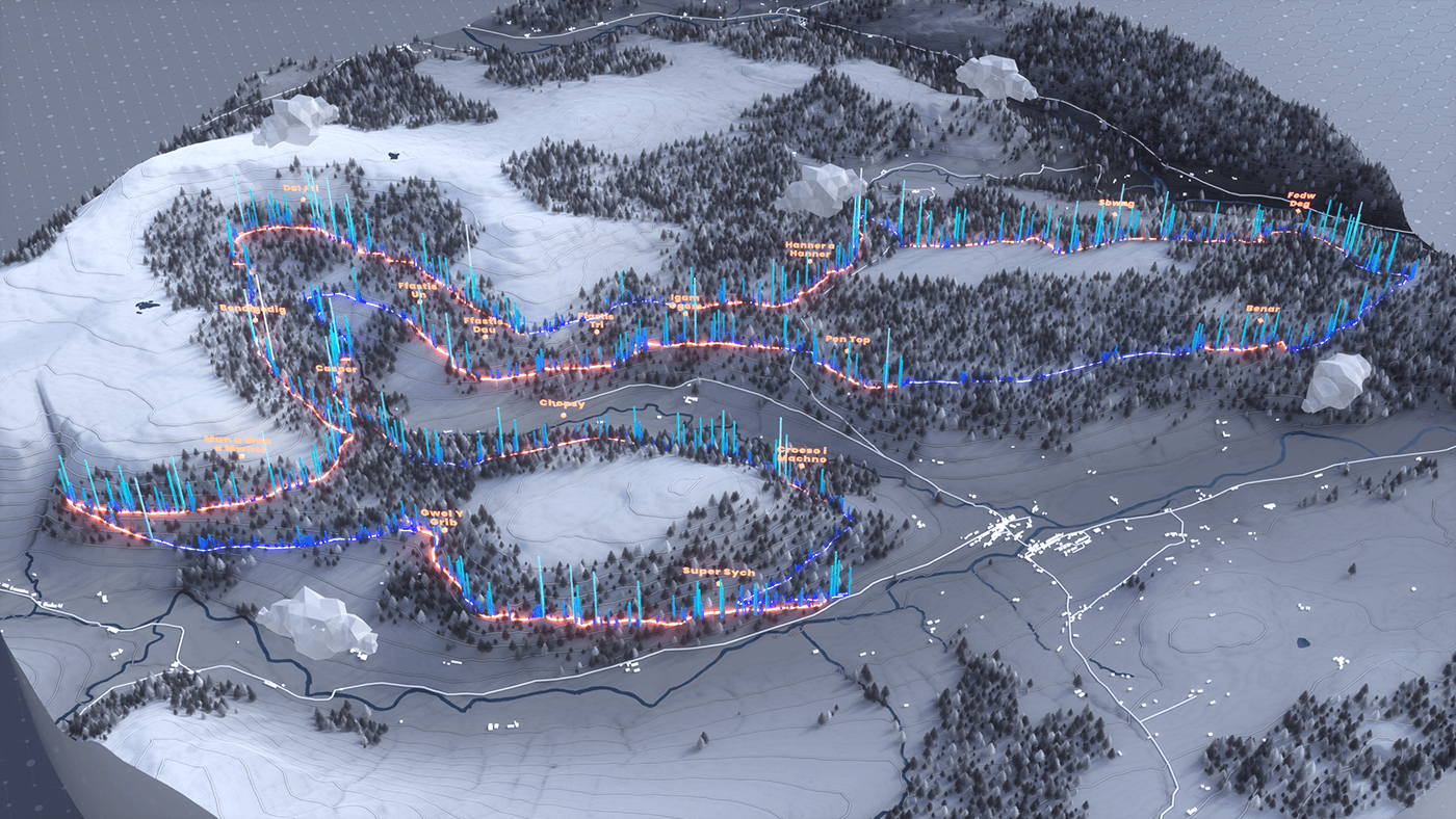


I also had fun experimenting with a toon shader for Penmachno which gave an interesting aesthetic. My aim is to add to these as I complete different trails around Wales so I'll try and keep the project updated.


