

Bicycle transport section of Wroclaw's Municipality planned promo campaign which goal was to convince citizens to travel by bike if they want to get to city center (Old Town).
My role was to design and deliver four different maps from each direction: west, north, east and south. From each direction there has to be main routes, alternative routes (with reduced car traffic), and recreational routes (delineated mainly through green areas). Routes were prepared and tested by Radek Lesisz from WIR (Wroclaw's Bike Initiative).
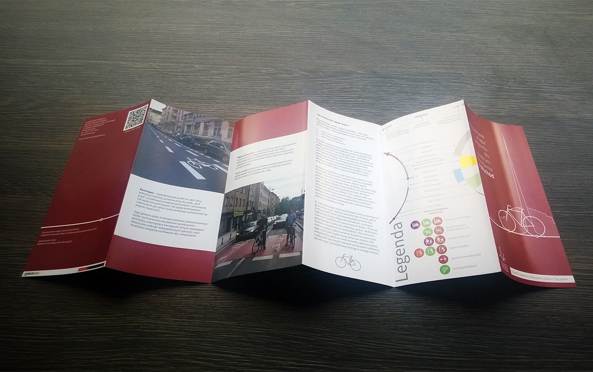
Maps comes in two versions: printed (6-folded to 99x210mm format), and digital pdf to download from city's website (http://www.wroclaw.pl/rowerowe-mapy-wroclawia).
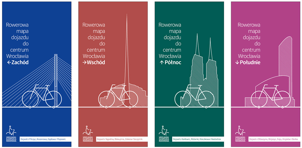
Each map has its own guiding color. Cover background color is also used to mark main route and background of warning icons. Covers have bike silhouette with city landmark from particular part of Wroclaw. Bottom white stripe lists boroughs from which you can cycle to city center using this map.

West map - PDF version.

East map - PDF version.

North map - PDF version.

South map - PDF version.

Routes (and map) was designed in form resembling metro maps. Each route-street crossing is marked as node with name of street crossed. This way you can easily find yourself on the map and you know in what part of route you are. One-way route parts were also placed.
Node with black filling is a point of warning - icons informs about kind of danger to watch out for. On top of each map there is a "ruler" that tells you how much time it will take you to get to certain points on map. These are of course only indications, or let's say - average times.
Important buildings and places were marked in yellow color with caption - this should help people that are unfamiliar with using maps to position themselves.

Icon set designed for maps. From left - beware of trains, pull over to roadway, limited visibility, beware of pedestrians, steep route, beware of cars, narrow route, pull over to the left lane to turn left, directional bicycle street lights, pull over to the route on the other side of street.

West map - printed version.


East map - printed version.
East map - printed version. Other side.

South map - printed version.


North map - printed version. Two folds were hidden.

Duo-wheel legend.


Maps were also featured in the main Wroclaw's newspaper - Gazeta Wyborcza:

Thanks for watching :)


